
San Lucas is an unincorporated community and census-designated place (CDP) in Monterey County, California, United States. It was founded in 1886 and named after the Rancho San Lucas, which was granted in 1842. The post office was first established in 1892.
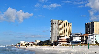
Miramar Beach is a census-designated place (CDP) in Walton County, Florida, United States. The population was 6,146 at the 2010 census. Although many other coastal localities in Florida have appended "Beach" to their names to distinguish themselves from an adjacent inland or cross-bay municipality – such as Miami Beach, St. Pete Beach, Fort Myers Beach, Panama City Beach, Melbourne Beach, Cocoa Beach, and Jacksonville Beach – the city of Miramar, Florida is actually over 450 miles (720 km) away in South Florida. Miramar Beach is due east of Destin, Florida. It is often considered to be part of the city of Destin. However, it has its own ZIP code (32550) and is in Walton County, whereas Destin is in Okaloosa County.

Calcutta is an unincorporated community and census-designated place in southeastern Columbiana County, Ohio, United States. The population was 3,941 at the 2020 census. Historically a rural town, Calcutta grew as businesses from neighboring East Liverpool moved into larger shopping centers clustered around Ohio State Route 170.

Fairfield Beach is an unincorporated community and census-designated place (CDP) in Fairfield County, Ohio, United States. The population was 1,267 at the 2020 census.

Beechwood Trails is a census-designated place (CDP) in Harrison Township, Licking County, Ohio, United States. The population was 3,276 at the 2020 census.
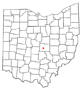
Granville South is a census-designated place (CDP) in Licking County, Ohio, United States. The population was 1,420 at the 2020 census.

Harbor Hills is a census-designated place (CDP) in southern Licking County, Ohio, United States. The population was 1,565 at the 2020 census.

Eaton Estates is an unincorporated community and census-designated place (CDP) in Lorain County, Ohio, United States. The population was 1,155 at the 2020 census.

Lucasville is a census-designated place (CDP) in Scioto County, Ohio, United States. The population was 1,655 at the 2020 census. It is part of the Portsmouth micropolitan area.

Jerusalem Township is one of the eleven townships of Lucas County, Ohio, United States. The 2020 census found 2,895 people in the township.

Brownsville is an unincorporated community and census-designated place (CDP) in northeastern Bowling Green Township, Licking County, Ohio, United States. As of the 2020 census, it had a population of 214. It lies at the intersection of U.S. Route 40 with State Route 668.

East Rochester is an unincorporated community and census-designated place (CDP) in southern West Township, Columbiana County, Ohio, United States. The population was 224 as of the 2020 census. It lies along U.S. Route 30, and has a post office with the ZIP code 44625. It is a part of the Salem micropolitan area, about 20 miles (32 km) east of Canton.

Etna is an unincorporated community and census-designated place (CDP) in Licking County, Ohio, United States. As of the 2020 census it had a population of 1,209. It lies at an elevation of 1,069 feet (326 m) at the intersection of U.S. Route 40 and State Route 310. It was listed as a census-designated place in 2010.
Beulah Beach is an unincorporated community and census-designated place located adjacent to Lake Erie in Erie County, Ohio, United States. As of the 2020 census it had a population of 75. It is located within Vermilion Township.
Four Bridges is a census-designated place (CDP) in Liberty Township, Butler County, Ohio, United States. The population was 3,401 at the 2020 census.
Hide-A-Way Hills is a census-designated place (CDP) in Fairfield and Hocking counties in the U.S. state of Ohio. As of the 2020 census, the community had a population of 976.

Pottery Addition is a census-designated place (CDP) in Jefferson County, Ohio, United States. Its population was 258 as of the 2020 census. The community is located along the Ohio River and is served by Ohio State Route 7.
Suffield is an unincorporated community and census-designated place (CDP) in Suffield Township, Portage County, Ohio, United States. The population was 949 at the 2020 census. It was first listed as a CDP prior to the 2020 census.
Lincoln Heights is an unincorporated area and census-designated place (CDP) in Richland County, Ohio, United States. It was first listed as a CDP prior to the 2020 census.

Reedurban is an unincorporated community and census-designated place (CDP) in Perry Township, Stark County, Ohio, United States. It was first listed as a CDP prior to the 2020 census, where it had a population of 5,889.


