Saldanha Bay

Last updated
Saldanha Bay
Saldanhabaai (Afrikaans)
Saldanha Bay WW.jpg
Present day Saldanha Bay. To the right (south) is the Langebaan lagoon
South Africa relief location map.svg
Red pog.svg
Saldanha Bay
Location in South Africa
Coordinates 33°02′05″S18°00′35″E / 33.03472°S 18.00972°E / -33.03472; 18.00972
Ocean/sea sources Southern Atlantic Ocean
Basin  countries South Africa
Max. length12 km (7.5 mi)
Max. width11 km (6.8 mi)
Islands St Croix Islands,
Bird Islands
Settlements Saldanha, Langebaan

Saldanha Bay (Afrikaans : Saldanhabaai) is a natural harbour on the south-western coast of South Africa. [1] The town that developed on the northern shore of the bay, also called Saldanha, was incorporated with five other towns into the Saldanha Bay Local Municipality in 2000. The current population of the municipality is estimated at 72,000.

Contents

The place is mentioned in the first edition of John Locke's Two Treatises of Government as an example of the state of nature. [2]

Saldanha Bay's location makes it a paradise for the watersport enthusiast, and its local economy being strongly dependent on fishing, mussels, seafood processing, the steel industry and the harbour. Furthermore, its sheltered harbour plays an important part in the Sishen-Saldanha iron-ore project (connected by the Sishen-Saldanha Railway Line) at which Saldanha Steel takes center stage.

Geography

Saldanha Bay is located about 105 kilometres (65 mi) north west of Cape Town. It faces southwest and is 11 km long and 12 km wide. The Langebaan Lagoon, a SE prolongation of the bay, extends for 14 km southeastwards from the SE corner of the inner bay by Langebaan.

History

Saldanha Bay is named after António de Saldanha, captain of a vessel in Albuquerque's fleet which visited South Africa in 1503. The name was first given to Table Bay, where Saldanha's ship cast anchor. On Table Bay being given its present name in 1601, the older appellation was transferred to the bay now called after Saldanha. In 1781 a British squadron under Commodore George Johnstone seized six Dutch East Indiamen, which, fearing an attack on Cape Town, had taken refuge in Saldanha Bay. This was the only achievement, so far as South Africa was concerned, of the expedition despatched to seize Cape Town during the war of 1781–1783. [1]

Diplomat Edmund Roberts visited the Bay in 1833. He noted that it was "well sheltered from violent winds, having a sufficient depth of water, but the country is very sandy and agriculture but little attended to; a few cattle and sheep are raised among the scanty herbage." He suggested that it was an uneventful area to visit, except for a few areas in the Bay where whales resided during his visit. [3]

Saldanha Bay is also home to numerous fish canneries. The most notable of these is the Saldanha Bay Canning Company, founded by James Kasner and Ellis Silverman in 1905.

With strong historic military links Saldanha is also host to a Naval training base and the South African Military Academy. The SAS Saldanha Nature Reserve offers a display of wildflowers during late winter and spring while southern right whales also visit the waters in and around the nature reserve. The area has a Mediterranean climate but the annual rainfall is quite low; it verges on the desert region of Namaqualand.

Modern day

The port developed into a modern harbour only recently, when it became necessary to facilitate the export of iron ore from the Northern Cape. This required the construction of a railway more than 800 kilometres to the mines at Sishen in the Northern Cape and the construction of a deepwater jetty in Saldanha Bay to accommodate Capesize ore carrier ships.

See also

Related Research Articles

Kathu is a town in South Africa, and the iron ore capital of the Northern Cape province. Its name means "town under the trees", after the Camel Thorn forest it is situated in. The phrase "the town under the trees" was coined by an engineer working in the town in the early-1990s as part of a tourist marketing drive, together with the accompanying graphic. It was intended to be a marketing slogan. The meaning of the word "Kathu" has anecdotically been attributed to a porridge brewed by the local population from the powder found in the pods of the Camel Thorn trees.

<span class="mw-page-title-main">Paternoster, South Africa</span> Place in Western Cape, South Africa

Paternoster is one of the oldest fishing villages on the West Coast of South Africa. It is situated 15 km north-west of Vredenburg and 145 km north of Cape Town, at Cape Columbine between Saldanha Bay and St Helena Bay. The town covers an area of 194.8 hectare and has approximately 1883 inhabitants.

<span class="mw-page-title-main">Saldanha Bay Local Municipality</span> Local municipality in Western Cape, South Africa

Saldanha Bay Municipality is a local municipality located within the West Coast District Municipality, in the Western Cape province of South Africa. As of 2011, it had a population of 99,193. Its municipality code is WC014.

<span class="mw-page-title-main">Port Nolloth</span> Place in Northern Cape, South Africa

Port Nolloth is a town and small domestic seaport in the Namaqualand region on the northwestern coast of South Africa, 144 kilometres (89 mi) northwest of Springbok. It is the seat of the Richtersveld Local Municipality.

<span class="mw-page-title-main">West Coast, Western Cape</span>

The West Coast is a region of the Western Cape province in South Africa and is bordered by the Atlantic Ocean on the west and the Swartland region on the east.

<span class="mw-page-title-main">West Coast National Park</span> Nature reserve north of Cape Town in the Western Cape province of South Africa

The West Coast National Park lies 88 km (55 mi) north of Cape Town in the Western Cape province of South Africa. The park is found inside of the Cape West Coast Biosphere Reserve, part of the UNESCO Man and the Biosphere Programme. It is bordered by the Atlantic Ocean on the west and the R27 coastal road, and runs from the town of Yzerfontein in the south, up to the Langebaan Lagoon. The park is particularly well known for its bird life and for the spring flowers which occur in the months from August to September, especially in the Postberg flower reserve section of the park. The park, with the islands in Saldanha Bay, has been identified by BirdLife International as an Important Bird Area. The park was proclaimed in 1985, and is 36,259.8 hectares (140.000 sq mi) in size.

<span class="mw-page-title-main">Langebaan</span> Place in Western Cape, South Africa

Langebaan is a town in the Western Cape province of South Africa on the eastern shore of Langebaan Lagoon.

<span class="mw-page-title-main">Sishen–Saldanha railway line</span> Railway line in South Africa

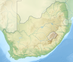
The Sishen–Saldanha railway line, also known as the Ore Export Line (OREX), is an 861-kilometre-long (535 mi) heavy-haul railway line in South Africa. It connects iron ore mines near Sishen in the Northern Cape with the port at Saldanha Bay in the Western Cape. It is used primarily to transport iron ore (60 million tonnes per year) and does not carry passenger traffic.

<span class="mw-page-title-main">Saldanha, South Africa</span> Place in Western Cape, South Africa

Saldanha, also known as Saldanha Bay, is a town of 21,636 people, located 110 kilometres (70 mi) north of Cape Town on the northern shore of Saldanha Bay, in the Western Cape province of South Africa. Its situation as a natural sheltered harbour has led to development as a port for the export of iron ore from Sishen in the Northern Cape, which is transported on the Sishen–Saldanha railway line. The port is one of the largest exporting ports of ore in the whole of Africa, and it is able to handle ships as large as 200 000 tons deadweight. Saldanha Bay is named after António de Saldanha, captain of a vessel in Albuquerque's fleet which visited South Africa in 1503.

SAS <i>Somerset</i> Boom defence vessel of the South African Navy during World War II

SAS Somerset was a Bar-class boom defence vessel of the South African Navy, now preserved as a museum ship in Cape Town. Formerly HMS Barcross, it operated in Saldanha Bay, was transferred to South Africa Naval Forces during World War II, and was purchased by South Africa in 1947.

<span class="mw-page-title-main">Hopefield, South Africa</span> Place in Western Cape, South Africa

Hopefield is a settlement in West Coast District Municipality in the Western Cape province of South Africa on the R45 between Malmesbury and Vredenburg. The town lies east of Saldanha Bay and Langebaan, 40 km (25 mi) southeast of Vredenburg and 120 km (75 mi) north of Cape Town.

<span class="mw-page-title-main">South African Class 9E, Series 1</span> Locomotive class

The South African Railways Class 9E, Series 1 of 1978 is an electric locomotive.

<span class="mw-page-title-main">South African Class 9E, Series 2</span> Class of 6 South African electric locomotives

The South African Railways Class 9E, Series 2 of 1982 is an electric locomotive.

<span class="mw-page-title-main">Miller's Point, Western Cape</span> Place in Western Cape, South Africa

Miller's Point is a headland and stretch of protected coastline in South Africa. It is located about 4 kilometres (2.5 mi) south of Simon's Town on the road to Cape Point.

<span class="mw-page-title-main">South African Class 34-400</span>

The South African Railways Class 34-400 of 1973 is a diesel-electric locomotive.

<span class="mw-page-title-main">South African Class 34-900</span>

The South African Railways Class 34–900 of 1980 is a diesel-electric locomotive.

Dingleton is a town in Northern Cape, South Africa.

The Sishen mine is a large iron mine located in central South Africa in Kathu, Northern Cape. Sishen represents one of the largest iron ore reserves in South Africa and in the world having estimated reserves of 2.43 billion tonnes of ore grading 58.6% iron metal.

The marine protected areas of South Africa are in an area of coastline or ocean within the exclusive economic zone (EEZ) of the Republic of South Africa that is protected in terms of specific legislation for the benefit of the environment and the people who live in and use it. An MPA is a place where marine life can thrive under less pressure than unprotected areas. They are like underwater parks, and this healthy environment can benefit neighbouring areas.

<span class="mw-page-title-main">Schaapeneiland</span>

Schaapeneiland is an island in Saldanha Bay on West Coast, Western Cape, South Africa.

References

  1. 1 2 Wikisource-logo.svg One or more of the preceding sentences incorporates text from a publication now in the public domain :  Chisholm, Hugh, ed. (1911). "Saldanha Bay". Encyclopædia Britannica . Vol. 24 (11th ed.). Cambridge University Press. p. 60.
  2. Second Treatise, sec. 14. Locke replaced the reference to "Soldania" with a story told by Garcilaso de la Vega about a desert island in subsequent editions (Peter Laslett, ed., Two Treatises of Government, by John Locke, student edition [New York: Cambridge University Press, 1988], 277n).
  3. Roberts, Edmund (1837). Embassy to the Eastern Courts of Cochin-China, Siam, and Muscat. New York: Harper & Brothers. p. 389.