
Fairfield is a city in southern Butler County, Ohio, United States. It is a suburb located about 25 miles (40 km) north of Cincinnati and is situated on the east bank of the Great Miami River. The population was 44,907 as of the 2020 census. Incorporated in 1955 from portions of Fairfield Township, it includes the former hamlets of Symmes Corner, Fair Play, Furmandale, and Stockton. The Fairfield City School District is one of the largest in Ohio and serves both the City of Fairfield and Fairfield Township.

Warren County is a county located in the southwestern part of the U.S. state of Ohio. As of the 2020 census, the population was 242,337. Its county seat is Lebanon and largest city is Mason. The county is one of Ohio's most affluent, with the highest median income of the state's 88 counties. The county was established on May 1, 1803, from Hamilton County; it is named for Dr. Joseph Warren, a hero of the Revolution who sent Paul Revere and the overlooked William Dawes on their famous rides and who died at the Battle of Bunker Hill. Warren County is part of the Cincinnati, OH-KY-IN Metropolitan Statistical Area.

Butler County is a county located in the southwestern part of the U.S. state of Ohio. As of the 2020 census, the population was 390,357. Its county seat and largest city is Hamilton. It is named for General Richard Butler, who died in 1791 during St. Clair's Defeat. Located along the Great Miami River, it is also home to Miami University, a public university founded in 1809. Butler County is part of the Cincinnati, OH-KY-IN Metropolitan Statistical Area. The majority of the county is in District 52 of the State House.

Millville is a village in Butler County, Ohio, United States. The population was 634 at the 2020 census. Millville sits between Oxford, Ohio and Cincinnati, Ohio along U.S. Route 27.
Ross is a census-designated place (CDP) in Ross Township, Butler County, Ohio, United States. The population was 3,478 at the 2020 census. Ross sits along U.S. Route 27 between Cincinnati, Ohio and Oxford, Ohio. Ross is part of the Cincinnati metropolitan area.

William Bebb was a Whig politician from Ohio. He served as the 19th governor of Ohio from 1846 to 1849 and was the third native Ohioan to be elected to the office.

Fairfield Township is one of thirteen townships in Butler County, Ohio, United States. It is located in the south central portion of the county. The population was 22,645 at the 2020 census. Before annexations by the cities of Hamilton and Fairfield, it had an area of about 50 square miles (130 km2).

Ross Township is one of thirteen townships in Butler County, Ohio, United States. It is located in the south-central part of the county, southwest of the city of Hamilton. The population was 8,736 at the 2020 census.

Poast Town is an unincorporated community located in northeastern Madison Township, Butler County, Ohio, United States, on State Route 4, about one mile north of Middletown in Section 12 of T2R4 of the Congress Lands. It was laid out in 1818 by Peter Post as the town of West Liberty. A post office with the name Poast Town was established in 1848 but closed in 1934. Mail is provided through the Middletown post office, it is located in the Middletown telephone exchange. It is in the Madison Local School District.
West Middletown is an unincorporated community in eastern Madison Township, Butler County, Ohio, United States. It is located on the west shore of the Great Miami River about one mile from Middletown. It had about 200 people in 1905 and was formerly a station on the Cincinnati, Hamilton, and Dayton Railroad. Founded as Madison City, it received the name Heno when it was awarded a post office in 1882. Since there was already another Madison City in Ohio, the postmaster general demanded a name change. According to legend, as old-timers were discussing the new name around the cracker barrel in the general store, a can of Heno tea caught their attention. So the town was named for the tea. But in 1907, the postmaster general decreed the village was within the shadow of Middletown, and only a few postal workers had ever heard of Heno, making it difficult to sort and forward mail to the place. The government ordered the village to accept the name of West Middletown. In 1963 the postmaster general in another decree closed the West Middletown post office, transferring its business to Middletown.

Woodsdale is an unincorporated community in Madison and St. Clair Townships in central Butler County, Ohio, United States, about three miles northeast of Hamilton. It was established in 1867 by the Beckett Paper Company and was formerly a stop on the Cincinnati, Hamilton, and Dayton Railroad. An electric generation plant of the Cincinnati Gas and Electric Company is located in Woodsdale. Woodsdale is also the location of the Samuel Augspurger House & Farm and The Augspurger Schoolhouse both of which are on the National Register of Historic Places. Woodsdale was also known for the Woodsdale Island Amusement Park.

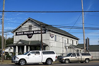
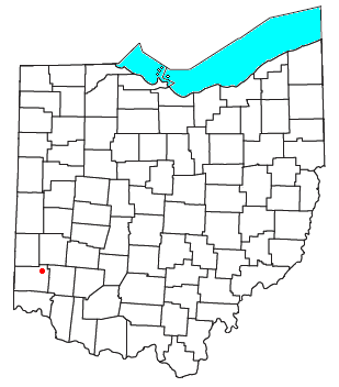
Alert is an unincorporated community in southern Morgan Township, Butler County, Ohio, in the United States. It is located about ten miles southwest of Hamilton on Howards Creek, a tributary of the Great Miami River in section 28 of R1ET3N of the Congress Lands. It is three miles west of Shandon and two miles south of Okeana.
Okeana, originally known as Tariff, is an unincorporated community in central Morgan Township, Butler County, Ohio, United States. It is located on Dry Fork Creek, a tributary of the Great Miami River, on State Route 126 about three miles northwest of Shandon in sections 21 and 26 of R1ET3N of the Congress Lands. It is a mile north of Alert, a mile east of Macedonia, and ten miles southwest of Hamilton. The bulk of addresses served by the Okeana post office are in the Ross Local School District, but parts of the region are in the Southwest Local School District.

McGonigle is an unincorporated community in northwestern Hanover Township, Butler County, Ohio, United States about seven miles northwest of Hamilton at the intersection of U.S. Route 27 and State Route 130 in sections 17 and 18 of R2ET4N of the Congress Lands. It was formerly a stop on the Cincinnati, Hamilton, and Dayton Railroad's Indianapolis branch. It was named for Philip McGonigle, an early settler, and is spelled in various ways.

Port Union is an unincorporated community in western West Chester Township, Butler County, Ohio, United States, on State Route 747 about three miles north of Springdale and three miles southeast of Hamilton. The town was laid out in 1827 by William Elliott alongside the turning basin for the Miami and Erie Canal and was about midway between Crescentville and Hamilton on the canal. It was originally known as McMaken's Bridge, but took the name its township.. The Cincinnati, Hamilton, and Dayton Railroad later laid tracks through Port Union.

Llanbrynmair or Llanbryn-mair is a village, community and electoral ward in Montgomeryshire, Powys, on the A470 road between Caersws and Machynlleth. Llanbrynmair, in area, is the second largest in Powys. In 2011, it had a population of 920.

John Vaughan House is a historic house near Shandon, Ohio.
Saint Afan's Church (SN68387192) is located in Llanafan, 8 miles (13 km) east of Aberystwyth, Ceredigion, in Wales.

The Congress Lands West of Miami River was a land tract in southwest Ohio that was established by the Congress late in the 18th century. It is located south of the Greenville Treaty Line, east of Indiana, and north of the Great Miami River. The original survey in 1798 contained a triangular shaped slice of land, now located in Indiana, that extended to the Greenville line as it ran from Fort Recovery to opposite the mouth of the Kentucky River.

John Reily (1763-1850) was a soldier in the American Revolution who later held a number of civic positions including helping draft the Ohio State Constitution. Reily Township in Butler County, Ohio is named for him.


