Related Research Articles

Harrison County is a county located in the U.S. state of Ohio. As of the 2010 census, the population was 15,864, making it the fifth-least populous county in Ohio. Its county seat is Cadiz. The county is named for General William Henry Harrison, who was later President of the United States.

Freeport is a village in Harrison County, Ohio, United States. The population was 369 at the 2010 census.

New Rumley is an unincorporated community in central Rumley Township, Harrison County, Ohio, United States. It is famous for being the birthplace of George Armstrong Custer.

Minford is a census-designated place located on the border of Harrison and Madison townships in northeastern Scioto County, Ohio, United States, about 14 miles (23 km) northeast of the county seat of Portsmouth. As of the 2010 census, it had a population of 693.

Freeport Township is one of the fifteen townships of Harrison County, Ohio, United States. As of the 2010 census the population was 745, of whom 376 lived in the unincorporated portion of the township.

Perry Township is one of the fourteen townships of Carroll County, Ohio, United States. As of the 2010 census, the population was 996.

Tippecanoe is an unincorporated community and census-designated place (CDP) in central Washington Township, Harrison County, Ohio, United States. It is located along State Route 800 in the valley of Stillwater Creek, a north-flowing tributary of the Tuscarawas River. it had a post office until 2011 with the ZIP code 44699. The population was 121 at the 2010 census.
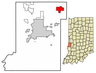
Fontanet is an unincorporated census-designated place in central Nevins Township, Vigo County, in the U.S. state of Indiana. It lies along Baldwin St., northeast of the city of Terre Haute, the county seat of Vigo County. Its elevation is 614 feet (187 m), and it is located at 39°34′34″N87°14′37″W. Although Fontanet is unincorporated, it has a post office, with the ZIP Code of 47851.

Morges is an unincorporated community in Rose Township, Carroll County, Ohio, United States. The community is part of the Canton–Massillon Metropolitan Statistical Area. Part of the community is served by Waynesburg, post office 44688, and part by Magnolia, post office 44643.

Peoli is an unincorporated community in Washington Township, Tuscarawas County, Ohio, United States, along State Route 258.

The Seven Ranges was a land tract in eastern Ohio that was the first tract to be surveyed in what became the Public Land Survey System. The tract is 42 miles (68 km) across the northern edge, 91 miles (146 km) on the western edge, with the south and east sides along the Ohio River. It consists of all of Monroe, Harrison, Belmont and Jefferson, and portions of Carroll, Columbiana, Tuscarawas, Guernsey, Noble, and Washington County.

New Harrisburg is an unincorporated community in Harrison TownshipCarroll County, Ohio, United States. The community is part of the Canton–Massillon Metropolitan Statistical Area. The community is served by the Carrollton post office, and has ZIP code 44615. It lies on State route 171.

Petersburg sometimes spelled “Petersburgh”, is an unincorporated community in Union Township, Carroll County, Ohio, United States. The community is part of the Canton–Massillon Metropolitan Statistical Area. The community is served by the Carrollton post office, ZIP code 44615. It is located on the North Fork McGuire Creek and State Route 332.
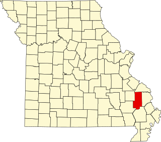
Sank is an unincorporated community in the south-central part of Liberty Township in Bollinger County, Missouri, United States. The community is accessed via a county road, one mile north of Missouri Route 51. The confluence of Clubb and Hawker creeks lies just to the southwest of the location and the Sank State Wildlife Area is located along the south side of Route 51 and Hawker Creek. Zalma lies four miles to the southwest and Dongola is three miles east. Marble Hill is about nine miles to the north-northeast along Route 51.
Laceyville is a former community in Harrison County, Ohio, United States.
Moorefield is an unincorporated community in Harrison County, in the U.S. state of Ohio.
West Chester is an unincorporated community in Tuscarawas County, in the U.S. state of Ohio.
Freeburg is an unincorporated community in Washington Township, Stark County, in the U.S. state of Ohio.

Comet is an unincorporated community in Green Township, Summit County, Ohio, United States. It is located at 40°55′21″N81°31′32″W, on the northwestern end of Comet Lake and wholly within the city of Green.
Yellow Creek is an unincorporated community in Saline Township, Jefferson County, Ohio, United States. It is located northwest of Hammondsville at the intersection of Ohio State Route 7 and Ohio State Route 213 where the Yellow Creek empties into the Ohio River, at 40°34′28″N80°40′03″W.
References
- ↑ U.S. Geological Survey Geographic Names Information System: Smyrna, Ohio
- ↑ Historic Map Works: Freeport Township, Harrison County, Ohio 1934. Accessed May 2021.
- ↑ Hanna, Charles Augustus (1900). Historical Collections of Harrison County, in the State of Ohio. Privately printed. p. 115.
- ↑ Mindat.org: Smyrna, Township of Freeport, Harrison County, Ohio, United States. Accessed May 2021.
- ↑ Home Town Locator: Smyrna Post Office (historical), Harrison County, Ohio. Accessed May 2021.
Municipalities and communities of Harrison County, Ohio, United States | ||
|---|---|---|
| Villages |  | |
| Townships | ||
| CDP | ||
| Unincorporated communities | ||
| Ghost towns | ||
| Footnotes | ‡This populated place also has portions in an adjacent county or counties | |
Coordinates: 40°10′18″N81°14′37″W / 40.17167°N 81.24361°W
| | This Harrison County, Ohio state location article is a stub. You can help Wikipedia by expanding it. |