Spencer, Ohio

Last updated

Spencer, Ohio
Spencer Ohio old Town Hall, now Historical Society.jpg
Old Town Hall now houses Spencer Historical Society
OHMap-doton-Spencer.png
Location of Spencer, Ohio
Map of Medina County Ohio Highlighting Spencer Village.png
Location of Spencer in Medina County
Coordinates: 41°05′59″N82°07′32″W / 41.09972°N 82.12556°W / 41.09972; -82.12556
Country United States
State Ohio
County Medina
Area
[1]
  Total0.99 sq mi (2.57 km2)
  Land0.99 sq mi (2.55 km2)
  Water0.01 sq mi (0.02 km2)
Elevation
[2]
915 ft (279 m)
Population
 (2020)
  Total684
  Density693.71/sq mi (267.83/km2)
Time zone UTC-5 (Eastern (EST))
  Summer (DST) UTC-4 (EDT)
ZIP code
44275
Area code 330
FIPS code 39-73992 [3]
GNIS feature ID2399870 [2]
Website spencervillageohio.com

Spencer is a village in Spencer Township located in Medina County, Ohio, United States. The population was 684 at the 2020 census.

Contents

History

A post office called Spencer has been in operation since 1849. [4] The village takes its name from Spencer Township. [5]

Geography

According to the United States Census Bureau, the village has a total area of 1.00 square mile (2.59 km2), of which, 0.99 square miles (2.56 km2) is land and 0.01 square miles (0.03 km2) is water. [6]

Demographics

Historical population
CensusPop.Note
1880 159
1920 527
1930 59212.3%
1940 591−0.2%
1950 74025.2%
1960 7420.3%
1970 7582.2%
1980 7640.8%
1990 726−5.0%
2000 7472.9%
2010 7530.8%
2020 684−9.2%
U.S. Decennial Census [7]

2010 census

As of the census [8] of 2010, there were 753 people, 283 households, and 203 families living in the village. The population density was 760.6 inhabitants per square mile (293.7/km2). There were 306 housing units at an average density of 309.1 per square mile (119.3/km2). The racial makeup of the village was 97.5% White, 0.1% African American, 0.1% Native American, 0.3% Asian, 0.5% from other races, and 1.5% from two or more races. Hispanic or Latino of any race were 3.1% of the population.

There were 283 households, of which 37.1% had children under the age of 18 living with them, 56.2% were married couples living together, 9.9% had a female householder with no husband present, 5.7% had a male householder with no wife present, and 28.3% were non-families. 23.0% of all households were made up of individuals, and 13.1% had someone living alone who was 65 years of age or older. The average household size was 2.66 and the average family size was 3.09.

The median age in the village was 37.3 years. 27.5% of residents were under the age of 18; 8.3% were between the ages of 18 and 24; 25.7% were from 25 to 44; 24.3% were from 45 to 64; and 13.9% were 65 years of age or older. The gender makeup of the village was 49.4% male and 50.6% female.

2000 census

As of the census [3] of 2000, there were 747 people, 285 households, and 204 families living in the village. The population density was 755.8 inhabitants per square mile (291.8/km2). There were 296 housing units at an average density of 299.5 per square mile (115.6/km2). The racial makeup of the village was 99.06% White, 0.54% Native American, 0.13% Asian, and 0.27% from two or more races. Hispanic or Latino of any race were 0.80% of the population.

There were 285 households, out of which 37.9% had children under the age of 18 living with them, 57.9% were married couples living together, 9.8% had a female householder with no husband present, and 28.1% were non-families. 21.4% of all households were made up of individuals, and 9.1% had someone living alone who was 65 years of age or older. The average household size was 2.62 and the average family size was 3.09.

In the village, the population was spread out, with 30.0% under the age of 18, 6.8% from 18 to 24, 32.1% from 25 to 44, 20.6% from 45 to 64, and 10.4% who were 65 years of age or older. The median age was 34 years. For every 100 females there were 95.5 males. For every 100 females age 18 and over, there were 93.0 males.

The median income for a household in the village was $37,404, and the median income for a family was $42,500. Males had a median income of $35,556 versus $25,278 for females. The per capita income for the village was $16,708. About 2.0% of families and 3.9% of the population were below the poverty line, including 2.9% of those under age 18 and 6.3% of those age 65 or over.

Related Research Articles

<span class="mw-page-title-main">Chrisney, Indiana</span> Town in Indiana, United States

Chrisney is a town in Grass Township, Spencer County, in the U.S. state of Indiana. The population was 481 at the 2010 census.

<span class="mw-page-title-main">Wilbur Park, Missouri</span> Village in Missouri, United States

Wilbur Park is a village in St. Louis County, Missouri, United States. The population was 439 at the 2020 census.

<span class="mw-page-title-main">Spencer, Nebraska</span> Village in Nebraska, United States

Spencer is a village in Boyd County, Nebraska, United States. The population was 455 at the 2010 census, down from 541 in 2000.

<span class="mw-page-title-main">Hanley Hills, Missouri</span> Village in Missouri, United States

Hanley Hills is a village in St. Louis County, Missouri, United States. The population was 2,101 at the 2010 census.

<span class="mw-page-title-main">Spencerville, Ohio</span> Village in Ohio, United States

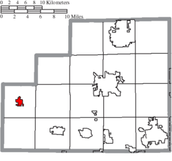
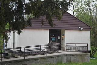
Spencerville is a village in Allen County, Ohio, United States. The population was 2,198 at the 2020 census. It is included in the Lima, Ohio Metropolitan Statistical Area.

<span class="mw-page-title-main">Bremen, Ohio</span> Village in Ohio, United States

Bremen is a village in Fairfield County, Ohio, United States. The population was 1,479 at the 2020 census.

<span class="mw-page-title-main">Valleyview, Ohio</span> Village in Ohio, United States

Valleyview is a village in Franklin County, Ohio, United States. The population was 669 at the 2020 census.

<span class="mw-page-title-main">Addyston, Ohio</span> Village in Ohio, United States

Addyston is a village in Miami Township, Hamilton County, Ohio, United States. Located along the Ohio River, it is a western suburb of the neighboring city of Cincinnati. The population was 927 at the 2020 census.

<span class="mw-page-title-main">Cleves, Ohio</span> City in Ohio, United States

Cleves is a village in Miami Township, Hamilton County, Ohio, United States. Located along the Ohio River, it is a western suburb of Cincinnati. The population was 3,414 at the 2020 census.

<span class="mw-page-title-main">Haviland, Ohio</span> Village in Ohio, United States

Haviland is a village in Paulding County, Ohio, United States. The population was 160 at the 2020 census.

<span class="mw-page-title-main">South Webster, Ohio</span> Village in Ohio, United States

South Webster is a village in northeast Scioto County, Ohio, United States. It lies along State Route 140. The population was 670 at the 2020 census.

<span class="mw-page-title-main">Macksburg, Ohio</span> Village in Ohio, United States

Macksburg is a village in Washington County, Ohio, United States, along the West Fork of Duck Creek. The population was 120 at the 2020 census. The village is about 28 miles (45 km) south of Cambridge, Ohio.

<span class="mw-page-title-main">Vienna, West Virginia</span> City in West Virginia, United States

Vienna is a city in Wood County, West Virginia, United States, situated along the Ohio River. The population was 10,676 at the 2020 census. It is the second-largest city in the Parkersburg–Vienna metropolitan area.

<span class="mw-page-title-main">Grant, Clark County, Wisconsin</span> Town in Wisconsin, United States

Grant is a town in Clark County in the U.S. state of Wisconsin. The population was 916 at the 2010 census. The ghost towns of Kurth and Maple Works were located in the town.

<span class="mw-page-title-main">Friesland, Wisconsin</span> Village in Wisconsin, United States

Friesland is a village in Columbia County, Wisconsin, United States. The population was 320 at the 2020 census. It is part of the Madison Metropolitan Statistical Area, and was named after Friesland, one of the twelve provinces of the Netherlands.

<span class="mw-page-title-main">Verona, Ohio</span> Village in Ohio, United States

Verona is a village in Montgomery and Preble counties in the U.S. state of Ohio. The population was 403 at the 2020 census. It is part of the Dayton Metropolitan Statistical Area.

Spencer is a town in Tioga County, New York, United States. The population was 2,976 at the 2020 census. The town and its primary village are named after Ambrose Spencer. It lies on the western border of the county and is south of Ithaca. Inside the town is the Village of Spencer. The village of Candor borders the town to the east and southeast, with Waverly to the southwest and Van Etten to the west, while Danby is to the north.

<span class="mw-page-title-main">Lowell, Wisconsin</span> Village in Wisconsin, United States

Lowell is a village in Dodge County, Wisconsin, United States, along the Beaver Dam River. The population was 340 at the 2010 census. The village is located within the Town of Lowell.

The Town of Spencer is located in Marathon County, Wisconsin, United States. It is part of the Wausau, WI Metropolitan Statistical Area. The population was 1,581 at the 2010 census. The village of Spencer is located in the northeastern part of the town.The unincorporated community of Mann also is located in the town.

<span class="mw-page-title-main">Spencer, Wisconsin</span> Village in Wisconsin, United States

Spencer is a village in Marathon County, Wisconsin. It is part of the Wausau, Wisconsin Metropolitan Statistical Area. The population was 1,925 at the 2010 census.

References

  1. "ArcGIS REST Services Directory". United States Census Bureau. Retrieved September 20, 2022.
  2. 1 2 U.S. Geological Survey Geographic Names Information System: Spencer, Ohio
  3. 1 2 "U.S. Census website". United States Census Bureau . Retrieved January 31, 2008.
  4. "Post offices". Jim Forte Postal History. Retrieved June 20, 2016.
  5. Overman, William Daniel (1958). Ohio Town Names. Akron, OH: Atlantic Press. p. 129.
  6. "US Gazetteer files 2010". United States Census Bureau. Archived from the original on January 25, 2012. Retrieved January 6, 2013.
  7. "Census of Population and Housing". Census.gov. Retrieved June 4, 2015.
  8. "U.S. Census website". United States Census Bureau . Retrieved January 6, 2013.