Stewartsville, Indiana

Last updated
Stewartsville, Indiana
Unincorporated community
USA Indiana location map.svg
Red pog.svg
Stewartsville
Usa edcp location map.svg
Red pog.svg
Stewartsville
Coordinates: 38°11′05″N87°49′58″W / 38.18472°N 87.83278°W / 38.18472; -87.83278 Coordinates: 38°11′05″N87°49′58″W / 38.18472°N 87.83278°W / 38.18472; -87.83278
Country United States
State Indiana
County Posey
Township Robb
Elevation [1] 479 ft (146 m)
Time zone Central (CST) (UTC-6)
  Summer (DST) CDT (UTC-5)
ZIP code 47633
Area code(s) 812, 930
GNIS feature ID 444158

Stewartsville is an unincorporated community in Robb Township, Posey County, in the U.S. state of Indiana. [2]
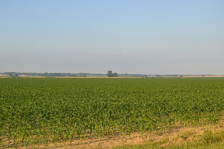
Robb Township, Posey County, Indiana Township in Indiana, United States

Robb Township is one of ten townships in Posey County, Indiana. As of the 2000 census, its population was 2,074.

Posey County, Indiana county in Indiana, United States

Posey County is a county located in the southwestern corner of the U.S. state of Indiana. Its southern border is formed by the Ohio River, and the western border by the Wabash River, a tributary. As of 2010, the population was 25,910. The county seat is Mount Vernon.

U.S. state constituent political entity sharing sovereignty as the United States of America

In the United States, a state is a constituent political entity, of which there are currently 50. Bound together in a political union, each state holds governmental jurisdiction over a separate and defined geographic territory and shares its sovereignty with the federal government. Due to this shared sovereignty, Americans are citizens both of the federal republic and of the state in which they reside. State citizenship and residency are flexible, and no government approval is required to move between states, except for persons restricted by certain types of court orders. Four states use the term commonwealth rather than state in their full official names.

Contents

History

Stewartsville was originally called Paris, and under the latter name was laid out in 1838. [3] The name was later changed to honor the community's founder, James Stewart. [4] A post office was established under the name Stewartsville in 1852, and remained in operation until it was discontinued in 1982. [5]

Geography

Stewartsville is located at 38°11′05″N87°49′58″W / 38.18472°N 87.83278°W / 38.18472; -87.83278 .

Related Research Articles

Solitude, Indiana Unincorporated community in Indiana, United States

Solitude is an unincorporated community in Lynn Township, Posey County, in the U.S. state of Indiana.

Bogle Corner, Indiana Unincorporated community in Indiana, United States

Bogle Corner is an unincorporated community in Lewis Township, Clay County, Indiana. It is part of the Terre Haute Metropolitan Statistical Area.

Blairsville, Indiana Unincorporated community in Indiana, United States

Blairsville is an unincorporated community in Robinson Township, Posey County, in the U.S. state of Indiana.

Parkers Settlement, Indiana Census-designated place in Indiana, United States

Parkers Settlement is an unincorporated community and census-designated place in Robinson Township, Posey County, in the U.S. state of Indiana.

Saint Wendel, Indiana Unincorporated community in Indiana, United States

Saint Wendel is an unincorporated community located on the Vanderburgh-Posey county line in the U.S. state of Indiana. It occupies small portions of two townships-- Armstrong and Robinson. The community is named for St. Wendel Parish, which in turn is named after Wendelin of Trier, patron saint of Wendel Wassmer, who originally owned the grounds used for this Catholic church building.

Caborn, Indiana Unincorporated community in Indiana, United States

Caborn is an unincorporated community in Marrs Township, Posey County, in the U.S. state of Indiana.

Farmersville, Indiana Unincorporated community in Indiana, United States

Farmersville is an unincorporated community in Black Township, Posey County, in the U.S. state of Indiana.

Hovey, Indiana Unincorporated community in Indiana, United States

Hovey is an unincorporated community in Point Township, Posey County, in the U.S. state of Indiana.

Savah, Indiana Unincorporated community in Indiana, United States

Savah is an unincorporated community in Lynn Township, Posey County, in the U.S. state of Indiana.

Saint Philip, Indiana Unincorporated community in Indiana, United States

Saint Philip is an unincorporated community in Marrs Township, Posey County, in the U.S. state of Indiana.

West Franklin, Indiana Unincorporated community in Indiana, United States

West Franklin is an unincorporated community in Marrs Township, Posey County, in the U.S. state of Indiana.

Barrett, Indiana Unincorporated community in Indiana, United States

Barrett is an unincorporated community in Robb Township, Posey County, in the U.S. state of Indiana.

Erwin, Indiana Unincorporated community in Indiana, United States

Erwin is an unincorporated community in Black Township, Posey County, in the U.S. state of Indiana.

Grafton, Indiana Unincorporated community in Indiana, United States

Grafton is an unincorporated community in Black Township, Posey County, in the U.S. state of Indiana.

Hepburn, Indiana Unincorporated community in Indiana, United States

Hepburn is an unincorporated community in Center Township, Posey County, in the U.S. state of Indiana.

Lippe, Indiana Unincorporated community in Indiana, United States

Lippe is an unincorporated community in Robinson Township, Posey County, in the U.S. state of Indiana.

New Baltimore, Indiana Unincorporated community in Indiana, United States

New Baltimore is an unincorporated community in Bethel Township, Posey County, in the U.S. state of Indiana.

Oliver, Indiana Unincorporated community in Indiana, United States

Oliver is an unincorporated community in Center Township, Posey County, in the U.S. state of Indiana.

Springfield, Posey County, Indiana Unincorporated community in Indiana, United States

Springfield is an unincorporated community in Lynn Township, Posey County, in the U.S. state of Indiana.

References

  1. "US Board on Geographic Names". United States Geological Survey. October 25, 2007. Retrieved 2016-11-17.
  2. "Stewartsville, Indiana". Geographic Names Information System . United States Geological Survey . Retrieved July 14, 2017.
  3. Leffel, John C. (1913). History of Posey County, Indiana. Standard Publishing Company. p. 116.
  4. History of Posey County, Indiana: from the earliest times to the present. Goodspeed Publishing Co. 1886. p. 413.
  5. "Posey County". Jim Forte Postal History. Retrieved 1 November 2015.