
Posey County is the southernmost, southwesternmost, and westernmost county in the U.S. state of Indiana. Its southern border is formed by the Ohio River, and its western border by the Wabash River, a tributary to the Ohio. As of 2020, the population was 25,222. The county seat is Mount Vernon.

Mount Vernon is a city in and the county seat of Posey County, Indiana, United States. Located in the state's far southwestern corner, within 15 miles (24 km) of both the southernmost or westernmost points, it is the westernmost city in the state. The southernmost is Rockport, located along the Ohio River about 40 miles (64 km) to the southeast.
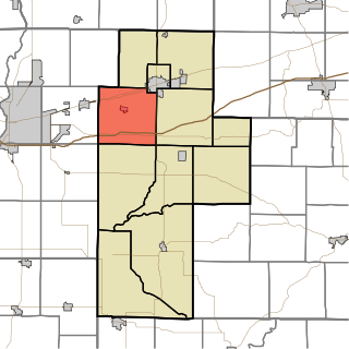
Posey Township is one of eleven townships in Clay County, Indiana. As of the 2010 census, its population was 4,063 and it contained 1,706 housing units.

Bethel Township is one of ten townships in Posey County, Indiana. As of the 2000 census, its population was 327.

Black Township is one of ten townships in Posey County, Indiana. As of the 2000 census, its population was 10,288. The township is the largest both in terms of area and population in Posey County.

Center Township is one of ten townships in Posey County, Indiana. As of the 2000 census, its population was 1,321.

Lynn Township is one of ten townships in Posey County, Indiana. As of the 2000 census, its population was 945.

Marrs Township is one of ten townships in Posey County, Indiana. As of the 2000 census, its population was 4,868.

Point Township is one of ten townships in Posey County, Indiana. As of the 2000 census, its population was 497. The lowest, the southernmost, and the westernmost points in Indiana are all located along the township's boundaries.
Smith Township is one of ten townships in Posey County, Indiana, USA. At the 2000 census, its population was 1,292.

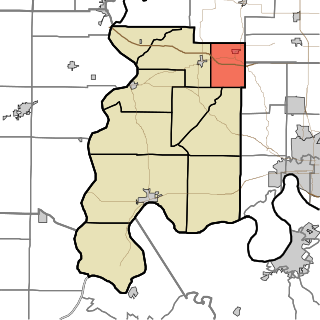
Posey Township is one of thirteen townships in Franklin County, Indiana, United States. As of the 2010 census, its population was 1,051.

Wadesville is a census designated place in northern Center Township, Posey County, in the U.S. state of Indiana. It lies along State Road 66 northeast of the city of Mt. Vernon, the county seat of Posey County. Although Wadesville is unincorporated, it has a post office, with the ZIP code of 47638.

The Evansville metropolitan area is the 164th largest metropolitan statistical area (MSA) in the United States. The primary city is Evansville, Indiana, the third most populous city in Indiana and the most populous city in Southern Indiana as well as the hub for Southwestern Indiana. Other Indiana cities include Boonville, Mount Vernon, Oakland City, and Princeton. Large towns in Indiana include Chandler, Fort Branch, and Newburgh. Cities in Kentucky include Henderson, Dixon, Providence, and Robards and currently covers an area of 2,367 sq mi (6,130 km2). It is the primary metropolitan area in the Illinois–Indiana–Kentucky Tri-State Area.
Rapture is an unincorporated community in Harmony Township, Posey County, in the U.S. state of Indiana.
Caborn is an unincorporated community in Marrs Township, Posey County, in the U.S. state of Indiana.
Farmersville is an unincorporated community in Black Township, Posey County, in the U.S. state of Indiana.
Stewartsville is an unincorporated community and Census Designated Place in Robb Township, Posey County, in the U.S. state of Indiana.
Grafton is an unincorporated community in Black Township, Posey County, in the U.S. state of Indiana.
New Baltimore is an unincorporated community in Bethel Township, Posey County, in the U.S. state of Indiana.
Springfield is an unincorporated community in Lynn Township, Posey County, in the U.S. state of Indiana.


