The Cabot Trail is a scenic highway on Cape Breton Island in Nova Scotia, Canada. It is a 298 km (185 mi) loop around the northern tip of the island, passing along and through the Cape Breton Highlands and the Cape Breton Highlands National Park.

Gongliao District is a rural district in the eastern part of New Taipei City, Taiwan. It is the easternmost district on the main island of Taiwan and at its easternmost tip is Cape Santiago.

Quadra Island is a large island off the eastern coast of Vancouver Island in British Columbia, Canada. It is part of the Discovery Islands located within the Strathcona Regional District.

The R402 is a Regional Route in South Africa that connects the N2 between Stormsrivier and Humansdorp with the R62 between Humansdorp and Joubertina.

Port Elizabeth, officially renamed Gqeberha and colloquially often referred to as P.E., is a major seaport and the most populous city in the Eastern Cape province of South Africa. It is the seat of the Nelson Mandela Bay Metropolitan Municipality, South Africa's second-largest metropolitan district by area size. It is the sixth-most-populous city in South Africa and is the cultural, economic and financial centre of the Eastern Cape.

Somerset West is a town in the Western Cape, South Africa. Organisationally and administratively it is included in the City of Cape Town metropolitan municipality as a suburb of the Helderberg region . The vehicle registration code for Somerset West is CFM and the post code is 7130 for street addresses, and 7129 for post office boxes.
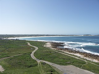
Cape St. Francis is a village in South Africa, situated on a headland in the Eastern Cape Province. It is popular for its clean beaches and as a surfing location.

Pringle Bay is a small coastal village in the Overberg region of the Western Cape, in South Africa. It is situated at the foot of Hangklip, on the opposite side of False Bay from Cape Point. The town and surrounds are part of the Kogelberg Biosphere Reserve, a UNESCO Heritage Site. The bay is named after Rear-Admiral Thomas Pringle, of the Royal Navy, who commanded the naval station at the Cape in the late 1790s.

Rosebank railway station is a Metrorail station on the Southern Line in Rosebank, a suburb of Cape Town. It is located between Main Road and Liesbeek Parkway; on the west side it is accessible from Ryan Road and Hope Road, while on the east side it is accessible from Lower Nursery Road.
Bizana is a town in the Eastern Cape province of South Africa. It is the seat of the Winnie Madikizela-Mandela Local Municipality.

Storms River is a river in the Eastern Cape province of South Africa. The river mouth is located in the Tsitsikamma National Park. The 5 day Otter Trail starts at the Storms River mouth.

Joubertina is a small town in the Kou-Kamma Local Municipality, Sarah Baartman District of the Eastern Cape province of South Africa.

Rooiels is a settlement in Overberg District Municipality in the Western Cape province of South Africa. The name is often written as Rooi-Els, but the name of the township was registered as Rooiels. It was declared a township in June 1948, and is situated 5 km north of Pringle Bay, on the eastern shore of False Bay. It was named after the farm and river by this name.
Prototheora serruligera is a species of moth of the family Prototheoridae. It is found in South Africa, where it known only from two somewhat disjunct southern coastal Cape sites, one at 1,220 meters in mountain fynbos vegetation in the Hottentots Holland Mountains and the other in the wetter, temperate Tsitsikamma Forest along the Stormsrivier.
Qamata is a small town in Intsika Yethu Municipality, Chris Hani District, Eastern Cape Province, South Africa. From 1963 to 1994 it was part of the semi-autonomous Transkei, and before that of western Tembuland. Qamata is located on Route R61 and on the Qamata River. It is 18 kilometres (11 mi) west of the town of Cofimvaba, 39 kilometres (24 mi) east of the R61 junction with Route N6 and 58 kilometres (36 mi) east of Queenstown.

St Francis Bay is a holiday town in Sarah Baartman District Municipality in the Eastern Cape province of South Africa, roughly one hour’s drive from Port Elizabeth.
Morgan Bay is a village in Amathole District Municipality in the Eastern Cape province of South Africa.

Steenberg railway station is a Metrorail station on the Southern Line in Steenberg, a suburb of Cape Town. It is located on Henley Road, which is just off Military Road. The station is located on the edge of Steenberg, towards Kirstenhof and is alongside the Keyser River, which flows into Zandvlei.
Pinelands railway station is a Metrorail station situated on the western edge of Pinelands, a suburb of Cape Town, South Africa. It is served by trains on the Cape Flats Line and the Central Line. Cape Flats Line trains travel from Cape Town through Pinelands and Athlone to Retreat. Central Line trains travel from Cape Town through Pinelands and Langa to Mitchell's Plain, Khayelitsha and Bellville.
Tula is a village in the Eastern District of Tutuila Island in American Samoa. Tula is located in Vaifanua County and had a population of 405 as of the 2010 U.S. Census.


