
Columbus is a city in and the county seat of Bartholomew County, Indiana, United States. The population was 50,474 at the 2020 census. The relatively small city has provided a unique place for noted Modern architecture and public art, commissioning numerous works since the mid-20th century; the annual program Exhibit Columbus celebrates this legacy. Located about 40 mi (64 km) south of Indianapolis, on the east fork of the White River, it is the state's 20th-largest city. It is the principal city of the Columbus, Indiana metropolitan statistical area, which encompasses all of Bartholomew County. Columbus is the birthplace of former Indiana Governor and former Vice President of the United States, Mike Pence.
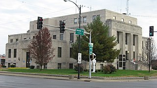
Jefferson County is a county located in the southern part of the U.S. state of Illinois. According to the 2020 census, it has a population of 37,113. The county seat is Mount Vernon.

Morrisonville is a small town in Christian County, Illinois, United States. The population was 997 at the 2020 census.

Trenton is a city in Clinton County, Illinois, United States. The population was 2,690 at the 2020 census.

Streamwood is a village in Cook County, Illinois, United States. Per the 2020 census, the population was 39,577. It is a northwest suburb of Chicago, and is a part of the Chicago metropolitan area.

Wheaton is a suburban city in Milton and Winfield Townships and is the county seat of DuPage County, Illinois. It is located approximately 25 miles (40 km) west of Chicago. As of the 2020 census, Wheaton's population was 53,970, making it the 27th most populous municipality in Illinois.
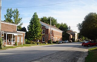
Bishop Hill is a village in Henry County, Illinois, United States, along the South Edwards River. The population was 128 at the 2010 census, up from 125 in 2000. It is the home of the Bishop Hill State Historic Site, a park operated by the Illinois Historic Preservation Agency.

Jerseyville is the largest city in and the county seat of Jersey County, Illinois, United States. At the 2020 census, the city had a total population of 8,337.

Hanover is a town in Hanover Township, Jefferson County, southeast Indiana, along the Ohio River. The population was 3,546 at the 2010 census. Hanover is the home of Hanover College, a small Presbyterian liberal arts college. The "Point," located on the campus of Hanover College, is the only place along the Ohio River that three bends of the river can be viewed at once. The tallest waterfall in Indiana, Fremont Falls, is located in Hanover.

Texico is a city in Curry County, New Mexico, United States. Its population was 1,130 at the 2010 census. The city is located on the Texas-New Mexico border with the town of Farwell across the border.
Farwell is a city in and the county seat of Parmer County, Texas, United States. Its population was 1,363 at the 2010 census. The city is located on the Texas-New Mexico border with the city of Texico, New Mexico, across the border.

La Vernia is a city in Wilson County, Texas, United States. La Vernia is on the south bank of Cibolo Creek at the junction of U.S. Highway 87 and Texas Farm to Market Road 775, about 25 miles east of downtown San Antonio. The population was 1,077 at the 2020 census. La Vernia is part of the San Antonio Metropolitan Statistical Area.
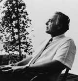
Harry Mohr Weese was an American architect who had an important role in 20th century modernism and historic preservation. His brother, Ben Weese, is also a renowned architect.
Sandia View Academy is a private high school in Corrales, New Mexico. It is located in panoramic view of the Sandia Mountains. Sandia View Academy is a seven Albuquerque-area constituent church-run, grades 9 to 12, accredited senior high school in the Texico Conference of the Southwestern Union Conference of the Seventh-day Adventist Church. The school was founded in 1941 and has students from around the ABQ Metro area. Sandia View Academy is accredited through the State of New Mexico's Public Education Department (PED) for private schools, the Adventist Accrediting Association, and the National Association of Private Schools. The Adventist school system is a worldwide network and is recognized as the second-largest parochial school system in the world.
St. John's Catholic Newman Center is the largest Newman Center in the United States. It is located on the campus of the University of Illinois at Urbana–Champaign. Consisting of St. John's Catholic Chapel, Newman Hall, and a variety of student-focused ministry programs, the center resides within the Roman Catholic Diocese of Peoria.

Field Township is one of sixteen townships in Jefferson County, Illinois, USA. As of the 2010 census, its population was 1,468 and it contained 637 housing units.

M. Miriam Herrera is an American author and poet. She teaches at the University of Texas Rio Grande Valley and currently teaches Introduction to Mexican Studies as well as Composition and Rhetoric and Creative Writing. She is a Lecturer with the Department of Writing Language Studies, and a Mexican American Studies Program (MASC) Affiliate. Her poetry often explores Mexican-American or Chicano life and her Crypto-Jewish and Cherokee heritage, but mainly the universal themes of nature, family, myth, and the transcendent experience.
The Empire City Historic Landmark is a California Historic Landmark in honor of the pioneer John C. Marvin who from 1850, settled on the south bank of the Tuolumne River and called the town "Empire City". Empire City was the head of navigation for small steamboats that could ascend the Tuolumne River carrying passengers and supplies. It was the shipping point for the large grain crops grown in the area. At its height, the town had three stores, a three-story hotel, two boarding houses, a blacksmith shop, a church, and a school house. Empire City was voted as the county seat of Stanislaus County from October 1854 to December 1855. The town was destroyed by flood waters during the Great Flood of 1862. A new railroad town was built 40 years later 1 mile north of the old town site, taking the name Empire.
The Imani School is a Christian private elementary and middle school in the Power Center, a multi-purpose complex in the 5 Corners District, and in Southwest Houston, Texas, United States. The school is marketed to African-American children, and it is one of the ministries of the Windsor Village United Methodist Church.

Elmhurst Christian Reformed Church is a congregation of the Christian Reformed Church in North America located on the southern edge of Elmhurst, Illinois. It was founded in 1924 as a Baptist mission in Bellwood. The founder was a woman who had converted to Christianity after a difficult life in which she was won by her husband in a card game. After moving to Elmhurst in 1964, the congregation flourished and constructed a large new building just off of Roosevelt Road. It remains one of the largest congregations in the Christian Reformed denomination and runs many programs for children, students, adults, and seniors.


