The Great Serpent Mound is a 1,348-foot-long (411 m), three-foot-high prehistoric effigy mound located in Peebles, Ohio. It was built on what is known as the Serpent Mound crater plateau, running along the Ohio Brush Creek in Adams County, Ohio. The mound is the largest serpent effigy in the world.

Fort Ancient is a name for a Native American culture that flourished from c. 1000–1750 CE and predominantly inhabited land near the Ohio River valley in the areas of modern-day southern Ohio, northern Kentucky, southeastern Indiana and western West Virginia. Although a contemporary of the Mississippian culture, they are often considered a "sister culture" and distinguished from the Mississippian culture. While far from agreed upon, there is evidence to suggest that the Fort Ancient Culture were not the direct descendants of the Hopewellian Culture. It is suspected that the Fort Ancient Culture introduced maize agriculture to Ohio. The Fort Ancient Culture were most likely the builders of the Great Serpent Mound. Recent archeological study and carbon dating suggests that Alligator Mound in Granville also dates to the Fort Ancient era, rather than the assumed Hopewell era. It is believed that neither the Serpent or Alligator Mounds are burial locations, but rather served as ceremonial effigy sites.


The Grand Village of the Illinois, also called Old Kaskaskia Village, is a site significant for being the best documented historic Native American village in the Illinois River valley. It was a large agricultural and trading village of Native Americans of the Illinois confederacy, located on the north bank of the Illinois River near the present town of Utica, Illinois. French explorers Louis Joliet and Father Jacques Marquette came across it in 1673. The Kaskaskia, a tribe of the Illiniwek people lived in the village. It grew rapidly after a French mission and fur trading post were established there in 1675, to a population of about 6,000 people in about 460 houses. Around 1691 the Kaskaskia and other Illiniwek moved further south, abandoning the site due to pressure from an Iroquois invasion from the northeast.
The Clough Creek and Sand Ridge Archaeological District is a historic district composed of two archaeological sites in the southwestern part of the U.S. state of Ohio. Its name is derived from those of the two sites included in the district: one that lies along Clough Creek, and one that occupies part of the Sand Ridge near the creek.

The Madisonville site is a prehistoric archaeological site near Mariemont, Ohio, United States. It was listed on the National Register of Historic Places on October 16, 1974 as the "Mariemont Embankment and Village Site".

The Mathew Mound is a Native American mound in the southwestern part of the U.S. state of Ohio. Located off Oak Road near the village of Evendale, the mound is believed to have been built by members of the Adena or Hopewell peoples during the Woodland period.

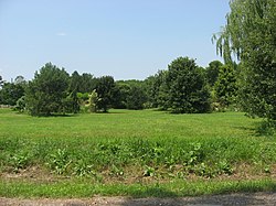
The Odd Fellows' Cemetery Mound is a Native American mound in the southwestern part of the U.S. state of Ohio. Located in the village of Newtown in Hamilton County, the mound is an oval approximately 110 feet (34 m) long and 90 feet (27 m) wide; its height is 11.3 feet (3.4 m). It is believed to have been built by the Adena culture.

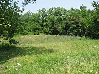
The Perin Village Site is an archaeological site in the southwestern part of the U.S. state of Ohio. Located in Newtown in Hamilton County, it is believed to have been inhabited by peoples of the Hopewell tradition.

The State Line Archeological District is a complex of archaeological sites and national historic district located west of Elizabethtown, Ohio, United States. Located on both sides of the Indiana/Ohio border, the historic district is composed of five contributing properties spread out across 8 acres (3.2 ha) of land. It is believed to have been the site of a village of the Fort Ancient culture of prehistoric Native Americans.

The Great Mound is a massive Native American mound in the southwestern part of the U.S. state of Ohio. Located in Section 19 of Madison Township in Butler County, it has a height of 43 feet (13 m) and a circumference of 511 feet (156 m). Its total volume is nearly 825,000 cubic feet (23,400 m3), making it the largest mound in Butler County and one of the largest in southwestern Ohio. Because of the mound's height and its placement on a ridgeline, an individual at the summit can see for a great distance. In the late nineteenth century, it was theorized that mounds such as the Great Mound were built as observation or watch points, and that the builders maintained the ability to light fires atop the mounds as a method of communicating across wide distances. The potential of these mounds for long-distance communication was demonstrated in 1990 by three groups of volunteers. After climbing the Great Mound, the first group established visual contact with the Hill-Kinder Mound in Franklin, from which point the observers of the second group contacted the third group atop the Miamisburg Mound near Dayton.

The Clover site (46CB40) is a Fort Ancient culture archeological site located near Lesage in Cabell County, West Virginia, United States. It is significant for its well-preserved remains of a late prehistoric/protohistoric Native American village. The site's unique assemblage has made it the type site for the Clover Phase of the Madisonville horizon of the Fort Ancient culture.

Georgesville is an unincorporated community in western Pleasant Township, Franklin County, Ohio, United States. It is located southwest of Columbus, the county seat of Franklin County and the capital and largest city of Ohio.

Prehistory of Ohio provides an overview of the activities that occurred prior to Ohio's recorded history. The ancient hunters, Paleo-Indians, descended from humans that crossed the Bering Strait. There is evidence of Paleo-Indians in Ohio, who were hunter-gatherers that ranged widely over land to hunt large game. For instance, mastodon bones were found at the Burning Tree Mastodon site that showed that it had been butchered. Clovis points have been found that indicate interaction with other groups and hunted large game. The Paleo Crossing site and Nobles Pond site provide evidence that groups interacted with one another. The Paleo-Indian's diet included fish, small game, and nuts and berries that gathered. They lived in simple shelters made of wood and bark or hides. Canoes were created by digging out trees with granite axes.

The Bone Mound II is a Native American mound in the southwestern part of the U.S. state of Ohio. Located northwest of the unincorporated community of Oregonia, the mound sits in an area of light woodland.

The Bone Stone Graves are a prehistoric cemetery in the southwestern part of the U.S. state of Ohio. Located northwest of the unincorporated community of Oregonia in northwestern Washington Township, Warren County, the cemetery is composed of an uncertain number of graves of individuals from the Fort Ancient culture of Native Americans.
The Bentley site (15Gp15) is a Late Fort Ancient culture Madisonville horizon archaeological site overlain by an 18th-century Shawnee village; it is located within the Lower Shawneetown Archeological District, near South Portsmouth in Greenup County, Kentucky and Lewis County, Kentucky. It was added to the National Register of Historic Places on April 28, 1983. It is located near four groups of Hopewell tradition mounds, built between 100 BCE and 500 CE, known as the Portsmouth Earthworks.

The Hillside Haven Mound is a Native American mound in the southwestern part of the U.S. state of Ohio. Located southwest of Oakland in Clinton County, it sits in dense woodland on the side of a hill. It is believed to have been conical in shape at the time of construction, but today it is rounded in shape, measuring 2.5 feet (0.76 m) high and 33 feet (10 m) in diameter.
The Beam Farm Woodland Archaeological District is a group of archaeological sites in the southwestern part of the U.S. state of Ohio. Located at 3983 Stone Road near the village of Sabina in Clinton County, the district is composed of one Native American mound and two other archaeological sites spread out over an area of 2 acres (0.81 ha). Known as the Beam Farm Mound and the Beam Sites 9 and 12, the sites that compose the district have yielded artifacts from the Adena culture and the Hopewell tradition, both of which inhabited southwestern Ohio during the Woodland period. Because both the Adena and the Hopewell lived around the mound, and because both cultures built mounds, the identity of the people who constructed the Beam Farm Mound cannot be established; all that can be known with reasonable certainty is that it was raised during the early or middle portion of the Woodland period, or between 800 BC and AD 500.
The Hotel Plaza site (Ls-36) is located near Starved Rock, on the Illinois River across from the Zimmerman site (aka Grand Village of the Illinois. It is a multi-component site representing prehistoric, protohistoric and early historic periods, with the main occupation being an early Historic component associated with the French Fort St. Louis.