The Great Serpent Mound is a 1,348-foot-long (411 m), three-foot-high prehistoric effigy mound located in Peebles, Ohio. It was built on what is known as the Serpent Mound crater plateau, running along the Ohio Brush Creek in Adams County, Ohio. The mound is the largest serpent effigy in the world.

Fort Ancient is a name for a Native American culture that flourished from c. 1000–1750 CE and predominantly inhabited land near the Ohio River valley in the areas of modern-day southern Ohio, northern Kentucky, southeastern Indiana and western West Virginia. Although a contemporary of the Mississippian culture, they are often considered a "sister culture" and distinguished from the Mississippian culture. While far from agreed upon, there is evidence to suggest that the Fort Ancient Culture were not the direct descendants of the Hopewellian Culture. It is suspected that the Fort Ancient Culture introduced maize agriculture to Ohio. The Fort Ancient Culture were most likely the builders of the Great Serpent Mound. Recent archeological study and carbon dating suggests that Alligator Mound in Granville also dates to the Fort Ancient era, rather than the assumed Hopewell era. It is believed that neither the Serpent or Alligator Mounds are burial locations, but rather served as ceremonial effigy sites.

The Clough Creek and Sand Ridge Archaeological District is a historic district composed of two archaeological sites in the southwestern part of the U.S. state of Ohio. Its name is derived from those of the two sites included in the district: one that lies along Clough Creek, and one that occupies part of the Sand Ridge near the creek.

The Odd Fellows' Cemetery Mound is a Native American mound in the southwestern part of the U.S. state of Ohio. Located in the village of Newtown in Hamilton County, the mound is an oval approximately 110 feet (34 m) long and 90 feet (27 m) wide; its height is 11.3 feet (3.4 m). It is believed to have been built by the Adena culture.

The Rennert Mound Archeological District is a group of archaeological sites in the southwestern part of the U.S. state of Ohio. Located west of Elizabethtown in Hamilton County, the site is composed of one Native American mound and the remnants of two others, spread out over an area of 40 acres (16 ha).

The State Line Archeological District is a complex of archaeological sites and national historic district located west of Elizabethtown, Ohio, United States. Located on both sides of the Indiana/Ohio border, the historic district is composed of five contributing properties spread out across 8 acres (3.2 ha) of land. It is believed to have been the site of a village of the Fort Ancient culture of prehistoric Native Americans.

The Turpin site (33Ha19) is an archaeological site in the southwestern portion of the U.S. state of Ohio. Located near Newtown in Hamilton County, the site includes the remains of a village of the Fort Ancient culture and of multiple burial mounds. Numerous bodies have been found in and around the mounds as a result of thorough site investigations. The archaeological value of the site has resulted in its use in the study of similar locations and in its designation as a historic site.

The Great Mound is a massive Native American mound in the southwestern part of the U.S. state of Ohio. Located in Section 19 of Madison Township in Butler County, it has a height of 43 feet (13 m) and a circumference of 511 feet (156 m). Its total volume is nearly 825,000 cubic feet (23,400 m3), making it the largest mound in Butler County and one of the largest in southwestern Ohio. Because of the mound's height and its placement on a ridgeline, an individual at the summit can see for a great distance. In the late nineteenth century, it was theorized that mounds such as the Great Mound were built as observation or watch points, and that the builders maintained the ability to light fires atop the mounds as a method of communicating across wide distances. The potential of these mounds for long-distance communication was demonstrated in 1990 by three groups of volunteers. After climbing the Great Mound, the first group established visual contact with the Hill-Kinder Mound in Franklin, from which point the observers of the second group contacted the third group atop the Miamisburg Mound near Dayton.

The Carl Potter Mound is a historic Native American mound in southern Champaign County, Ohio, United States. Located near Mechanicsburg, it lies on a small ridge in a pasture field in southeastern Union Township. In 1974, the mound was listed on the National Register of Historic Places as a potential archaeological site, primarily because of its use as a burial mound.

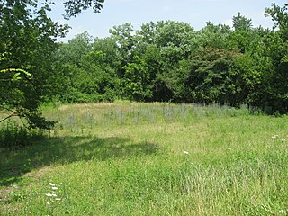
The Bone Mound II is a Native American mound in the southwestern part of the U.S. state of Ohio. Located northwest of the unincorporated community of Oregonia, the mound sits in an area of light woodland.
The Ufferman Site is an archaeological site in the central part of the U.S. state of Ohio. Located north of the city of Delaware, it occupies approximately 2 acres (0.81 ha) of land near Delaware Lake on property near to the boundaries of Delaware State Park. It appears to have been the location of a village of the Cole culture, which inhabited the region during the later portion of the Woodland period. Ufferman lies only 0.6 kilometres (0.37 mi) south of the W.S. Cole Site, the type site for the culture, and approximately 23 kilometres (14 mi) north of the Highbank Park Works, which are believed to have been built by peoples of the Cole culture.
The Zaleski Mound Group is a collection of three burial mounds in the village of Zaleski, Ohio, United States. Built by people of the prehistoric Adena culture, these earthworks are valuable archaeological sites.

The Feurt Mounds and Village Site is a Fort Ancient culture archaeological site with three burial mounds and an associated village, located in Clay Township in Scioto County, Ohio.
The Edith Ross Mound is a Native American mound and archaeological site in the southeastern part of the U.S. state of Ohio. Located near the village of Laurelville in Hocking County, the mound is a circular structure that measures 40 feet (12 m) in diameter at its base and 4.6 feet (1.4 m) high at the center. It is constructed primarily of earth, with large stones placed on various parts of the surface. Few changes have been made to the mound since white settlement of the region; a small depression in the northwestern corner may be the result of someone digging, but no significant damage was done.
Stone box graves were a method of burial used by Native Americans of the Mississippian culture in the Midwestern United States and the Southeastern United States. Their construction was especially common in the Cumberland River Basin, in settlements found around present-day Nashville, Tennessee.
The Beam Farm Woodland Archaeological District is a group of archaeological sites in the southwestern part of the U.S. state of Ohio. Located at 3983 Stone Road near the village of Sabina in Clinton County, the district is composed of one Native American mound and two other archaeological sites spread out over an area of 2 acres (0.81 ha). Known as the Beam Farm Mound and the Beam Sites 9 and 12, the sites that compose the district have yielded artifacts from the Adena culture and the Hopewell tradition, both of which inhabited southwestern Ohio during the Woodland period. Because both the Adena and the Hopewell lived around the mound, and because both cultures built mounds, the identity of the people who constructed the Beam Farm Mound cannot be established; all that can be known with reasonable certainty is that it was raised during the early or middle portion of the Woodland period, or between 800 BC and AD 500.

The Hodgen's Cemetery Mound is a Native American mound in the far eastern part of the U.S. state of Ohio. Located in the village of Tiltonsville along the Ohio River shoreline of Jefferson County, the mound is a prehistoric earthwork and archaeological site, and it has been named a historic site.

Fewkes Group Archaeological Site, also known as the Boiling Springs Site, is a pre American history Native American archaeological site located in the city of Brentwood, in Williamson County, Tennessee. It is in Primm Historic Park on the grounds of Boiling Spring Academy, a historic schoolhouse established in 1830. The 15-acre site consists of the remains of a late Mississippian culture mound complex and village roughly dating to 1050-1475 AD. The site, which sits on the western bank of the Little Harpeth River, has five mounds, some used for burial and others, including the largest, were ceremonial platform mounds. The village was abandoned for unknown reasons around 1450. The site is named in honor of Dr. J. Walter Fewkes, the Chief of the Bureau of American Ethnology in 1920, who had visited the site and recognized its potential. While it was partially excavated by the landowner in 1895, archaeologist William E. Myer directed a second, more thorough excavation in October 1920. The report of his findings was published in the Bureau of American Ethnology's Forty-First Annual Report. Many of the artifacts recovered from the site are now housed at the Smithsonian Institution. It was added to the National Register of Historic Places on April 21, 1980, as NRIS number 80003880.

The Bullskin Creek Site is an archaeological site in the southwestern portion of the U.S. state of Ohio. Located near Felicity in Clermont County, the site appears to have been a base camp for nomads during the Late Archaic period. The site comprises three loci: two significant areas of various debris and a large midden that underlies everything else. From these components, which cover an area of approximately 400 feet (120 m) by 600 feet (180 m), collectors and archaeologists have recovered hundreds of artifacts, including stone tools, weapons, and bone tools. Because the site is located in a farm field, it has frequently been cultivated, and the plow has brought at least five burials to the surface from a cemetery on the edge of the site. Among the types of features found at the site are ovens, trash pits, and postmolds. Bodies at the site were generally adorned with red ochre and buried in a flexed position.