Union County, Pennsylvania

Last updated

Union County
Old Union County Courthouse (New Berlin, Pennsylvania) 3.jpg
Old Union County Courthouse in New Berlin
Map of Pennsylvania highlighting Union County.svg
Location within the U.S. state of Pennsylvania
Pennsylvania in United States.svg
Pennsylvania's location within the U.S.
Coordinates: 40°58′N77°04′W / 40.96°N 77.06°W / 40.96; -77.06
CountryFlag of the United States.svg United States
StateFlag of Pennsylvania.svg  Pennsylvania
FoundedMarch 22, 1813
Seat Lewisburg
Largest boroughLewisburg
Area
  Total318 sq mi (820 km2)
  Land316 sq mi (820 km2)
  Water1.8 sq mi (5 km2)  0.6%
Population
 (2020)
  Total42,681 Decrease2.svg
  Density142/sq mi (55/km2)
Time zone UTC−5 (Eastern)
  Summer (DST) UTC−4 (EDT)
Congressional district 12th
Website unionco.org

Union County is a county in the Commonwealth of Pennsylvania. As of the 2020 census, the population was 42,681. [1] Its county seat is Lewisburg. [2] The county was created on March 22, 1813, from part of Northumberland County. Its name is an allusion to the federal Union. Mifflinburg was established by legislation as the first county seat until it was moved to New Berlin in 1815. Lewisburg became county seat in 1855 and has remained so since. Union County comprises the Lewisburg, PA Micropolitan Statistical Area, which is also included in the Bloomsburg-Berwick-Sunbury, PA Combined Statistical Area. The county is part of the Central Pennsylvania region of the state. [lower-alpha 1]

Contents

Geography

According to the U.S. Census Bureau, the county has a total area of 318 square miles (820 km2), of which 316 square miles (820 km2) is land and 1.8 square miles (4.7 km2) (0.6%) is water. [3] It is the fourth-smallest county in Pennsylvania by area. Union has a humid continental climate (Dfa/Dfb) and average temperatures in Lewisburg range from 27.2 °F in January to 72.7 °F in July, while in Hartleton they range from 26.4 °F in January to 72.1 °F in July. [4]

Adjacent counties

State protected areas

Major highways

Demographics

Historical population
CensusPop.Note
1820 18,619
1830 20,79511.7%
1840 22,7879.6%
1850 26,08314.5%
1860 14,145−45.8%
1870 15,56510.0%
1880 16,9058.6%
1890 17,8205.4%
1900 17,592−1.3%
1910 16,249−7.6%
1920 15,850−2.5%
1930 17,46810.2%
1940 20,24715.9%
1950 23,15014.3%
1960 25,64610.8%
1970 28,60311.5%
1980 32,87014.9%
1990 36,17610.1%
2000 41,62415.1%
2010 44,9478.0%
2020 42,681−5.0%
U.S. Decennial Census [5]
1790–1960 [6] 1900–1990 [7]
1990–2000 [8] 2010–2017 [9] 2010-2020 [10]

As of the census [11] of 2000, there were 41,624 people, 13,178 households, and 9,211 families residing in the county. The population density was 131 people per square mile (51 people/km2). There were 14,684 housing units at an average density of 46 units per square mile (18/km2). The racial makeup of the county was 90.08% White, 6.91% Black or African American, 0.16% Native American, 1.06% Asian, 0.04% Pacific Islander, 0.37% from other races, and 1.37% from two or more races. 3.90% of the population were Hispanic or Latino of any race. 41.2% were of German, 13.9% American, 6.5% Irish, 5.9% English and 5.3% Italian ancestry. 90.4% spoke English, 3.7% Spanish, 2.0% Pennsylvania Dutch and 1.2% German as their first language.

There were 13,178 households, out of which 31.10% had children under the age of 18 living with them, 59.90% were married couples living together, 6.90% had a female householder with no husband present, and 30.10% were non-families. 25.30% of all households were made up of individuals, and 11.80% had someone living alone who was 65 years of age or older. The average household size was 2.50 and the average family size was 3.00.

In the county, the population was spread out, with 20.10% under the age of 18, 13.90% from 18 to 24, 30.90% from 25 to 44, 21.70% from 45 to 64, and 13.40% who were 65 years of age or older. The median age was 36 years. For every 100 females there were 123.90 males. For every 100 females age 18 and over, there were 128.50 males.

2020 census

Union County Racial Composition [12]
RaceNum.Perc.
White (NH)36,05084.46%
Black or African American (NH)2,4595.76%
Native American (NH)730.2%
Asian (NH)8142%
Pacific Islander (NH)80.02%
Other/Mixed (NH)1,2683%
Hispanic or Latino 2,0004.7%

Micropolitan Statistical Area

Map of the Bloomsburg-Berwick-Sunbury, PA Combined Statistical Area (CSA), composed of the following parts:
.mw-parser-output .legend{page-break-inside:avoid;break-inside:avoid-column}.mw-parser-output .legend-color{display:inline-block;min-width:1.25em;height:1.25em;line-height:1.25;margin:1px 0;text-align:center;border:1px solid black;background-color:transparent;color:black}.mw-parser-output .legend-text{}
Bloomsburg-Berwick, PA Metropolitan Statistical Area (MSA)
Sunbury, PA Micropolitan Statistical Area (mSA)
Lewisburg, PA Micropolitan Statistical Area (mSA)
Selinsgrove, PA Micropolitan Statistical Area (mSA) BloomsburgBerwickSunburyCSA2014.jpg
Map of the Bloomsburg–Berwick–Sunbury, PA Combined Statistical Area (CSA), composed of the following parts:
  Sunbury, PA Micropolitan Statistical Area (μSA)

The United States Office of Management and Budget [13] has designated Union County as the Lewisburg, PA Micropolitan Statistical Area (µSA). As of the 2010 census [14] the micropolitan area ranked 12th most populous in the State of Pennsylvania and the 263rd most populous in the United States with a population of 44,947. Union County is also a part of the Bloomsburg–Berwick–Sunbury, PA Combined Statistical Area (CSA), which combines the populations of Union County, as well as Columbia, Montour, Northumberland and Snyder Counties in Pennsylvania. The Combined Statistical Area ranked 8th in the State of Pennsylvania and 115th most populous in the United States with a population of 264,739.

Government

County commissioners

State government

Federal level

Politics

United States presidential election results for Union County, Pennsylvania [15]
Year Republican Democratic Third party
No.%No.%No.%
2020 12,35661.19%7,47537.02%3611.79%
2016 10,62260.02%6,18034.92%8945.05%
2012 9,89660.57%6,10937.39%3322.03%
2008 9,85956.42%7,33341.96%2831.62%
2004 10,33464.09%5,70035.35%890.55%
2000 8,52364.69%4,20931.95%4433.36%
1996 6,57056.04%3,65831.20%1,49612.76%
1992 6,36251.87%3,62329.54%2,28018.59%
1988 7,91271.05%3,16328.40%610.55%
1984 7,79273.66%2,74725.97%400.38%
1980 6,79866.28%2,68726.20%7717.52%
1976 6,30963.71%3,40534.39%1881.90%
1972 6,90573.57%2,27824.27%2022.15%
1968 6,42269.69%2,17823.64%6156.67%
1964 4,94453.65%4,26246.25%100.11%
1960 7,46678.82%1,99321.04%130.14%
1956 6,62078.08%1,84421.75%140.17%
1952 6,55880.16%1,61019.68%130.16%
1948 5,05876.79%1,44221.89%871.32%
1944 5,58576.19%1,70423.25%410.56%
1940 5,61271.43%2,22028.26%250.32%
1936 5,58964.97%2,94634.25%670.78%
1932 3,53461.63%1,94833.97%2524.39%
1928 5,70887.45%76511.72%540.83%
1924 3,70771.59%1,20923.35%2625.06%
1920 3,30571.38%1,15524.95%1703.67%
1916 1,90258.06%1,27238.83%1023.11%
1912 47013.56%1,12632.50%1,86953.94%
1908 2,54766.89%1,15430.30%1072.81%
1904 2,54869.26%1,03428.11%972.64%
1900 2,81065.82%1,35931.83%1002.34%
1896 2,58565.63%1,18630.11%1684.27%
1892 2,30858.02%1,56939.44%1012.54%
1888 2,44859.85%1,58238.68%601.47%

In presidential elections, Union County has voted for Democratic candidates less than almost any county in the nation.[ citation needed ] Andrew Jackson was the last Democratic Party candidate to win the county, in 1828. The county has been solidly Republican in Presidential elections since John C. Frémont's win against James Buchanan in 1856. The only exception was William Howard Taft's loss to Theodore Roosevelt of the Bull Moose (Progressive) Party which had splintered from the Republican Party in 1912. [16] The county has also voted for Republican Senators, [17] State Treasurers, [18] and State Auditors [19] for decades. Robert P. Casey is the only Democratic gubernatorial candidate to win the county in the last fifty years. [20] The county seat of Lewisburg is heavily Democratic, having given Joe Biden over 70% of its vote in 2020. However, the rest of the county is overwhelmingly Republican. [21]

Education

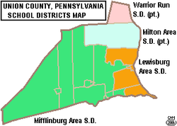
Map of Union County, Pennsylvania Public School Districts Map of Union County Pennsylvania School Districts.png
Map of Union County, Pennsylvania Public School Districts

Public school districts

Vocational school

Higher education

Private schools

Communities

Map of Union County, Pennsylvania with municipal labels showing boroughs (red), townships (white), and census-designated places (blue) Map of Union County Pennsylvania With Municipal and Township Labels.png
Map of Union County, Pennsylvania with municipal labels showing boroughs (red), townships (white), and census-designated places (blue)

Under Pennsylvania law, there are four types of incorporated municipalities: cities, boroughs, townships, and, in most cases, towns. The following boroughs and townships are located in Union County:

Boroughs

Townships

Census-designated places

Census-designated places are geographical areas designated by the U.S. Census Bureau for the purposes of compiling demographic data. They are not actual jurisdictions under Pennsylvania law. Other unincorporated communities, such as villages, may be listed here as well.

Population ranking

The population ranking of the following table is based on the 2010 census of Union County. [14]

county seat

RankCity/Town/etc.Municipal typePopulation (2010 Census)
1 Lewisburg Borough5,792
2 Mifflinburg Borough3,540
3 Linntown CDP1,489
4 New Columbia CDP1,013
T-5 West Milton CDP900
T-5 Winfield CDP900
6 New Berlin Borough873
7 Allenwood CDP321
8 Hartleton Borough283
9 Vicksburg CDP261
10 Laurelton CDP221

See also

Related Research Articles

<span class="mw-page-title-main">Clinton County, Pennsylvania</span> County in Pennsylvania, United States

Clinton County is a county in the Commonwealth of Pennsylvania. As of the 2020 census, the population was 37,450. Its county seat is Lock Haven. The county was created on June 21, 1839, from parts of Centre and Lycoming Counties. Its name is in honor of the sixth Governor of New York, DeWitt Clinton. Some alternate sources suggest the namesake is Henry Clinton. Clinton County comprises the Lock Haven, PA Micropolitan Statistical Area, which is also included in the Williamsport-Lock Haven, PA Combined Statistical Area. The county is part of the Central Pennsylvania region of the state.
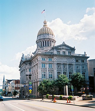
<span class="mw-page-title-main">Westmoreland County, Pennsylvania</span> County in Pennsylvania, United States

Westmoreland County is a county in the Commonwealth of Pennsylvania, United States, located in the Pittsburgh Metropolitan Statistical Area. As of the 2020 census, the population was 354,663. The county seat is Greensburg and the most populous community is Hempfield Township. It is named after Westmorland, a historic county of England. The county is part of the Southwest Pennsylvania region of the state.

<span class="mw-page-title-main">Warren County, Pennsylvania</span> County in Pennsylvania, United States

Warren County is a county in the Commonwealth of Pennsylvania. As of the 2020 census, the population was 38,587. Its county seat is Warren. The county was established in 1800 from parts of Allegheny and Lycoming counties; attached to Crawford County until 1805 and then to Venango County until Warren was formally established in 1819.

<span class="mw-page-title-main">Snyder County, Pennsylvania</span> County in Pennsylvania, United States

Snyder County is a county in the Commonwealth of Pennsylvania. As of the 2020 census, the population was 39,736. The county seat is Middleburg. Snyder County was formed in 1855 from parts of Union County. The county is part of the Central Pennsylvania region of the state.
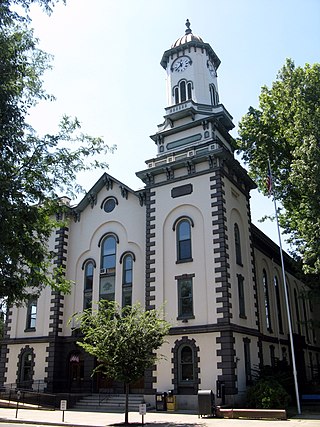
<span class="mw-page-title-main">Northumberland County, Pennsylvania</span> County in Pennsylvania, United States

Northumberland County is a county in the Commonwealth of Pennsylvania. As of the 2020 census, the population was 91,647. Its county seat is Sunbury. The county is part of the Central Pennsylvania region of the state.

<span class="mw-page-title-main">Montour County, Pennsylvania</span> County in Pennsylvania, United States

Montour County is a county in the Commonwealth of Pennsylvania. As of the 2020 census, the population was 18,136. Its county seat is Danville. The county is named for Andrew Montour, a prominent Métis interpreter who served with George Washington during the French and Indian War. It encompasses 132 sq mi, making it the smallest county by land area in the state. The county is part of the Central Pennsylvania region of the state.
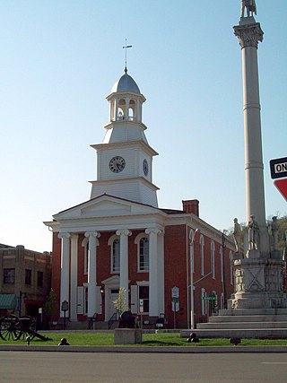
<span class="mw-page-title-main">Mifflin County, Pennsylvania</span> County in Pennsylvania, United States

Mifflin County is a county in the Commonwealth of Pennsylvania. As of the 2020 census, the population was 46,143. Its county seat is Lewistown. The county was created on September 19, 1789, from parts of Cumberland County and Northumberland County. It was named for Thomas Mifflin, the first Governor of Pennsylvania. Mifflin County comprises the Lewistown, PA Micropolitan Statistical Area. The county is part of the Central Pennsylvania region of the state.
<span class="mw-page-title-main">Lycoming County, Pennsylvania</span> County in Pennsylvania, United States

Lycoming County is a county in the Commonwealth of Pennsylvania. As of the 2020 census, the population was 114,188. Its county seat is Williamsport. The county is part of the Central Pennsylvania region of the state.

<span class="mw-page-title-main">Jefferson County, Pennsylvania</span> County in Pennsylvania, United States

Jefferson County is a county in the Commonwealth of Pennsylvania. As of the 2020 census, the population was 44,492. Its county seat is Brookville. The county was established on March 26, 1804, from part of Lycoming County and later organized in 1830. It is named for President Thomas Jefferson. It is home to Punxsutawney Phil, the most famous groundhog that predicts when spring will come every February 2 on Groundhog Day. The county is part of the North Central Pennsylvania region of the state.

<span class="mw-page-title-main">Franklin County, Pennsylvania</span> County in Pennsylvania, United States

Franklin County is a county in the Commonwealth of Pennsylvania. As of the 2020 census, the population was 155,932. Its county seat is Chambersburg.
<span class="mw-page-title-main">Columbia County, Pennsylvania</span> County in Pennsylvania, United States

Columbia County is a county in the Commonwealth of Pennsylvania. It is located in Northeastern Pennsylvania. As of the 2020 census, the population was 64,727. Its county seat is Bloomsburg. The county was created on March 22, 1813, from part of Northumberland County. It was named Columbia, alluding to the United States and Christopher Columbus. The county is part of the Central Pennsylvania region of the state.

<span class="mw-page-title-main">Centre County, Pennsylvania</span> County in Pennsylvania, United States

Centre County is a county in the Commonwealth of Pennsylvania, United States. As of the 2020 census, the population was 158,172. Its county seat is Bellefonte. Centre County comprises the State College, PA Metropolitan Statistical Area. The county is part of the Central Pennsylvania region of the state.
<span class="mw-page-title-main">Blair County, Pennsylvania</span> County in Pennsylvania, United States

Blair County is a county in the Commonwealth of Pennsylvania. As of the 2020 census, the population was 122,822. Its county seat is Hollidaysburg, and its largest city is Altoona. The county was created on February 26, 1846, from parts of Huntingdon and Bedford counties. The county is part of the Southwest Pennsylvania region of the state.

<span class="mw-page-title-main">Hartleton, Pennsylvania</span> Borough in Pennsylvania, United States

Hartleton is a borough in Union County, Pennsylvania, United States. The population was 247 at the 2020 census. The borough, as well as the adjoining township of Hartley, are both named for Colonel Thomas Hartley, American politician and Revolutionary War leader, and local landowner. An alternative name was Hartleyton and later shortened to the present name. The original name was Kester's, and named for Peter Kester who was the first tenant of Hartley. Kester's was at the intersection of "great Reuben Haines road" from Northumberland through Dry Valley, New Berlin and the Penns Valley Narrows, and the first public road laid out in the area by Northumberland County court from Northumberland through Derrstown (Lewisburg) and Mifflinburg. Hartley never lived there, as his home was in York, PA. Hartley acquired the land in 1784 from original purchaser Colonel Philip Cole after Cole left the area because of the "Big Runaway" of 1778. Cole purchased the land in 1773, and was living there in 1775. Hartley laid out a town as early as 1798, and the first lot sold in 1799.

<span class="mw-page-title-main">Mifflinburg, Pennsylvania</span> Borough in Pennsylvania, United States

Mifflinburg is a borough in Union County, located in the Susquehanna River Valley of central Pennsylvania, United States. In 1792, Mifflinburg was settled by Elias and Catharina Youngman and 8 other families, many of them German, and the village of Mifflinsburgh was formed. It was named for Thomas Mifflin, who was governor of Pennsylvania and first governor under the PA Constitution of 1790, and a signer of The Declaration of Independence. Youngmanstown was another name based upon common nemonclature only, but not officially. In 1827, Mifflinburg, a.k.a. Youngmanstown, and another town adjacent to the east named Greenville, a.k.a. Rhodestown,, were combined and incorporated into a borough. The first horse drawn buggy and carriage manufacturing company was established in 1845; and Mifflinburg would become the Buggy and carriage manufacturing capital of the United States in the late 19th century. There are many Victorian homes and downtown business buildings. Mifflinburg is known for The Mifflinburg Buggy Museum, Buggy Day, annual authentic Christkindle Market the second weekend of December, and German Oktoberfest.

<span class="mw-page-title-main">New Berlin, Pennsylvania</span> Borough in Pennsylvania, United States

New Berlin is a borough in Union County, Pennsylvania, United States. The population was 802 at the 2020 census.

<span class="mw-page-title-main">Cumberland County, Pennsylvania</span> County in Pennsylvania, United States

Cumberland County is a county in the Commonwealth of Pennsylvania. As of the 2020 census, the population was 259,469. Its county seat is Carlisle. The county is part of the South Central Pennsylvania region of the state.

<span class="mw-page-title-main">Pennsylvania Route 45</span> State highway in Pennsylvania, US

Pennsylvania Route 45 is an 86-mile-long (138 km) state highway that is located in central Pennsylvania, United States. The western terminus of the route is situated at PA 453 in Morris Township near the community of Water Street. The eastern terminus is located at PA 642 west of the small town of Mooresburg.
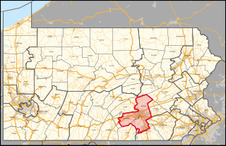
<span class="mw-page-title-main">Pennsylvania's 10th congressional district</span> U.S. House district for Pennsylvania

Pennsylvania's 10th congressional district is located in the south-central region of the state. It encompasses all of Dauphin County as well as parts of Cumberland County and York County. The district includes the cities of Harrisburg and York. Prior to 2019, the district was located in the northeastern part of the state. The Supreme Court of Pennsylvania redrew the district in 2018 after ruling the previous map unconstitutional because of gerrymandering. The court added State College to the old district's boundaries while removing some Democratic-leaning areas and redesignated it the twelfth district; an area encompassing Harrisburg and York was numbered as the "10th". The new tenth district is represented by Republican Scott Perry, who previously represented the old fourth district.

Central Susquehanna Intermediate Unit #16 (CSIU), located in the Milton Industrial Park, Milton, Pennsylvania, was created by the Pennsylvania General Assembly in 1971 as one of 29 Intermediate Units in the commonwealth. Intermediate units serve a given geographic area's educational needs and function as a step of organization above that of a public school district, but below that of the Pennsylvania Department of Education. The state's goal is for IU's to meet student and community needs in a cost-effective manner by providing services best offered on a regional basis such as special education, technical education, services to public and nonpublic schools. IN 2016-17 the CSIU16 budget is $76.7 million for programs and services and $1,073,846 General operating budget.

References

  1. Includes Centre, Lycoming, Northumberland, Columbia, Mifflin, Union, Snyder, Clinton, Juniata and Montour Counties
  1. "Census - Geography Profile: Union County, Pennsylvania". United States Census Bureau . Retrieved December 18, 2022.
  2. "Find a County". National Association of Counties. Retrieved June 7, 2011.
  3. "2010 Census Gazetteer Files". United States Census Bureau. August 22, 2012. Retrieved March 11, 2015.
  4. "PRISM Climate Group at Oregon State University".
  5. "U.S. Decennial Census". United States Census Bureau. Retrieved March 11, 2015.
  6. "Historical Census Browser". University of Virginia Library. Retrieved March 11, 2015.
  7. Forstall, Richard L., ed. (March 24, 1995). "Population of Counties by Decennial Census: 1900 to 1990". United States Census Bureau. Retrieved March 11, 2015.
  8. "Census 2000 PHC-T-4. Ranking Tables for Counties: 1990 and 2000" (PDF). United States Census Bureau. April 2, 2001. Archived (PDF) from the original on October 9, 2022. Retrieved March 11, 2015.
  9. "State & County QuickFacts". United States Census Bureau. Archived from the original on January 10, 2016. Retrieved November 22, 2013.
  10. "Census 2020".
  11. "U.S. Census website". United States Census Bureau . Retrieved May 14, 2011.
  12. "P2 HISPANIC OR LATINO, AND NOT HISPANIC OR LATINO BY RACE – 2020: DEC Redistricting Data (PL 94-171) – Union County, Pennsylvania".
  13. "Office of Management and Budget". whitehouse.gov. Retrieved March 23, 2018.
  14. 1 2 Promotions, Center for New Media and. "US Census Bureau 2010 Census". www.census.gov. Retrieved March 23, 2018.
  15. Leip, David. "Dave Leip's Atlas of U.S. Presidential Elections". uselectionatlas.org. Retrieved March 23, 2018.
  16. "Presidential Elections". staffweb.wilkes.edu. Retrieved March 23, 2018.
  17. "David Leip's Atlas". uselectionatlas.org. Retrieved March 23, 2018.
  18. "David Leip's Atlas". uselectionatlas.org. Retrieved March 23, 2018.
  19. "David Leip's Atlas". uselectionatlas.org. Retrieved March 23, 2018.
  20. "David Leip's Atlas". uselectionatlas.org. Retrieved March 23, 2018.
  21. "Dave Leip's Atlas of U.S. Presidential Elections".

40°58′N77°04′W / 40.96°N 77.06°W / 40.96; -77.06