Virginia State Route 80

Last updated

Virginia 80.svg

State Route 80

VA 80 map.svg
SR 80 highlighted in red
Route information
Maintained by VDOT
Length67.37 mi [1] [2] [3] [4]  (108.42 km)
ExistedJuly 1, 1933 [5] –present
Tourist
routes
Virginia D6-V1.svg Virginia Byway
Major junctions
West endElongated circle 80.svg KY 80 near Elkhorn City, KY
Major intersectionsVirginia 83.svg SR 83 in Haysi
US 19.svg US 19 at Rosedale
I-81.svg I-81 near Meadowview
East endUS 11.svg US 11 near Meadowview
Location
Country United States
State Virginia
Counties Buchanan, Dickenson, Russell, Washington
Highway system
Virginia 79.svg SR 79 I-81.svg I-81

State Route 80 is a primary state highway in the southwest part of the U.S. state of Virginia. It runs from the Kentucky state line at Breaks Interstate Park east to U.S. Route 11 near Meadowview. Kentucky Route 80 and Missouri's Route 80 continue the number west to Matthews, Missouri. The entire length of SR 80 is part of U.S. Bicycle Route 76.

Contents

Route description

View east along SR 80 at SR 83 in Haysi 2017-06-12 10 15 51 View east along Virginia State Route 80 (Helen Henderson Highway) at Virginia State Route 83 (Dickenson Highway) in Haysi, Dickenson County, Virginia.jpg
View east along SR 80 at SR 83 in Haysi

Buchanan and Dickenson counties

Kentucky Route 80 runs alongside the Russell Fork from Millard to just shy of the Virginia state line. There it turns northeasterly along the west bank of Grassy Creek, which lies inside Virginia and forms the line between Buchanan and Dickenson Counties, in order to avoid the deep gorge through Breaks Interstate Park. Route 80 soon crosses into Virginia, and continues to parallel Grassy Creek until the split with Hunts Creek, where it (and the county line) turns southeast to follow that creek. About halfway to the community of Breaks, SR 80 crosses the creek and county line.

SR 80 passes the community of Breaks, leaving Hunts Creek there and running past the entrance to Breaks Interstate Park. It runs south through Camp Branch Gap, and then continues in a general southerly direction alongside small creeks and over two summits to State Route 83 east of Haysi. SR 80 and SR 83 overlap west alongside Russell Prater Creek into Haysi, where they meet State Route 63 at the point where Russell Prater Creek empties into the Russell Fork. The two routes turn south, but SR 83 soon splits to the west to follow the McClure River. SR 80 continues southeasterly along the Russell Fork past Martha Gap and Birchleaf to the point where the Russell Fork turns east; SR 80 continues next to Fryingpan Creek past Colley, then alongside Priest Fork to Sportsman Lake and through Abner Gap to the Abner Branch, rejoining the Russell Fork at Bee.

SR 80 and the Russell Fork continue past Davenport and Council. The fork ends as the road approaches Sandy Ridge and the Tennessee Valley Divide, which it climbs Big A Mountain via a series of hairpin curves.

Russell County

SR 80 descends from Big A Mountain into a relatively flat area, where it runs cross-country and next to small creeks via Honaker, the junction with State Route 67, and a bridge over the Clinch River at Blackford to U.S. Route 19 at Rosedale. There it turns southwest with US 19, alongside Elk Garden Creek, to Smithfield, where it splits to the south. SR 80 again runs cross-country past Rockdell, where it begins to climb Clinch Mountain, which it crosses (into Washington County) at Hayters Gap.

Washington County

SR 80 descends from Hayters Gap to the East Fork Wolf Creek. There it turns southwest, following the creek to the community of Hayters Gap, and then following Wolf Creek through a gap in Little Mountain to the North Fork Holston River at the community of River Bridge. It crosses the river and follows Logan Creek uphill to Lindell, where the land levels out. It continues to follow Logan Creek past Yellow Springs and Giesley Mill, then crossing a low summit to Meadow View. SR 80 crosses Interstate 81 at a Diamond interchange southeast of Meadowview, providing access on I-81, and then ends at U.S. Route 11 at Cedarville. State Route 803, formerly part of SR 80, continues southeast from Cedarville to Lodi.

History

The road from Lodi to Cedarville, now State Route 803, was planned as part of State Route 12, the predecessor to U.S. Route 58, in 1923. [6] The next year, however, SR 12 was realigned to pass through Damascus, [7] and the road from State Route 10 (now U.S. Route 11) at Cedarville towards Lodi for five miles (8 km) was added to the state highway system [8] as State Route 125, a spur of SR 12. The next year it was extended southeast the rest of the way to SR 12 at Lodi and northwest 1.1 miles (1.8 km) to Meadowview. [9]

Five miles (8 km) of road northwest from Meadowview and three miles (5 km) southeast from State Route 11 (now U.S. Route 19) near Rosedale were added to the state highway system in 1928 as State Route 111, [10] and SR 125 was renumbered as part of SR 111 that same year. The gap was closed in 1930 and 1931. [11]

Major intersections

CountyLocationmi [1] [2] [3] [4] kmDestinationsNotes
Buchanan Breaks Interstate Park 0.000.00West plate.svg
Elongated circle 80.svg
KY 80 west Elkhorn City
Kentucky state line; western terminus
Dickenson US 121.svg US 121 (Coalfields Expressway)Proposed junction [12]
Haysi 10.0916.24East plate.svg
Virginia 83.svg
SR 83 east (Dickenson Highway) Vansant, Grundy
West end of concurrency with SR 83
11.1817.99South plate.svg
Virginia 63.svg
SR 63 south (Haysi Main Street) John Flannagan Dam
Northern terminus of SR 63
11.5218.54West plate.svg
Virginia 83.svg
SR 83 west (Dickenson Highway) Clintwood, Pound
East end of concurrency with SR 83
Russell Honaker 39.0962.91North plate.svg
Virginia 67.svg
SR 67 north (Swords Creek Road) Swords Creek
Southern terminus of SR 67
Rosedale 43.5970.15North plate.svg
US 19.svg
US 19 north Tazewell, Bluefield
West end of concurrency with US 19
Smithfield 46.1674.29South plate.svg
US 19.svg
US 19 south Lebanon, Bristol
East end of concurrency with US 19
Washington Meadowview 66.54107.09I-81.svg I-81  Roanoke, Bristol I-81 exit 24
Cedarville 67.37108.42US 11.svgCircle sign 803.svg US 11 (Lee Highway) / SR 803 (Cedar Creek Road) Chilhowie, Abingdon Eastern terminus
1.000 mi = 1.609 km; 1.000 km = 0.621 mi

Related Research Articles

<span class="mw-page-title-main">U.S. Route 58</span> Highway in the United States

U.S. Route 58 is an east–west U.S. Highway that runs for 508 miles (818 km) from U.S. Route 25E just northwest of Harrogate, Tennessee, to U.S. Route 60 in Virginia Beach, Virginia. Until 1996, when the Cumberland Gap Tunnel opened, US 58 ran only inside the commonwealth of Virginia. It was then extended southwest along a short piece of former US 25E, which no longer enters Virginia, to end at the new alignment in Tennessee. For most of its alignment, it closely parallels Virginia's southern border with North Carolina.

<span class="mw-page-title-main">Virginia State Route 70</span>

State Route 70 is a primary state highway in Lee County, Virginia, running from the Tennessee state line to U.S. Route 58 in Jonesville. Its continuation in Tennessee, also numbered State Route 70, continues south to the North Carolina state line at North Carolina Highway 208.

<span class="mw-page-title-main">Virginia State Route 71</span>

State Route 71 is a primary state highway in the southwest part of the U.S. state of Virginia. It runs from Gate City northeast to Lebanon, mostly through river valleys. Despite running more east–west than north–south, it is signed north–south; it parallels the similarly-oriented U.S. Route 11 and Interstate 81.

<span class="mw-page-title-main">Virginia State Route 89</span>

State Route 89 is a primary state highway in the U.S. state of Virginia. The state highway runs 7.85 miles (12.63 km) from the North Carolina state line, where the highway continues as North Carolina Highway 89, north to U.S. Route 58 and US 221 in Galax.

<span class="mw-page-title-main">Virginia State Route 72</span>

State Route 72 is a primary state highway in the southwest part of the U.S. state of Virginia. It runs from SR 71 in Gate City north to SR 65 at Fort Blackmore, northeast with SR 65 to Dungannon, and north via Coeburn to SR 83 near Clintwood.

<span class="mw-page-title-main">Virginia State Route 75</span>

State Route 75 is a primary state highway in the southwest part of the U.S. state of Virginia, running southwest from U.S. Route 11 and U.S. Route 58 Alternate in Abingdon to Tennessee's State Route 44.

<span class="mw-page-title-main">Virginia State Route 68</span>

State Route 68 is a primary state highway in the U.S. state of Virginia. Known for most of its length as Exeter Road, the state highway runs 6.13 miles (9.87 km) from the Lee–Wise county line near Keokee, where the highway continues west as SR 606, east to U.S. Route 23 Business in Appalachia.

<span class="mw-page-title-main">Virginia State Route 67</span>

State Route 67 is a primary state highway in the southwest part of the U.S. state of Virginia. It runs from SR 80 near Honaker east to U.S. Route 460 at Raven, east concurrently with US 460 and US 460 Business into downtown Richlands, and north to SR 616 at Jewell Ridge on the Tazewell–Buchanan county line.

<span class="mw-page-title-main">Virginia State Route 16</span>

State Route 16 is a primary state highway in the southwest part of the U.S. state of Virginia. It runs from the North Carolina border at North Carolina Highway 16 north to the West Virginia border at West Virginia Route 16, passing through the towns of Troutdale, Marion, and Tazewell. Highway 16 is part of a three-state route 16 that connects the Charlotte region with northwestern West Virginia.

<span class="mw-page-title-main">U.S. Route 52 in Virginia</span>

U.S. Route 52 in Virginia runs north–south through the southwestern part of the state along the Interstate 77 (I-77) corridor. Though an even-numbered U.S. route, it is signed north–south in Virginia. In some other states along its route, it is signed east–west. The Virginia segment is signed such that US 52 north corresponds to the general westward direction of the highway, and vice versa.

<span class="mw-page-title-main">U.S. Route 220 in Virginia</span>

In the U.S. state of Virginia, U.S. Route 220 (US 220) is a major north-south state highway that extends from the North Carolina state line through Roanoke to the West Virginia state line. South of Roanoke, US 220 is a four-lane highway within the proposed Interstate 73 (I-73) corridor. US 220 narrows to two lanes north of Roanoke, connecting to I-64 near Clifton Forge and then paralleling the Appalachian Mountains north-northeasterly in the direction of Cumberland, Maryland.

<span class="mw-page-title-main">U.S. Route 19 in Virginia</span> State highway in Virginia

U.S. Route 19 is a part of the U.S. Highway System that runs from Memphis, Florida to Erie, Pennsylvania. In Virginia, the highway runs 88.89 miles (143.05 km) between two pairs of twin cities: Bristol, Tennessee and Bristol, Virginia, at the Virginia–Tennessee state line, and Bluefield, Virginia and Bluefield, West Virginia, at the Virginia–West Virginia state line. Between its endpoints, US 19 has lengthy concurrencies with US 11, US 58 Alternate, and US 460 during its course connecting Abingdon, Lebanon, and Tazewell within Washington, Russell, and Tazewell counties in Southwest Virginia.

<span class="mw-page-title-main">Virginia State Route 9</span> State highway in Virginia, United States

Virginia State Route 9 is a primary state highway in the U.S. state of Virginia. Known as Charles Town Pike, the state highway runs 13.08 miles (21.05 km) from the West Virginia state line near Mechanicsville, where the highway continues west as West Virginia Route 9, east to SR 7 and SR 7 Business in Paeonian Springs. SR 9 is the main east–west highway of northwestern Loudoun County, connecting Leesburg with Hillsboro and the West Virginia cities of Charles Town and Martinsburg. As a result, the state highway and its West Virginia continuation are a major, overburdened commuter route between the Eastern Panhandle of West Virginia and Washington, D.C.

<span class="mw-page-title-main">Virginia State Route 63</span>

State Route 63 is a primary state highway in the U.S. state of Virginia. The state highway runs 39.28 miles (63.22 km) from U.S. Route 58 Alternate in St. Paul north to SR 80 and SR 83 in Haysi.

<span class="mw-page-title-main">Virginia State Route 65</span>

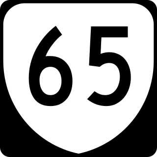
State Route 65, formerly State Route 66, is a primary state highway in the U.S. state of Virginia. The state highway runs 34.06 miles (54.81 km) from U.S. Route 23, US 58, and US 421 in Clinchport north to US 58 Alternate in Castlewood.

<span class="mw-page-title-main">Virginia State Route 8</span> State highway in Virginia, United States

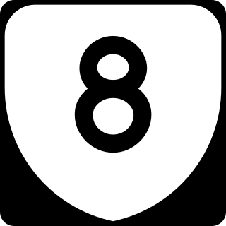
State Route 8 is a primary state highway in the U.S. state of Virginia. The state highway runs 55.88 miles (89.93 km) from the North Carolina state line near Palmetto, where the highway continues south as North Carolina Highway 8, north to U.S. Route 11 in Christiansburg. SR 8 is part of a 151-mile (243 km) two-state highway 8 system and is the main north–south highway of Patrick County, Floyd County, and southern Montgomery County, connecting their respective county seats of Stuart, Floyd, and Christiansburg with each other and with the Blue Ridge Parkway. The state highway also links the New River Valley region of Virginia with Southside Virginia via US 58 and the Piedmont Triad of North Carolina via NC 8.

<span class="mw-page-title-main">Virginia State Route 41</span>

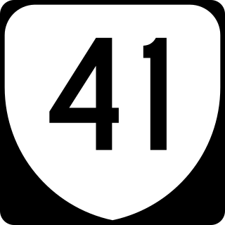
State Route 41 is a primary state highway in the U.S. state of Virginia. Known as Franklin Turnpike, the state highway runs 22.5 miles (36.2 km) from SR 360 northeast of Danville to SR 57 in Callands. The Virginia Department of Transportation (VDOT) officially designates the route north of U.S. Route 29 Business in Danville as a part of SR 41 but the Franklin Turnpike south and east of this point is signed as SR 41.

References

  1. 1 2 "2010 Virginia Department of Transportation Jurisdiction Report - Daily Traffic Volume Estimates - Buchanan County" (PDF). (129  KiB)
  2. 1 2 "2010 Virginia Department of Transportation Jurisdiction Report - Daily Traffic Volume Estimates - Dickenson County" (PDF). (146  KiB)
  3. 1 2 "2010 Virginia Department of Transportation Jurisdiction Report - Daily Traffic Volume Estimates - Russell County" (PDF). (356  KiB)
  4. 1 2 "2010 Virginia Department of Transportation Jurisdiction Report - Daily Traffic Volume Estimates - Washington County" (PDF). (356  KiB)
  5. "New Numbers of Va. Highways Effective July 1". The Richmond Times-Dispatch. May 10, 1933. p. 5. Retrieved January 21, 2020 via Newspapers.com. Open Access logo PLoS transparent.svg
  6. State Highway Commission of Virginia (December 11–12, 1923). "Minutes of Meeting" (PDF) (Report). Richmond, VA: Commonwealth of Virginia. p. 13.
  7. State Highway Commission of Virginia (May 14, 1924). "Minutes of Meeting" (PDF) (Report). Commonwealth of Virginia. p. 2.
  8. State Highway Commission of Virginia (July 9, 1924). "Minutes of Meeting" (PDF) (Report). Richmond, VA: Commonwealth of Virginia. p. 7.
  9. State Highway Commission of Virginia (August 14, 1925). "Minutes of Meeting" (PDF) (Report). Woodstock, VA: Commonwealth of Virginia. pp. 5 and 6.
  10. State Highway Commission of Virginia (August 9–10, 1928). "Minutes of Meeting" (PDF) (Report). Richmond, VA: Commonwealth of Virginia. pp. 12 and 13.
  11. State Highway Commission of Virginia (December 18, 1930). "Minutes of Meeting" (PDF) (Report). Lynchburg, VA: Commonwealth of Virginia. pp. 4 and 5.
  12. "Coalfields Expressway conceptual map" (GIF). Virginia Department of Transportation . VDOT. March 26, 2013. Retrieved July 29, 2017.

Route map:

Template:Attached KML/Virginia State Route 80
KML is from Wikidata
<  SR 117 Spurs of   SR 11
1923–1928
SR 119  >
<  SR 124 Spurs of   SR 12
1923–1928
none
<  SR 110 District 1 State Routes
1928–1933
SR 112  >
<  SR 124 District 1 State Routes
1928–1933
SR 126  >