Lebanon, Virginia

Last updated

Lebanon
Lebanon, VA.jpg
Downtown Lebanon (2012)
Lebanon, Virginia Seal.png
Nickname: 
"Heart of Southwest Virginia"
Motto: 
"Progressing for the Future"
VAMap-doton-Lebanon.PNG
Location in Virginia
Coordinates: 36°54′3″N82°4′37″W / 36.90083°N 82.07694°W / 36.90083; -82.07694
CountryUnited States
State Virginia
County Russell
Government
   Mayor Nelson A.Dodi
Area
[1]
  Total4.83 sq mi (12.52 km2)
  Land4.82 sq mi (12.47 km2)
  Water0.02 sq mi (0.05 km2)
Elevation
2,060 ft (628 m)
Population
 (2010)
  Total3,424
  Estimate 
(2019) [2]
3,147
  Density653.45/sq mi (252.30/km2)
 U.S. Census Bureau, 2010 Population Estimates
Time zone UTC−5 (EST)
  Summer (DST) UTC−4 (EDT)
ZIP code
24266
Area code 276
FIPS code 51-44696 [3]
GNIS feature ID1498504 [4]
Website lebanonva.net

Lebanon is a town in Russell County, Virginia, United States. The population was 3,424 at the 2010 census. It is the county seat of Russell County. [5]

Contents

History

The town of Lebanon was founded in 1818 as per an effort to create a new county seat for Russell County. [6] The Lebanon Lutheran Church was founded in 1851 by pastor Jacob Scherer. [7]

Geography

According to the United States Census Bureau, the town has a total area of 4.1 square miles (10.6 km2), all of it land.

Climate

The town has a humid subtropical climate (Köppen climate classification Cfa). The Trewartha climate classification is temperate oceanic due to five months of winter chill (monthly means below 10 °C (50 °F)), abbreviated "Do" on climate maps.

Climate data for Lebanon, Virginia (1991–2020 normals, extremes 1989–present)
MonthJanFebMarAprMayJunJulAugSepOctNovDecYear
Record high °F (°C)79
(26)
79
(26)
89
(32)
89
(32)
90
(32)
99
(37)
99
(37)
94
(34)
95
(35)
92
(33)
81
(27)
76
(24)
99
(37)
Mean daily maximum °F (°C)44.9
(7.2)
48.4
(9.1)
56.5
(13.6)
66.9
(19.4)
74.5
(23.6)
81.2
(27.3)
84.0
(28.9)
83.2
(28.4)
78.7
(25.9)
68.1
(20.1)
57.0
(13.9)
48.2
(9.0)
66.0
(18.9)
Daily mean °F (°C)33.9
(1.1)
37.0
(2.8)
44.0
(6.7)
53.2
(11.8)
61.5
(16.4)
69.1
(20.6)
72.5
(22.5)
71.5
(21.9)
65.9
(18.8)
54.4
(12.4)
44.0
(6.7)
37.3
(2.9)
53.7
(12.1)
Mean daily minimum °F (°C)22.9
(−5.1)
25.6
(−3.6)
31.4
(−0.3)
39.5
(4.2)
48.5
(9.2)
56.9
(13.8)
61.0
(16.1)
59.7
(15.4)
53.2
(11.8)
40.8
(4.9)
30.9
(−0.6)
26.4
(−3.1)
41.4
(5.2)
Record low °F (°C)−18
(−28)
−24
(−31)
−6
(−21)
14
(−10)
28
(−2)
38
(3)
46
(8)
44
(7)
33
(1)
20
(−7)
8
(−13)
−2
(−19)
−24
(−31)
Average precipitation inches (mm)3.49
(89)
3.68
(93)
4.18
(106)
4.12
(105)
4.42
(112)
4.31
(109)
4.86
(123)
4.04
(103)
3.34
(85)
2.55
(65)
3.01
(76)
3.94
(100)
45.94
(1,167)
Average snowfall inches (cm)4.4
(11)
2.8
(7.1)
2.5
(6.4)
0.0
(0.0)
0.0
(0.0)
0.0
(0.0)
0.0
(0.0)
0.0
(0.0)
0.0
(0.0)
0.2
(0.51)
0.5
(1.3)
2.0
(5.1)
12.4
(31)
Average precipitation days (≥ 0.01 in)12.311.913.612.414.012.613.211.38.69.19.512.7141.2
Average snowy days (≥ 0.1 in)2.52.01.30.10.00.00.00.00.00.10.41.78.1
Source: NOAA [8] [9]

Demographics

Historical population
CensusPop.Note
1860 264
1870 209−20.8%
1880 24416.7%
1890 31027.0%
1900 3254.8%
1910 36612.6%
1920 46928.1%
1930 56019.4%
1940 62211.1%
1950 6728.0%
1960 2,085210.3%
1970 2,2729.0%
1980 3,20641.1%
1990 3,3865.6%
2000 3,273−3.3%
2010 3,4244.6%
2019 (est.)3,147 [2] −8.1%
U.S. Decennial Census [10]
Confederate Monument in Lebanon Lebanon, Virginia (8127232645).jpg
Confederate Monument in Lebanon

As of the census [3] of 2010, there were 3,424 people, 1,507 households, and 884 families living in the town. The population density was 835.1 people per square mile (323.0/km2). There were 1,681 housing units at an average density of 410.0 per square mile (158.6/km2). The racial makeup of the town was 94.7% White, 2.9% African American, 0.3% Native American, 0.5% from other races, and 0.8% from two or more races. Hispanic or Latino of any race were 1.4% of the population. [11]

There were 1,507 households, out of which 23.7% had children under the age of 18 living with them, 41.0% were married couples living together, 14.1% had a female householder with no husband present, and 41.3% were non-families. 36.5% of all households were made up of individuals, and 16.9% had someone living alone who was 65 years of age or older. The average household size was 2.17 and the average family size was 2.84. [11]

In the town, the population was spread out, with 21.0% under the age of 18, 5.9% from 20 to 24, 25.9% from 25 to 44, 24.8% from 45 to 64, and 20.0% who were 65 years of age or older. The median age was 41 years. For every 100 females, there were 86.9 males. For every 100 females aged 18 and over, there were 82.6 males. [11]

The median income for a household in the town was $24,272, and the median income for a family was $47,708. Males had a median income of $42,404 versus $37,900 for females. The per capita income for the town was $23,822. About 25.9% of families and 28.8% of the population were below the poverty line, including 40.0% of those under age 18 and 11.9% of those age 65 or over. [12]

Arts and culture

Sites in Lebanon listed on the National Register of Historic Places include Blackford Bridge, Carter Hill, Daugherty's Cave and Breeding Site, Samuel Gilmer House, and Stephen B. Quillen House. [13]

Lebanon is the location of the only Bonanza restaurant in the Southern United States, out of four in the country. [14] [15] [16]

Related Research Articles

<span class="mw-page-title-main">Livingston, New York</span> Town in Columbia County, New York, US

Livingston is a town in Columbia County, New York, United States. The population was 3,628 at the 2020 census. The town is named after its founding father.

<span class="mw-page-title-main">Towner, North Dakota</span> City in North Dakota, United States

Towner is a city in McHenry County, North Dakota. It is the county seat of McHenry County. The population was 479 at the time of the 2020 census. It is part of the Minot Micropolitan Statistical Area. Towner was founded in 1886.

<span class="mw-page-title-main">Bonanza, Oregon</span> Town in Oregon, United States

Bonanza is a town in Klamath County, Oregon, United States, near Klamath Falls. The population was 415 at the 2010 census.

<span class="mw-page-title-main">Hallwood, Virginia</span> Town in Virginia, United States

Hallwood is a town in Accomack County, Virginia, in the United States. As of the 2010 census, the town population was 206.

<span class="mw-page-title-main">Buchanan, Virginia</span> Town in Virginia, United States

Buchanan is a town in Botetourt County, Virginia, United States. The population was 1,196 at the 2020 census. It is part of the Roanoke Metropolitan Statistical Area. It was the western terminus of the James River and Kanawha Canal when construction on the canal ended.

<span class="mw-page-title-main">Halifax, Virginia</span> Town in Virginia, United States

Halifax is a town in Halifax County, Virginia, United States, along the Banister River. The population was 1,309 at the 2010 census. It is the county seat of Halifax County.

<span class="mw-page-title-main">Monterey, Virginia</span> Town in Virginia, United States

Monterey is a town in Highland County, Virginia, United States. The population was 165 at the 2020 census. It is the county seat of Highland County.

<span class="mw-page-title-main">Madison, Virginia</span> Town in Virginia, United States

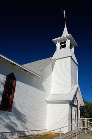
Madison is a town in Madison County, Virginia, United States. The population was 205 at the 2020 census. It is the county seat of Madison County.

<span class="mw-page-title-main">Broadway, Virginia</span> Town in Virginia, United States

Broadway is a town in Rockingham County, Virginia, United States. The population was 3,691 at the 2010 census. It is included in the Harrisonburg Metropolitan Statistical Area.

<span class="mw-page-title-main">Grantsville, West Virginia</span> Town in West Virginia, United States

Grantsville is a town in Calhoun County, West Virginia, United States. The population was 482 at the 2020 census. It is the county seat of Calhoun County. The town was established along the Little Kanawha River in 1865 and named for Ulysses S. Grant. Grantsville is home to Wayne Underwood Park, which includes a .25-mile-long (0.40 km) walking trail, and to the annual West Virginia Wood Festival.

<span class="mw-page-title-main">Wardensville, West Virginia</span> Town in West Virginia, United States

Wardensville is a town in Hardy County, West Virginia, United States. The population was 265 at the 2020 census. Originally named Trout Run, Wardensville was chartered in Virginia in 1832 and incorporated in West Virginia in 1879. Wardensville is located west of the Great North Mountain range, which separates it from the Shenandoah Valley. The town lies on the east bank of the Cacapon River at its confluence with Trout Run. The George Washington and Jefferson National Forests border the town to its east and south.

<span class="mw-page-title-main">Henderson, West Virginia</span> Unincorporated Town in West Virginia, United States

Henderson is an unincorporated community and former town in Mason County, West Virginia, United States, at the confluence of the Ohio and Kanawha Rivers. The population was 231 at the 2020 census. It is part of the Point Pleasant, WV–OH Micropolitan Statistical Area. The town was incorporated in 1893 and named for Samuel Bruce Henderson, who owned the townsite at the time. The town was unincorporated following a public hearing on August 11, 2022.

<span class="mw-page-title-main">Athens, West Virginia</span> Town in West Virginia, United States

Athens is a town in Mercer County, West Virginia, United States. The population was 944 at the 2020 census. It is part of the Bluefield, WV-VA micropolitan area which has a population of 107,578. Athens is the home of Concord University.

<span class="mw-page-title-main">Westover, West Virginia</span> City in West Virginia

Westover is a city in Monongalia County, West Virginia, United States, along the Monongahela River. The population was 3,995 at the 2020 census. It is part of the Morgantown metropolitan area.

<span class="mw-page-title-main">Albright, West Virginia</span> Town in West Virginia, United States

Albright is a town in central Preston County, West Virginia, United States, along the Cheat River. The population was 260 at the 2020 census. A former coal town, it is part of the Morgantown metropolitan area.

<span class="mw-page-title-main">Huttonsville, West Virginia</span> Town in West Virginia, United States

Huttonsville is a town in Randolph County, West Virginia, United States, along the Tygart Valley River. The population was 163 at the 2020 census.

<span class="mw-page-title-main">Cairo, West Virginia</span> Town in West Virginia, United States

Cairo is a town in Ritchie County, West Virginia, United States, along West Virginia Route 31, the North Fork of the Hughes River, and the North Bend Rail Trail. The population was 174 at the 2020 census.

<span class="mw-page-title-main">Spencer, West Virginia</span> City in West Virginia, United States

Spencer is a city in and the county seat of Roane County, West Virginia, United States. Originally known as "California," Spencer was chartered in 1858, and named after Spencer Roane (1762–1822), a distinguished jurist from Virginia, who served on the Virginia Supreme Court of Appeals, and for whom Roane County was named. The population was 2,062 at the 2020 census. Spencer is the home of the annual West Virginia Black Walnut Festival. Points of interest include Charles Fork Lake, Chrystal Water and Power Company-Spencer Water and Ice Company, the McIntosh Mansion, and the Robey Theatre.

<span class="mw-page-title-main">Hambleton, West Virginia</span> Town in West Virginia, United States

Hambleton is a town in Tucker County, West Virginia, United States. The population was 216 at the 2020 census. Hambleton was established in 1889, but not incorporated until 1905. It was named by then United States Senator Stephen B. Elkins in honor of a stockholder by this name in the West Virginia Central Railroad Company. The town was previously known as Hulings.

<span class="mw-page-title-main">Middlebourne, West Virginia</span> Town in West Virginia, United States

Middlebourne is a town and the county seat of Tyler County, West Virginia, United States. The population was 715 at the 2020 census.

References

Commons-logo.svg Media related to Lebanon, Virginia at Wikimedia Commons

  1. "2019 U.S. Gazetteer Files". United States Census Bureau. Retrieved August 7, 2020.
  2. 1 2 "Population and Housing Unit Estimates". United States Census Bureau. May 24, 2020. Retrieved May 27, 2020.
  3. 1 2 "U.S. Census website". United States Census Bureau . Retrieved January 31, 2008.
  4. "US Board on Geographic Names". United States Geological Survey. October 25, 2007. Retrieved January 31, 2008.
  5. "Find a County". National Association of Counties. Retrieved June 7, 2011.
  6. "History". Lebanon. March 19, 2022. Retrieved March 19, 2022.
  7. A History of the Lutheran Church in Virginia and East Tennessee. Lutheran Synod of Virginia. 1922. pp. 251–252.
  8. "NowData – NOAA Online Weather Data". National Oceanic and Atmospheric Administration. Retrieved June 28, 2021.
  9. "Station: Lebanon, VA". U.S. Climate Normals 2020: U.S. Monthly Climate Normals (1991-2020). National Oceanic and Atmospheric Administration. Retrieved June 28, 2021.
  10. "Census of Population and Housing". Census.gov. Retrieved June 4, 2015.
  11. 1 2 3 "Profile of General Population and Housing Characteristics: 2010". United States Census Bureau . Retrieved May 14, 2013.
  12. "2007-2011 American Community Survey". American Fact Finder. United States Census Bureau. Archived from the original on February 12, 2020. Retrieved May 14, 2013.
  13. "National Register Information System". National Register of Historic Places . National Park Service. July 9, 2010.
  14. https://www.facebook.com/pg/ponbonsteakhouses/locations/?ref=page_internal [ user-generated source ]
  15. "Iowa restaurant closures continue amid hope for industry recovery, but it could be an uneven one". February 22, 2021.
  16. "Bonanza closes doors for final time in Hazle TWP".