Kilmarnock, Virginia

Last updated
Kilmarnock, Virginia
KilmarnockStreetCorner.jpg
Street corner in downtown Kilmarnock
VAMap-doton-Kilmarnock.PNG
Location of Kilmarnock, Virginia
Coordinates: 37°42′45″N76°22′54″W / 37.71250°N 76.38167°W / 37.71250; -76.38167
Country United States
State Virginia
Counties Lancaster, Northumberland
Area
[1]
  Total3.42 sq mi (8.86 km2)
  Land3.41 sq mi (8.83 km2)
  Water0.01 sq mi (0.03 km2)
Elevation
89 ft (27 m)
Population
 (2020)
  Total1,445
  Density409.04/sq mi (157.94/km2)
Time zone UTC-5 (Eastern (EST))
  Summer (DST) UTC-4 (EDT)
ZIP code
22482
Area code 804
FIPS code 51-42424
GNIS feature ID 1495790
Website kilmarnockva.com

Kilmarnock is a town in Lancaster and Northumberland counties in the U.S. Commonwealth of Virginia. The population was 1,445 at the 2020 census. It is located near the mouth of the Rappahannock River and is located within the Northern Neck George Washington Birthplace American Viticultural Area winemaking appellation. There is a small hospital in the town. Lancaster Middle School, grades 4–8, is also located in town. Approximately 500 students attend the school.

Contents

The town was named after Kilmarnock, in Scotland. [2]

Geography

Kilmarnock is located at 37°42′45″N76°22′54″W / 37.71250°N 76.38167°W / 37.71250; -76.38167 (37.712437, -76.381707). [3]

According to the United States Census Bureau, the town has a total area of 2.9 square miles (7.4 km2), of which, 2.9 square miles (7.4 km2)is land and 0.35% is water.

Kilmarnock hosts the Holly Ball, a debutante ball founded in 1895, at the Indian Creek Yacht and Country Club every December.

Demographics

Historical population
CensusPop.Note
1880 59
1940 614
1950 68912.2%
1960 92734.5%
1970 841−9.3%
1980 94512.4%
1990 1,10917.4%
2000 1,24412.2%
2010 1,48719.5%
2020 1,445−2.8%
U.S. Decennial Census [4]

As of the 2020 census, [5] the total population is 1,445. The town has 802 total housing units, with 687 occupied and 645 of those belonging to families. 115 houses were vacant. 54.7% of homes were owned instead of rented. Of the population, 926 are white, 446 are black, 37 are mixed race, 18 are Hispanic or Latino, 17 are Asian, 3 are American Indian, 1 is Hawaiian, and 15 are some other race.

The median age in Kilmarnock is 60.2. 42% of the population is 65 years or older. 10.7% of the population is a veteran, with 89% of those being male. 23.1% of the population had a bachelor's degree or other form of higher education.

Outskirts of Kilmarnock KilmarnockOutskirts.jpg
Outskirts of Kilmarnock

The median household income was $36,875. 29.4% of the population was below the poverty line, 77.4% of which were under 18. 23.9% of the remainder was between 18 and 64 while the remaining 17.4% was 65 or older. The median income for families is $44,242 while for married-couple families it is $71,125 and $25,677 for non-family households.

Related Research Articles

<span class="mw-page-title-main">Paradise, Pennsylvania</span> Census-designated place in Pennsylvania, United States

Paradise is an unincorporated community and census-designated place (CDP) in Lancaster County, Pennsylvania, United States, with a ZIP code of 17562. The population was 1,129 at the 2010 census.

<span class="mw-page-title-main">Willow Street, Pennsylvania</span> Census-designated place in Pennsylvania, United States

Willow Street is an unincorporated community and census-designated place (CDP) in Lancaster County, Pennsylvania, United States. The population was 7,578 at the 2010 census. In the early part of the 20th century, the main thoroughfare in town was lined with willow trees on both sides for the length of the town, hence the community's name. As time passed and the town grew, the road was widened and sidewalks were installed, which required the trees be removed. Only a few of the original trees remain to this day.

<span class="mw-page-title-main">Richmond County, Virginia</span> County in Virginia, United States

Richmond County is a county located on the Northern Neck in the U.S. state of Virginia. As of the 2020 census, the population sits at 8,923. Its county seat is Warsaw. The rural county should not be confused with the large city and state capital Richmond, Virginia. It was formed in 1692 when the first Rappahannock County was divided to form Richmond County and Essex County.

<span class="mw-page-title-main">Lancaster County, Virginia</span> County in Virginia, United States

Lancaster County is a county located on the Northern Neck in the Commonwealth of Virginia. As of the 2020 census, the population sits at 10,919. Its county seat is Lancaster.

<span class="mw-page-title-main">Essex County, Virginia</span> County in Virginia, United States

Essex County is a county located in the Middle Peninsula in the U.S. state of Virginia; the peninsula is bordered by the Rappahannock River on the north and King and Queen County on the south. As of the 2020 census, the population was 10,599. Its county seat is Tappahannock.

<span class="mw-page-title-main">Brickerville, Pennsylvania</span> Census-designated place in Pennsylvania, United States

Brickerville is an unincorporated community and census-designated place (CDP) in Elizabeth Township, Lancaster County, Pennsylvania, United States, with a ZIP code of 17543. The population was 1,309 at the 2010 census.

<span class="mw-page-title-main">Conestoga Township, Pennsylvania</span> Township in Pennsylvania, United States

Conestoga Township is a township in west central Lancaster County, Pennsylvania. At the 2020 census, the population was 3,922.

<span class="mw-page-title-main">East Cocalico Township, Pennsylvania</span> Township in Pennsylvania, United States

East Cocalico Township is a township in northeastern Lancaster County, Pennsylvania, United States. At the 2020 census, the population was 10,808.

<span class="mw-page-title-main">East Earl Township, Pennsylvania</span> Township in Pennsylvania, United States

East Earl Township is a township in northeastern Lancaster County, Pennsylvania, United States. At the 2020 census, the population was 6,721.

<span class="mw-page-title-main">East Lampeter Township, Pennsylvania</span> Township in Pennsylvania, United States

East Lampeter Township is a township in central Lancaster County, Pennsylvania, United States. At the 2020 census, the population was 17,834.

<span class="mw-page-title-main">Nelson, Georgia</span> City in Georgia, United States

Nelson is a city in Pickens and Cherokee Counties, Georgia, United States. At the 2020 census, the population was 1,145. It is part of the Atlanta metropolitan area.

<span class="mw-page-title-main">Mountville, Pennsylvania</span> Borough in Pennsylvania, United States

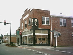
Mountville is a borough in Lancaster County, Pennsylvania, United States. The population was 3,022 at the 2020 census, an increase over the figure of 2,802 tabulated in 2010. The original Charles Chips potato chip factory was located here.

<span class="mw-page-title-main">Paradise Township, Lancaster County, Pennsylvania</span> Township in Pennsylvania, United States

Paradise Township is a township that is located in east-central Lancaster County, Pennsylvania, United States. The population was 5,696 at the time of the 2020 census.

<span class="mw-page-title-main">Penn Township, Lancaster County, Pennsylvania</span> Township in Pennsylvania, United States

Penn Township is a township that is located in north central Lancaster County, Pennsylvania, United States. The population was 10,224 at the time of the 2020 census.

<span class="mw-page-title-main">Quarryville, Pennsylvania</span> Borough in Pennsylvania, United States

Quarryville is a borough in Lancaster County, Pennsylvania, United States. The population was 2,852 at the 2020 census, an increase over the figure of 2,576 tabulated in 2010.

<span class="mw-page-title-main">Port Royal, Virginia</span> Town in Virginia, United States

Port Royal is an incorporated town in Caroline County, Virginia, United States. The population was 126 at the 2010 census.

<span class="mw-page-title-main">Tappahannock, Virginia</span> Town in Virginia, United States

Tappahannock is the oldest town in Essex County, Virginia, United States. The population was 2,375 at the 2010 census, up from 2,068 at the 2000 census. Located on the Rappahannock River, Tappahannock is the county seat of Essex County. Its name comes from an Algonquian language word lappihanne, meaning "Town on the rise and fall of water" or "where the tide ebbs and flows." The Rappahannock is a tidal estuary from above this point and downriver to its mouth on Chesapeake Bay.

<span class="mw-page-title-main">Irvington, Virginia</span> Town in Virginia, United States

Irvington is a town on the Rappahannock River in Lancaster County, Virginia, United States. The population was 474 at the 2020 census. Located on a peninsula known as the Northern Neck, it has been designated a historic district.

<span class="mw-page-title-main">White Stone, Virginia</span> Town in Virginia, United States

White Stone is a town in Lancaster County, Virginia, United States. The population was 380 at the 2020 census. White Stone is one of many small towns located in Virginia's Northern Neck region.

<span class="mw-page-title-main">Warsaw, Virginia</span> Town in Virginia, United States

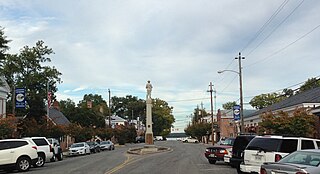
Warsaw is an incorporated town in and the county seat of Richmond County, Virginia, United States. The population was 1,637 at the 2020 census and is estimated to be 2,281 as of 2022.

References

  1. "2019 U.S. Gazetteer Files". United States Census Bureau. Retrieved August 7, 2020.
  2. Gannett, Henry (1905). The Origin of Certain Place Names in the United States. Govt. Print. Off. pp.  175.
  3. "US Gazetteer files: 2010, 2000, and 1990". United States Census Bureau. 2011-02-12. Retrieved 2011-04-23.
  4. "Census of Population and Housing". Census.gov. Retrieved June 4, 2015.
  5. "Kilmarnock town, Virginia". data.census.gov. Retrieved 2024-05-28.