Wakonda, South Dakota

Last updated

Wakonda, South Dakota
Town
Clay County South Dakota Incorporated and Unincorporated areas Wakonda Highlighted.svg
Location in Clay County and the state of South Dakota
Coordinates: 43°00′29″N97°06′22″W / 43.00806°N 97.10611°W / 43.00806; -97.10611
CountryUnited States
State South Dakota
County Clay
Platted 1888 [1]
Area
[2]
  Total0.39 sq mi (1.00 km2)
  Land0.39 sq mi (1.00 km2)
  Water0.00 sq mi (0.00 km2)
Elevation
[3]
1,388 ft (423 m)
Population
 (2020) [4]
  Total347
  Density898.96/sq mi (347.03/km2)
Time zone UTC-6 (Central (CST))
  Summer (DST) UTC-5 (CDT)
ZIP code
57073
Area code 605
FIPS code 46-68100 [5]
GNIS feature ID1267621 [3]

Wakonda is a town in Clay County, South Dakota, United States. The population was 347 at the 2020 census. [6]

Contents

History

A post office called Wakonda has been in operation since 1886. [7] Wakonda was platted in 1888 and its name is derived from the Sioux language. [8]

Geography

According to the United States Census Bureau, the town has a total area of 0.39 square miles (1.01 km2), all land. [9] Corn and soybeans are grown on the farms surrounding the town. The climate is humid continental, with hot summers and cold winters. Annual precipitation is approximately 25 inches.

Demographics

Historical population
CensusPop.Note
1900 220
1910 32648.2%
1920 45138.3%
1930 4530.4%
1940 451−0.4%
1950 4540.7%
1960 382−15.9%
1970 290−24.1%
1980 38332.1%
1990 329−14.1%
2000 37413.7%
2010 321−14.2%
2020 3478.1%
U.S. Decennial Census [10] [4]

2010 census

At the 2010 census, [11] there were 321 people, 128 households and 72 families residing in the town. The population density was 823.1 per square mile (317.8/km2). There were 163 housing units at an average density of 417.9 per square mile (161.4/km2). The racial make-up of the town was 98.4% White, 0.3% African American and 1.2% from other races. Hispanic or Latino of any race were 1.2% of the population.

There were 128 households, of which 29.7% had children under the age of 18 living with them, 50.8% were married couples living together, 1.6% had a female householder with no husband present, 3.9% had a male householder with no wife present, and 43.8% were non-families. 40.6% of all households were made up of individuals, and 22.6% had someone living alone who was 65 years of age or older. The average household size was 2.20 and the average family size was 3.03.

The median age in the town was 48.9 years. 21.8% of residents were under the age of 18; 3.7% were between the ages of 18 and 24; 20.2% were from 25 to 44; 27.7% were from 45 to 64; and 26.5% were 65 years of age or older. The sex make-up of the town was 49.8% male and 50.2% female.

2000 census

At the 2000 census, [5] there were 374 people, 133 households and 90 families residing in the town. The population density was 978.2 per square mile (377.7/km2). There were 156 housing units at an average density of 408.0 per square mile (157.5/km2). The racial make-up of the town was 99.47% White, 0.27% Native American and 0.27% from two or more races.

There were 133 households, of which 39.8% had children under the age of 18 living with them, 55.6% were married couples living together, 8.3% had a female householder with no husband present and 32.3% were non-families. 30.8% of all households were made up of individuals and 17.3% had someone living alone who was 65 years of age or older. The average household size was 2.47 and the average family size was 3.06.

27.3% of the population were under the age of 18, 4.0% from 18 to 24, 25.1% from 25 to 44, 16.8% from 45 to 64 and 26.7% were 65 years of age or older. The median age was 39 years. For every 100 females, there were 92.8 males. For every 100 females age 18 and over, there were 86.3 males.

The median household income was $31,875 and the median family income was $38,750. Males had a median income of $31,458 and females $18,250. The per capita income was $15,685. About 2.3% of families and 4.2% of the population were below the poverty line, including 6.3% of those under age 18 and none of those age 65 or over.

Related Research Articles

<span class="mw-page-title-main">Minnewaukan, North Dakota</span> City in North Dakota, United States

Minnewaukan is a city in Benson County, North Dakota, United States. It serves as the county seat and is fourth largest city in the county, after Fort Totten, Leeds, and Maddock. The population was 199 at the 2020 census. Minnewaukan was founded in 1884.

<span class="mw-page-title-main">Sinai, South Dakota</span> Town in South Dakota, United States

Sinai is a town in Brookings County, South Dakota, United States. The population was 99 at the 2020 census. Located there are a grainery, a post office, a bank, and a church.

<span class="mw-page-title-main">Claremont, South Dakota</span> Town in South Dakota, United States

Claremont is a town in Brown County, South Dakota, United States. The population was 108 at the 2020 census.

<span class="mw-page-title-main">Stratford, South Dakota</span> Town in South Dakota, United States

Stratford is a town in southern Brown County, South Dakota, United States. The population was 57 at the 2020 census.

<span class="mw-page-title-main">Mound City, South Dakota</span> Town in South Dakota, United States

Mound City is a town in and the county seat of Campbell County, South Dakota, United States. The population was 69 at the 2020 census.

<span class="mw-page-title-main">Naples, South Dakota</span> Town in South Dakota, United States

Naples is a town in Clark County, South Dakota, United States. The population was 38 at the 2020 census.

<span class="mw-page-title-main">Florence, South Dakota</span> Town in South Dakota, United States

Florence is a town in northwestern Codington County, South Dakota, United States. It is part of the Watertown, South Dakota Micropolitan Statistical Area. The population was 337 at the 2020 census.

<span class="mw-page-title-main">Fairburn, South Dakota</span> Town in South Dakota, United States

Fairburn is a town in Custer County, South Dakota, United States. The population was 60 at the 2020 census.

<span class="mw-page-title-main">Ethan, South Dakota</span> Town in South Dakota, United States

Ethan is a town in Davison County, South Dakota, United States. It is part of the Mitchell, South Dakota Micropolitan Statistical Area. The population was 365 at the 2020 census. Ethan is located 10 miles south of Mitchell.

<span class="mw-page-title-main">Onaka, South Dakota</span> Town in South Dakota, United States

Onaka is a town in Faulk County, South Dakota, United States. The population was 13 at the 2020 census.

<span class="mw-page-title-main">Revillo, South Dakota</span> Town in South Dakota, United States

Revillo is a town in southeastern Grant County, South Dakota, United States. The population was 99 at the 2020 census.

<span class="mw-page-title-main">Stockholm, South Dakota</span> Town in South Dakota, United States

Stockholm is a town in Grant County, South Dakota, United States. The population was 102 at the 2020 census.

<span class="mw-page-title-main">Olivet, South Dakota</span> Town in South Dakota, United States

Olivet is a town in and the county seat of Hutchinson County, South Dakota. The population was 64 at the time of the 2020 census.

<span class="mw-page-title-main">Lake City, South Dakota</span> Town in South Dakota, United States

Lake City is a town in Marshall County, South Dakota, United States. The population was 45 at the 2020 census. Fort Sisseton Historic State Park, whose fort is listed on the National Register of Historic Places, is located nearby.

<span class="mw-page-title-main">Langford, South Dakota</span> Town in South Dakota, United States

Langford is a town in Marshall County, South Dakota, United States. The population was 283 at the 2020 census.

<span class="mw-page-title-main">Roswell, South Dakota</span> Census-designated place in South Dakota, United States

Roswell is a CDP in Miner County, South Dakota, United States. The population was 8 at the 2020 census. It disincorporated as a town in 2012.

<span class="mw-page-title-main">Crooks, South Dakota</span> City in South Dakota, United States

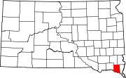
Crooks is a city in Minnehaha County, South Dakota, United States and is a suburb of Sioux Falls. The population was 1,362 at the 2020 census. Crooks was named New Hope until 1904. The town's present name honors W. A. Crooks, a local politician.

<span class="mw-page-title-main">Sherman, South Dakota</span> Town in South Dakota, United States

Sherman is a town in Minnehaha County, South Dakota, United States. The population was 81 at the 2020 census.

<span class="mw-page-title-main">Peever, South Dakota</span> Town in South Dakota, United States

Peever is a town in Roberts County, South Dakota, United States. The population was 180 at the 2020 census.

<span class="mw-page-title-main">Tulare, South Dakota</span> Town in South Dakota, United States

Tulare is a town in Spink County, South Dakota, United States. The population was 211 at the 2020 census.

References

  1. "SD Towns" (PDF). South Dakota State Historical Society . Retrieved February 17, 2010.
  2. "ArcGIS REST Services Directory". United States Census Bureau. Retrieved October 15, 2022.
  3. 1 2 U.S. Geological Survey Geographic Names Information System: Wakonda, South Dakota
  4. 1 2 "Census Population API". United States Census Bureau. Retrieved October 15, 2022.
  5. 1 2 "U.S. Census website". United States Census Bureau . Retrieved January 31, 2008.
  6. "U.S. Census Bureau: Wakonda town, South Dakota". United States Census Bureau. Retrieved July 21, 2022.
  7. "Clay County". Jim Forte Postal History. Retrieved March 31, 2015.
  8. Chicago and North Western Railway Company (1908). A History of the Origin of the Place Names Connected with the Chicago & North Western and Chicago, St. Paul, Minneapolis & Omaha Railways. p. 135 via Google Books.
  9. "US Gazetteer files 2010". United States Census Bureau . Retrieved June 21, 2012.
  10. "Census of Population and Housing". United States Census Bureau. Retrieved June 4, 2015.
  11. "U.S. Census website". United States Census Bureau . Retrieved June 21, 2012.