Irene, South Dakota

Last updated

Irene, South Dakota
Clay County South Dakota Incorporated and Unincorporated areas Irene Highlighted.svg
Location in Clay County and the state of South Dakota
Coordinates: 43°05′01″N97°09′27″W / 43.08361°N 97.15750°W / 43.08361; -97.15750
Country United States
State South Dakota
Counties Turner, Clay, Yankton
Incorporated1895 [1]
Area
[2]
  Total0.26 sq mi (0.66 km2)
  Land0.26 sq mi (0.66 km2)
  Water0.00 sq mi (0.00 km2)
Elevation
[3]
1,394 ft (425 m)
Population
 (2020) [4]
  Total422
  Density1,654.90/sq mi (638.32/km2)
Time zone UTC-6 (Central (CST))
  Summer (DST) UTC-5 (CDT)
ZIP code
57037
Area code 605
FIPS code 46-31940 [5]
GNIS feature ID1267437 [3]
Website www.irenesd.com

Irene is a city in Clay, Turner, and Yankton counties in South Dakota, United States. The population was 422 at the 2020 census. [6] The portion of Irene that is located in Turner County is a part of the Sioux Falls, South Dakota metropolitan area, the portion located in Yankton County is part of the Yankton Micropolitan Statistical Area, and the portion located in Clay County is part of both the Vermillion Micropolitan Statistical Area and the Sioux City-Vermillion Combined Statistical Area. Irene is also host to the Irene Rodeo, held every summer.

Contents

Irene was laid out in 1893, and named after Irene Fry, the daughter of a first settler. [7]

Geography

According to the United States Census Bureau, the city has a total area of 0.26 square miles (0.67 km2), all land. [8]

South Dakota Highway 46 runs east–west through the city. Irene is located approximately 18 miles west of I-29.

Demographics

Historical population
CensusPop.Note
1900 229
1910 26314.8%
1920 44669.6%
1930 49110.1%
1940 391−20.4%
1950 374−4.3%
1960 3996.7%
1970 46115.5%
1980 52313.4%
1990 464−11.3%
2000 432−6.9%
2010 420−2.8%
2020 4220.5%
U.S. Decennial Census [9] [4]

2010 census

As of the census [10] of 2010, there were 420 people, 172 households, and 102 families residing in the city. The population density was 1,615.4 inhabitants per square mile (623.7/km2). There were 194 housing units at an average density of 746.2 per square mile (288.1/km2). The racial makeup of the city was 98.6% White, 0.7% Native American, 0.2% Asian, 0.2% from other races, and 0.2% from two or more races. Hispanic or Latino of any race were 0.5% of the population.

There were 172 households, of which 29.7% had children under the age of 18 living with them, 44.2% were married couples living together, 9.9% had a female householder with no husband present, 5.2% had a male householder with no wife present, and 40.7% were non-families. 35.5% of all households were made up of individuals, and 15.7% had someone living alone who was 65 years of age or older. The average household size was 2.18 and the average family size was 2.78.

The median age in the city was 43.1 years. 22.6% of residents were under the age of 18; 5% were between the ages of 18 and 24; 25.2% were from 25 to 44; 26.4% were from 45 to 64; and 20.7% were 65 years of age or older. The gender makeup of the city was 44.0% male and 56.0% female.

2000 census

As of the census [5] of 2000, there were 432 people, 169 households, and 110 families residing in the city. The population density was 1,790.0 inhabitants per square mile (691.1/km2). There were 189 housing units at an average density of 783.1 per square mile (302.4/km2). The racial makeup of the city was 99.77% White and 0.23% Native American.

There were 169 households, out of which 26.0% had children under the age of 18 living with them, 56.8% were married couples living together, 7.1% had a female householder with no husband present, and 34.9% were non-families. 32.5% of all households were made up of individuals, and 19.5% had someone living alone who was 65 years of age or older. The average household size was 2.21 and the average family size was 2.76.

In the city, the population was spread out, with 19.7% under the age of 18, 6.9% from 18 to 24, 20.1% from 25 to 44, 22.0% from 45 to 64, and 31.3% who were 65 years of age or older. The median age was 47 years. For every 100 females, there were 79.3 males. For every 100 females age 18 and over, there were 70.9 males.

The median income for a household in the city was $30,500, and the median income for a family was $39,688. Males had a median income of $29,583 versus $20,000 for females. The per capita income for the city was $14,983. About 4.7% of families and 9.0% of the population were below the poverty line, including 10.8% of those under age 18 and 11.8% of those age 65 or over.

See also

Related Research Articles

<span class="mw-page-title-main">Springfield, South Dakota</span> City in South Dakota, United States

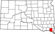
Springfield is a city in Bon Homme County, South Dakota, United States. The population was 1,914 at the 2020 census. As of 2012, about 1,200 of the residents were inmates at Mike Durfee State Prison.

<span class="mw-page-title-main">Lake Andes, South Dakota</span> City in South Dakota, United States

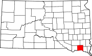
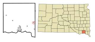
Lake Andes is a city in, and the county seat of, Charles Mix County, South Dakota, United States. The population was 710 at the 2020 census.

<span class="mw-page-title-main">Marty, South Dakota</span> CDP in South Dakota, United States

Marty is a census-designated place (CDP) in southern Charles Mix County, South Dakota, United States. The population was 677 at the 2020 census.

<span class="mw-page-title-main">Pickstown, South Dakota</span> Town in South Dakota, United States

Pickstown is a town in southern Charles Mix County, South Dakota, United States. The population was 230 at the 2020 census. It was named after U.S. Army General Lewis A. Pick, former director of the Missouri River Office of the United States Army Corps of Engineers.

<span class="mw-page-title-main">Platte, South Dakota</span> City in South Dakota, United States

Platte is a city in Charles Mix County, South Dakota, United States. The population was 1,311 at the 2022 census. The community is named after the Platte Creek, a tributary of the Missouri River reservoir Lake Francis Case. Platte is located 15 miles east of Lake Francis Case on the Missouri River.

<span class="mw-page-title-main">Wagner, South Dakota</span> City in South Dakota, United States

Wagner is a city in Charles Mix County, South Dakota, United States. The population was 1,490 at the 2020 census. The city is served by Wagner Municipal Airport as well as YST Transit buses.

<span class="mw-page-title-main">Clear Lake, South Dakota</span> City in South Dakota, United States

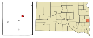
Clear Lake is a city in and the county seat of Deuel County, South Dakota, United States. The population was 1,218 at the 2020 census.

<span class="mw-page-title-main">Parkston, South Dakota</span> City in South Dakota, United States

Parkston is a city in Hutchinson County, South Dakota, United States. The population was 1,567 at the 2020 census.

<span class="mw-page-title-main">Whitewood, South Dakota</span> City in South Dakota, United States

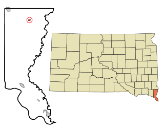
Whitewood is a city in Lawrence County, South Dakota, United States. The population was 879 at the 2020 census.

<span class="mw-page-title-main">Lennox, South Dakota</span> City in South Dakota, United States

Lennox is a city in Lincoln County, South Dakota, United States, located 20 miles (32 km) southwest of Sioux Falls. The population was 2,423 at the 2020 census.

<span class="mw-page-title-main">Hartford, South Dakota</span> City in South Dakota, United States

Hartford is a suburban American city in Minnehaha County, South Dakota, a few miles northwest of Sioux Falls. Its population was 3,354 at the 2020 census.

<span class="mw-page-title-main">Flandreau, South Dakota</span> City in South Dakota, United States

FlandreauFLAN-droo is a city in and county seat of Moody County, South Dakota, United States. The population was 2,372 at the 2020 census. It was named in honor of Charles Eugene Flandrau, a judge in the territory and state of Minnesota. He is credited with saving the community of New Ulm, Minnesota, from destruction during conflict with the Sioux tribe in 1862.

<span class="mw-page-title-main">Alcester, South Dakota</span> City in South Dakota, United States

Alcester is a city in northern Union County, South Dakota, United States. It is part of the Sioux City, IA–NE–SD Metropolitan Statistical Area. The population was 820 at the 2020 census.

<span class="mw-page-title-main">Jefferson, South Dakota</span> City in South Dakota, United States

Jefferson is a city in Union County, South Dakota, United States. The population was 475 at the 2020 census. It is part of the Sioux City, IA-NE-SD Metropolitan Statistical Area. Jefferson was founded in 1859. Every year the citizens of Jefferson and surrounding area celebrate the founding of Jefferson during the "Days of '59", a festival that includes softball, basketball, horseshoes, car show, fireworks and parade.

<span class="mw-page-title-main">North Sioux City, South Dakota</span> City in South Dakota, United States

North Sioux City is a city in Union County, South Dakota, United States. The population was 3,042 at the 2020 census. It is part of the Sioux City, IA-NE-SD Metropolitan Statistical Area.

<span class="mw-page-title-main">Gayville, South Dakota</span> Town in South Dakota, United States

Gayville is a town in Yankton County, South Dakota, United States. The population was 382 at the 2020 census.

<span class="mw-page-title-main">Lesterville, South Dakota</span> Town in South Dakota, United States

Lesterville is a town in Yankton County, South Dakota, United States. The population was 115 at the 2020 census.

<span class="mw-page-title-main">Mission Hill, South Dakota</span> Town in South Dakota, United States

Mission Hill is a town in Yankton County, South Dakota, United States. The population was 190 at the 2020 census.

<span class="mw-page-title-main">Utica, South Dakota</span> Town in South Dakota, United States

Utica is a town in Yankton County, South Dakota, United States. The population was 70 at the 2020 census.

<span class="mw-page-title-main">Volin, South Dakota</span> Town in South Dakota, United States

Volin is a town in Yankton County, South Dakota, United States. The population was 158 at the 2020 census.

References

  1. "SD Towns" (PDF). South Dakota State Historical Society. Archived from the original (PDF) on February 10, 2010. Retrieved February 13, 2010.
  2. "ArcGIS REST Services Directory". United States Census Bureau. Retrieved October 15, 2022.
  3. 1 2 U.S. Geological Survey Geographic Names Information System: Irene, South Dakota
  4. 1 2 "Census Population API". United States Census Bureau. Retrieved October 15, 2022.
  5. 1 2 "U.S. Census website". United States Census Bureau . Retrieved January 31, 2008.
  6. "U.S. Census Bureau: Irene city, South Dakota". www.census.gov. United States Census Bureau. Retrieved March 11, 2022.
  7. Federal Writers' Project (1940). South Dakota place-names, v.1-3. University of South Dakota. p. 43.
  8. "US Gazetteer files 2010". United States Census Bureau. Archived from the original on July 2, 2012. Retrieved June 21, 2012.
  9. "Census of Population and Housing". Census.gov. Retrieved June 4, 2015.
  10. "U.S. Census website". United States Census Bureau . Retrieved June 21, 2012.