
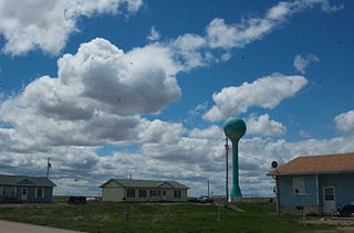
Turkey Ridge is an unincorporated community in Turner County, in the U.S. state of South Dakota. [1]
The community takes its name from nearby Turkey Ridge, an elevation noted for its population of wild turkeys. [2]
Turkey Ridge is an unincorporated community in Turner County, in the U.S. state of South Dakota. [1]
The community takes its name from nearby Turkey Ridge, an elevation noted for its population of wild turkeys. [2]

Turner County is a county in the U.S. state of South Dakota. As of the 2020 census, the population was 8,673. Its county seat is Parker. The county was established in 1871, and was named for Dakota Territory official John W. Turner.

Bennett County is a county in the U.S. state of South Dakota. As of the 2020 census, the population was 3,381. Its county seat is Martin. The county lies completely within the exterior boundary of the Pine Ridge Indian Reservation. To the east is the Rosebud Indian Reservation, occupied by Sicangu Oyate, also known the Upper Brulé Sioux Nation and the Rosebud Sioux Tribe (RST), a branch of the Lakota people.
Allen is a census-designated place on the Pine Ridge Indian Reservation in Bennett County, South Dakota, United States, that was named for the Allen Township, which it encompasses. As of the 2020 census, the CDP had a population of 460. It is one of two places which are closest to the North American continental pole of inaccessibility.

Kyle is a census-designated place (CDP) in Oglala Lakota County, South Dakota, United States. Its population was 943 at the 2020 census. Located within the Pine Ridge Indian Reservation of the Oglala Lakota, it is one of two settlements which are closest to the North American continental pole of inaccessibility.

Corinth is a village in Saratoga County, New York, United States. The population was 2,559 at the 2010 census. The village takes its name from the Greek city of Corinth.

Wounded Knee Creek is a tributary of the White River, approximately 100 miles (160 km) long, in Oglala Lakota County, South Dakota in the United States. Its Lakota name is Čhaŋkpé Ópi Wakpála.
Blue Ridge Community College is a community college located in Weyers Cave, Virginia in Augusta County. The campus is located between Interstate 81 and U.S. Route 11 just outside Weyers Cave. The school is a part of the Virginia Community College System and serves students from the cities of Harrisonburg, Staunton, and Waynesboro, Virginia, and the counties of Augusta, Highland and Rockingham. Blue Ridge also has a satellite location at Augusta Health in Fishersville, Virginia.
Sipsey Fork is an unincorporated community in Monroe County, Mississippi. Sipsey Fork is located at 33°56′57″N88°14′37″W east of Splunge.
Jefferson is an unincorporated community in Washington Township, Clinton County, Indiana. The town is named for U.S. President Thomas Jefferson.
The Sixth principal meridian at 97°22′08″W extends from the baseline coincident with the north boundary of Kansas in latitude 40°N south through the state to its south boundary in latitude 37°N and north through Nebraska to the Missouri River and governs the surveys in Kansas and Nebraska; the surveys in Wyoming except those referred to the Wind River meridian and base line, which intersect in latitude 43°01′20″N and longitude 108°48′40″W from Greenwich; the surveys in Colorado except those projected from the New Mexico and Ute meridians the latter intersecting its baseline in latitude 39°06′40″N and longitude 108°33′20″W from Greenwich; and the surveys in South Dakota extended or to be extended over the tract embracing the Pine Ridge and Rosebud Indian Reservations.
Elrod is an unincorporated community in Clark County, in the U.S. state of South Dakota.
Hooker is an unincorporated community in Turner County, in the U.S. state of South Dakota.
Riverside is an unincorporated community in Hanson County, in the U.S. state of South Dakota.
Hillhead is an unincorporated community in Marshall County, in the U.S. state of South Dakota. Hillhead is located approximately 2 kilometers northeast of Abraham Lake.
Holmquist is an unincorporated community in Day County, in the U.S. state of South Dakota.
Junius is an unincorporated community in Lake County, in the U.S. state of South Dakota.
Loyalton is an unincorporated community in Edmunds County, in the U.S. state of South Dakota. Other than a couple of farms, there are no businesses or services located there, and less than half a dozen homes.
Rockyford is an unincorporated community in Oglala Lakota County, in the U.S. state of South Dakota. It is on the Pine Ridge Indian Reservation.
Turkey Ridge Creek is a stream in the U.S. state of South Dakota.
Alston is an extinct town in Fairfield County, in the U.S. state of South Carolina. The GNIS classifies it as a populated place.
Municipalities and communities of Turner County, South Dakota, United States | ||
|---|---|---|
| Cities |  | |
| Towns | ||
| Townships | ||
| CDP | ||
| Other communities | ||
| Footnotes | ‡This populated place also has portions in an adjacent county or counties | |
43°14′37″N97°16′46″W / 43.24361°N 97.27944°W
| | This South Dakota state location article is a stub. You can help Wikipedia by expanding it. |