Wanatah, Indiana

Last updated

Wanatah, Indiana
Sacred Heart Church (Wanatah, Indiana) - exterior.jpg
Sacred Heart Church on North Ohio Street
LaPorte County Indiana Incorporated and Unincorporated areas Wanatah Highlighted 1880018.svg
Location of Wanatah in LaPorte County, Indiana.
Coordinates: 41°25′49″N86°52′55″W / 41.43028°N 86.88194°W / 41.43028; -86.88194
Country United States
State Indiana
County LaPorte
Township Clinton, Cass
Area
[1]
  Total1.40 sq mi (3.62 km2)
  Land1.40 sq mi (3.62 km2)
  Water0.00 sq mi (0.00 km2)
Elevation
[2]
728 ft (222 m)
Population
 (2020)
  Total1,009
  Density721.23/sq mi (278.38/km2)
Time zone UTC-6 (Central (CST))
  Summer (DST) UTC-5 (CDT)
ZIP code
46390
Area code 219
FIPS code 18-80018 [3]
GNIS feature ID2397721 [2]
Website http://www.wanatah.com/

Wanatah is a town in LaPorte County, Indiana, United States. The population was 1,048 at the 2010 census.

Contents

History

The first settlements were made at Wanatah in the 1850s when the railroad was extended to that point. [4] Wanatah was platted in 1865. [5] It was named for Wanata, a Native American leader. [6]

Geography

According to the 2010 census, Wanatah has a total area of 1.42 square miles (3.68 km2), all land. [7]

Climate

Climate data for Wanatah, Indiana (1991–2020 normals, extremes 1961–present)
MonthJanFebMarAprMayJunJulAugSepOctNovDecYear
Record high °F (°C)66
(19)
72
(22)
87
(31)
90
(32)
98
(37)
105
(41)
102
(39)
101
(38)
96
(36)
89
(32)
83
(28)
70
(21)
105
(41)
Mean maximum °F (°C)53.7
(12.1)
56.9
(13.8)
70.3
(21.3)
80.5
(26.9)
88.9
(31.6)
93.3
(34.1)
93.4
(34.1)
91.6
(33.1)
90.4
(32.4)
82.9
(28.3)
68.7
(20.4)
57.0
(13.9)
95.3
(35.2)
Mean daily maximum °F (°C)31.6
(−0.2)
35.4
(1.9)
46.6
(8.1)
59.2
(15.1)
70.7
(21.5)
80.3
(26.8)
83.1
(28.4)
81.2
(27.3)
76.1
(24.5)
63.4
(17.4)
48.7
(9.3)
36.8
(2.7)
59.4
(15.2)
Daily mean °F (°C)23.4
(−4.8)
26.9
(−2.8)
36.9
(2.7)
48.1
(8.9)
59.9
(15.5)
69.7
(20.9)
72.4
(22.4)
70.3
(21.3)
63.7
(17.6)
52.0
(11.1)
39.7
(4.3)
29.2
(−1.6)
49.4
(9.7)
Mean daily minimum °F (°C)15.3
(−9.3)
18.3
(−7.6)
27.2
(−2.7)
36.9
(2.7)
49.0
(9.4)
59.1
(15.1)
61.7
(16.5)
59.3
(15.2)
51.3
(10.7)
40.5
(4.7)
30.8
(−0.7)
21.5
(−5.8)
39.2
(4.0)
Mean minimum °F (°C)−8.1
(−22.3)
−3.0
(−19.4)
6.6
(−14.1)
20.6
(−6.3)
32.4
(0.2)
42.5
(5.8)
47.2
(8.4)
46.2
(7.9)
35.8
(2.1)
25.3
(−3.7)
15.1
(−9.4)
0.3
(−17.6)
−11.8
(−24.3)
Record low °F (°C)−26
(−32)
−21
(−29)
−13
(−25)
10
(−12)
26
(−3)
33
(1)
40
(4)
38
(3)
27
(−3)
18
(−8)
2
(−17)
−20
(−29)
−26
(−32)
Average precipitation inches (mm)2.12
(54)
1.88
(48)
2.35
(60)
3.78
(96)
4.00
(102)
4.71
(120)
4.18
(106)
4.38
(111)
3.28
(83)
3.78
(96)
2.88
(73)
2.11
(54)
39.45
(1,002)
Average snowfall inches (cm)10.6
(27)
8.8
(22)
5.1
(13)
0.8
(2.0)
0.0
(0.0)
0.0
(0.0)
0.0
(0.0)
0.0
(0.0)
0.0
(0.0)
0.1
(0.25)
1.4
(3.6)
6.8
(17)
33.6
(85)
Average precipitation days (≥ 0.01 in)10.89.211.212.512.911.710.610.49.511.611.211.1132.7
Average snowy days (≥ 0.1 in)7.46.13.40.70.00.00.00.00.00.11.24.923.8
Source: NOAA [8] [9]

Demographics

Historical population
CensusPop.Note
1880 372
1970 773
1980 87913.7%
1990 852−3.1%
2000 1,01318.9%
2010 1,0483.5%
2020 1,009−3.7%
Source: US Census Bureau

2010 census

As of the census [10] of 2010, there were 1,048 people, 436 households, and 295 families living in the town. The population density was 738.0 inhabitants per square mile (284.9/km2). There were 459 housing units at an average density of 323.2 per square mile (124.8/km2). The racial makeup of the town was 96.9% White, 0.1% African American, 1.0% Native American, 0.2% Asian, 0.1% Pacific Islander, 0.2% from other races, and 1.5% from two or more races. Hispanic or Latino of any race were 3.0% of the population.

There were 436 households, of which 29.8% had children under the age of 18 living with them, 55.7% were married couples living together, 8.0% had a female householder with no husband present, 3.9% had a male householder with no wife present, and 32.3% were non-families. 26.1% of all households were made up of individuals, and 9.9% had someone living alone who was 65 years of age or older. The average household size was 2.40 and the average family size was 2.91.

The median age in the town was 40.2 years. 22.9% of residents were under the age of 18; 5.5% were between the ages of 18 and 24; 26.9% were from 25 to 44; 32.1% were from 45 to 64; and 12.5% were 65 years of age or older. The gender makeup of the town was 50.0% male and 50.0% female.

2000 census

As of the census [3] of 2000, there were 1,013 people, 399 households, and 298 families living in the town. The population density was 739.2 inhabitants per square mile (285.4/km2). There were 411 housing units at an average density of 299.9 per square mile (115.8/km2). The racial makeup of the town was 98.03% White, 0.10% African American, 0.30% Native American, 0.20% Asian, 0.10% from other races, and 1.28% from two or more races. Hispanic or Latino of any race were 2.07% of the population.

There were 399 households, out of which 31.6% had children under the age of 18 living with them, 63.7% were married couples living together, 6.8% had a female householder with no husband present, and 25.3% were non-families. 21.6% of all households were made up of individuals, and 11.0% had someone living alone who was 65 years of age or older. The average household size was 2.54 and the average family size was 2.95.

In the town, the population was spread out, with 24.6% under the age of 18, 6.8% from 18 to 24, 30.3% from 25 to 44, 25.8% from 45 to 64, and 12.5% who were 65 years of age or older. The median age was 37 years. For every 100 females, there were 101.8 males. For every 100 females age 18 and over, there were 99.0 males.

The median income for a household in the town was $50,625, and the median income for a family was $54,554. Males had a median income of $41,667 versus $26,250 for females. The per capita income for the town was $19,945. About 3.6% of families and 5.3% of the population were below the poverty line, including 8.1% of those under age 18 and 5.8% of those age 65 or over.

Education

The town is served by the Wanatah Public Library. [11] Wanatah residents may also request a free library card from any La Porte County Public Library branch. [12]

Notable person

Related Research Articles

<span class="mw-page-title-main">Odon, Indiana</span> Town in Indiana, United States

Odon is a town in Madison Township, Daviess County, Indiana, United States. The population was 1,354 at the 2010 census.

<span class="mw-page-title-main">Worthington, Indiana</span> Town in Indiana, United States

Worthington is a town in Jefferson Township, Greene County, Indiana, United States. The population was 1,463 at the 2010 United States Census. It is part of the Bloomington, Indiana, Metropolitan Statistical Area.

<span class="mw-page-title-main">Coatesville, Indiana</span> Town in Indiana, United States

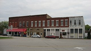
Coatesville is a town in Clay Township, Hendricks County, Indiana, United States. The population was 523 at the 2010 Census.

<span class="mw-page-title-main">Andrews, Indiana</span> Town in Indiana, United States

Andrews is a town in Dallas Township, Huntington County, Indiana, United States. The population was 1,048 at the 2020 census.

<span class="mw-page-title-main">Brownstown, Indiana</span> Town in Indiana, United States

Brownstown is a town within Brownstown Township and the county seat of Jackson County, Indiana, United States. The population was 2,947 at the 2010 census. It was named for Jacob Brown, a general of the War of 1812.

<span class="mw-page-title-main">Medora, Indiana</span> Town in Indiana, United States

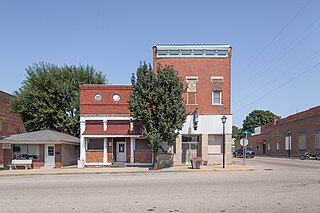
Medora is a town in Carr Township, Jackson County, Indiana, United States. The population was 693 at the 2010 census.

<span class="mw-page-title-main">New Whiteland, Indiana</span> Town in Indiana, United States

New Whiteland is a town in Pleasant Township, Johnson County, Indiana, United States. The population was 5,550 at the 2020 census.

<span class="mw-page-title-main">Mentone, Indiana</span> Town in Indiana, United States

Mentone is a town in Harrison and Franklin townships, Kosciusko County, in the U.S. state of Indiana. Mentone is the self-proclaimed "Egg Basket of the Midwest" because of prolific commercial egg production in the area, and holds an Egg Festival annually in early June to celebrate its heritage. A large concrete egg stands near the town center and is considered locally to be the "Largest Egg in the World". The Lawrence D. Bell Aircraft Museum, is located within the town limits. The Popular Rotorcraft Association has its home at the PRA Mentone Airport C92) and is home to their annual fly-in convention.

<span class="mw-page-title-main">Pierceton, Indiana</span> Town in Indiana, United States

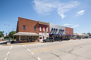
Pierceton is a town in Washington Township, Kosciusko County, in the U.S. state of Indiana. The population was 928 at the 2020 census.

<span class="mw-page-title-main">Syracuse, Indiana</span> Town in Indiana, United States

Syracuse is a town in Turkey Creek Township, Kosciusko County, in the U.S. state of Indiana. The population was 3,079 at the 2020 census. Syracuse is the location of Lake Syracuse and the nearby, larger Lake Wawasee, in addition to several other lakes in the region. The National Weather Service operates a Weather Forecast Office South of town, toward North Webster. It serves Northern Indiana.

<span class="mw-page-title-main">Topeka, Indiana</span> Town in Indiana, United States

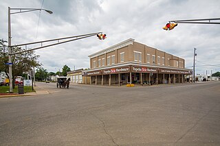
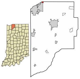
Topeka is a town in Clearspring and Eden townships, LaGrange County, Indiana, United States. The population was 1,153 at the 2010 census. Topeka is located approximately eleven miles south of Shipshewana, Indiana.

<span class="mw-page-title-main">Kingsbury, Indiana</span> Town in Indiana, United States

Kingsbury is a town in Washington Township, LaPorte County, Indiana, just northwest of the intersection of U.S. Route 35 and U.S. Route 6. The town was founded in 1835 and incorporated on March 3, 1941. During 1940 - 1941, the Kingsbury Ordnance Plant (KOP) was built for use during World War II. The plant closed after the war but reopened during the Korean War, closing permanently in 1959. The population was 242 at the 2010 census. It is included in the Michigan City, Indiana-La Porte, Indiana Metropolitan Statistical Area. The town has its own fire department, KVFD, and a Greek revival style First Baptist church built in 1851 with its own graveyard and Winchell Cemetery.

<span class="mw-page-title-main">Kingsford Heights, Indiana</span> Town in Indiana, United States

Kingsford Heights is a town in Union Township, LaPorte County, Indiana, United States. The population was 1,335 at the 2020 census. It is included in the Michigan City, Indiana-La Porte, Indiana Metropolitan Statistical Area. Also known as "Victory City," the town was built by the United States government for workers that worked in the Kingsbury Ordnance Plant, an ammunitions plant that served the US during World War II and later the Korean War.

<span class="mw-page-title-main">La Crosse, Indiana</span> Town in Indiana, United States

La Crosse is a town in LaPorte County, Indiana, United States. The population was 551 at the 2010 census. It is included in the Michigan City, Indiana-La Porte, Indiana Metropolitan Statistical Area.

<span class="mw-page-title-main">Michiana Shores, Indiana</span> Town in Indiana, United States

Michiana Shores is a town in Springfield and Michigan townships, LaPorte County, Indiana, United States. The population was 313 at the 2010 census. It is included in the Michigan City, Indiana-La Porte, Indiana Metropolitan Statistical Area. Michiana Shores is located in northwesternmost Springfield Township, and is the township's sole incorporated community.

<span class="mw-page-title-main">Trail Creek, Indiana</span> Town in Indiana, United States

Trail Creek is a town in Coolspring and Michigan townships, LaPorte County, Indiana, United States. The population was 2,052 at the 2010 census. It is included in the Michigan City, Indiana-La Porte, Indiana Metropolitan Statistical Area.

<span class="mw-page-title-main">Westville, Indiana</span> Town in Indiana, United States

Westville is a town in New Durham Township, LaPorte County, Indiana, United States. The population, as of the 2020 census is 5257. It is included in the Michigan City, Indiana-La Porte, Indiana Metropolitan Statistical Area. Westville is located in Northwest Indiana, also known as The Region.

<span class="mw-page-title-main">Brook, Indiana</span> Town in Indiana, United States

Brook is a town in Iroquois Township, Newton County, in the U.S. state of Indiana. The population was 997 at the 2010 census.

<span class="mw-page-title-main">New Carlisle, Indiana</span> Town in Indiana, United States

New Carlisle is a town in Olive Township, St. Joseph County, in the U.S. state of Indiana. The population was 1,891, as of the 2020 Census. It is part of the South Bend–Mishawaka, IN-MI, Metropolitan Statistical Area.

<span class="mw-page-title-main">Walkerton, Indiana</span> Town in Indiana, United States

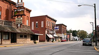
Walkerton is a town in Lincoln Township, St. Joseph County, in the U.S. state of Indiana. The population was 2,144 at the 2010 Census. It is part of the South Bend–Mishawaka, IN-MI, Metropolitan Statistical Area.

References

  1. "2020 U.S. Gazetteer Files". United States Census Bureau. Retrieved March 16, 2022.
  2. 1 2 U.S. Geological Survey Geographic Names Information System: Wanatah, Indiana
  3. 1 2 "U.S. Census website". United States Census Bureau . Retrieved January 31, 2008.
  4. History of La Porte County, Indiana: Together with Sketches of Its Cities, Villages, and Townships. C. C. Chapman & Co. 1880. p. 607.
  5. Packard, Jasper (1876). History of La Porte County, Indiana, and Its Townships, Towns and Cities. S. E. Taylor, printers. p. 180.
  6. Baker, Ronald L. (October 1995). From Needmore to Prosperity: Hoosier Place Names in Folklore and History. Indiana University Press. p. 338. ISBN   978-0-253-32866-3. ...Wanatah, for an Indian chief...
  7. "G001 - Geographic Identifiers - 2010 Census Summary File 1". United States Census Bureau. Archived from the original on February 13, 2020. Retrieved July 25, 2015.
  8. "NOWData – NOAA Online Weather Data". National Oceanic and Atmospheric Administration. Retrieved November 18, 2023.
  9. "Summary of Monthly Normals 1991–2020". National Oceanic and Atmospheric Administration. Retrieved November 18, 2023.
  10. "U.S. Census website". United States Census Bureau . Retrieved December 11, 2012.
  11. "Indiana public library directory" (PDF). Indiana State Library. Archived from the original (PDF) on February 18, 2017. Retrieved March 8, 2018.
  12. "How To Get A Library Card". La Porte County Public Library. Retrieved March 8, 2018.
  13. "Indiana State Pitcher Manaea Has Become Red Hot Prospect". Indiana Star. April 19, 2013. Archived from the original on April 21, 2013. Retrieved June 23, 2023.