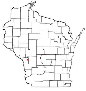
Demographics
As of the census [5] of 2000, the population of Waukau, Wisconsin was 178 people, 85 male and 93 female with a median age of 36.6, 9% under 5 years, 75.8% 18 years and over, and 11.2% 65 years and over.
The racial makeup of Waukau, Wisconsin was 97.8% White, 0.6% Black or African American, and 1.7% Multiracial American. Hispanic or Latino of any race were 2.2% of the population.
Average household size was 2.54. Average family size was 3.00. Total housing units was 73, 95.9% occupied. Of those occupied, 81.4% were owner-occupied, 18.6% renter occupied. Vacant housing units were 4.1%.
The population 25 years and over was 127, 72.4% a high school graduate or higher, and 7.1% held a bachelor's degree or higher. Civilian veteran population was 20.6%. Disability status of the population 5 years and over was 21.6%. Married male, except separated, population 15 years and over was 59.4%. Married female, except separated, population 15 years and over was 58.3%.
The population, 16 and over, in the labor force was 61.7%. Mean travel time to work for workers 16 and over was 26.1 minutes. The median household income was $41,042, median family income was $48,750,and per capita income was $16,923. Families below the poverty level was 0%. Individuals below the poverty level were 4.2%.
Single-family owner-occupied homes was 41 with a median value of $81,400. The median of selected monthly owner costs with a mortgage was $781, not mortgaged was $233.

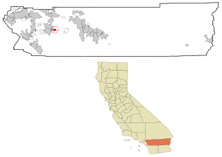
Arbuckle is a census-designated place (CDP) in Colusa County, California, United States. The population was 3,028 at the 2010 census, up from 2,332 at the 2000 census. Arbuckle is situated in the southerly portion of Colusa County, approximately 20 miles (32 km) southwest of the City of Colusa, the county seat. The town is characterized by single-family residences, multiple-family units, some mobile homes, and commercial activities. Land surrounding Arbuckle is agriculture including cultivated annual crops, and both active and unmaintained orchards. Various almond hullers may be found near the area. Regional access is provided by the north-south running Interstate 5, along with Old Highway 99 West running alongside Interstate 5.

Westhaven-Moonstone is a census-designated place (CDP) located in Humboldt County, California, United States. As of the 2010 census the population was 1,205, up from 1,044 at the 2000 census.

Dixon Lane-Meadow Creek is a census-designated place (CDP) in Inyo County, California, United States. The population was 2,645 at the 2010 census, down from 2,702 at the 2000 census.

Wilkerson is a census-designated place (CDP) in Inyo County, California, United States. The population was 563 at the 2010 census, up from 562 at the 2000 census.
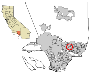
North El Monte is a census-designated place (CDP) in the San Gabriel Valley, in Los Angeles County, California, United States. The population was 3,723 at the 2010 census, up from 3,703 at the 2000 census.

Lake Wildwood is a census-designated place (CDP) in Nevada County, California, United States. The population was 4,991 at the 2010 census, up from 4,868 at the 2000 census.

Taylorsville is a census-designated place (CDP) in Plumas County, California, United States. The population was 150 at the 2010 census, down from 154 at the 2000 census. The annual Stone Ranch Reunion is held in Taylorsville.
Valle Vista is a census-designated place (CDP) in Riverside County, California, United States and is located in the San Jacinto Valley. Some areas of Valle Vista are considered to be part of both unincorporated San Jacinto and Hemet but have yet to be incorporated. The population was 11,036 at the 2010 census, up from 8,356 at the 2000 census.

Dorris is a city in Siskiyou County, California, United States. Its population is 860 as of the 2020 census, down from 939 from the 2010 census. The town being small, the only attractions are the flagpole and county library. The most notable people who have been residents of Dorris are two athletes who were born here.

Rancho San Diego is a census-designated place (CDP) in San Diego County, California. The population was 21,208 at the 2010 census, up from 20,155 at the 2000 census. The area was developed as subdivisions beginning in the 1970s.

Brighton Charter Township is a charter township of Livingston County in the U.S. state of Michigan. As of the 2020 census, the township population was 19,144. The township is bordered on the southwest by the city of Brighton, but the two are administered autonomously.

Berkshire is a town in Franklin County, Vermont, United States. The population was 1,547 at the 2020 census. It contains the unincorporated village of East Berkshire.
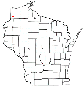
Dairyland is a town in Douglas County, Wisconsin, United States. The population was 186 at the 2000 census. The unincorporated communities of Cozy Corner, Dairyland, and Moose Junction are located in the town.
Burns is a town in La Crosse County, Wisconsin, United States. The population was 949 at the 2010 census. It is part of the La Crosse, Wisconsin Metropolitan Statistical Area. The unincorporated communities of Burns and Burns Corners are located in the town.

Troy is a town in St. Croix County, Wisconsin, United States. The population was 3,661 at the 2000 census. The unincorporated community of Glover is located in the town.

Dodge is a town in Trempealeau County, Wisconsin, United States. The population was 414 at the 2000 census. The census-designated place of Dodge is located in the town. The unincorporated community of Pine Creek is also located in the town.

Dodgeville is a city in and the county seat of Iowa County, Wisconsin, United States. The population was 4,984 at the 2020 census, making it the county's most populous city. Dodgeville is part of the Madison Metropolitan Statistical Area.
Miranda is a census-designated place in Humboldt County, California. It is located 2.5 miles (4 km) northwest of Phillipsville, at an elevation of 351 feet (107 m). The ZIP Code is 95553. The population was 520 at the 2010 census.
Sugarloaf is an unincorporated community residential area less than a mile south of Big Bear City and 8 miles from the eastern tip of Big Bear Lake in the San Bernardino Mountains of San Bernardino County, California. The area is primarily residential with a convenience store and a post office located at the center of the community. The residential area is set at an elevation of 7,096 feet at its center, whereas its extreme northern border is 6,998 feet above sea level and the southern tip sits at 7,218 feet above sea level. There is no municipal organization for the area, and all fire, water, and police service is provided by San Bernardino County. The ZIP code for the community is 92386, the area code 909, and the population is 1,816. Big Bear High School is located in the northern part of the community.

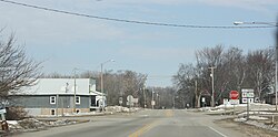
Eureka is an unincorporated census-designated place in the town of Rushford, in Winnebago County, Wisconsin, United States. It is located on the Fox River at the intersection of county highways K & E southwest of Omro. At the 2020 census, its population was 247.