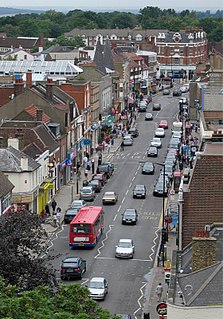
Stevenage is a large town and borough in Hertfordshire, England, about 27 miles (43 km) north of London. Stevenage is east of junctions 7 and 8 of the A1(M), between Letchworth Garden City to the north and Welwyn Garden City to the south. In 1946, Stevenage was designated the United Kingdom's first New Town under the New Towns Act.
Chipping Barnet or High Barnet is a suburban market town in north London, forming part of the London Borough of Barnet, England. It is a suburban development built around a 12th-century settlement, and is located 10+1⁄2 miles (17 km) north-northwest of Charing Cross, 3 miles (4.8 km) east from Borehamwood, 5.2 miles (8.4 km) west from Enfield and 3.2 miles (5.1 km) south from Potters Bar. Its population, including its localities East Barnet, New Barnet, Hadley Wood, Monken Hadley, Cockfosters and Arkley, was 47,359 as of 2011.
Much Hadham, formerly known as Great Hadham, is a village and civil parish in the district of East Hertfordshire, Hertfordshire, England. The parish of Much Hadham contains the hamlets of Perry Green and Green Tye, as well as the village of Much Hadham itself and Hadham Cross. It covers 4,490 acres (1,820 ha). The village of Much Hadham is situated midway between Ware and Bishop's Stortford. The population of the parish was recorded as 2,087 in the 2011 census, an increase from 1,994 in 2001.

Buntingford is a market town and civil parish in the district of East Hertfordshire and county of Hertfordshire in England. It lies next to the River Rib and is located on the historic Roman road, Ermine Street. As a result of its location, it grew mainly as a staging post with many coaching inns and has an 18th-century one-cell prison known as The Cage, by the ford at the end of Church Street. It has a population of 6,844, as of the 2020 UK Census.

The Diocese of St Albans forms part of the Province of Canterbury in England and is part of the wider Church of England, in turn part of the worldwide Anglican Communion.

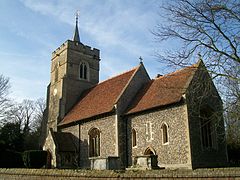
Walkern is a village and civil parish in East Hertfordshire, England. It is about two miles from Stevenage.

Buckland is a village and civil parish in the East Hertfordshire district of Hertfordshire, England. The village is situated on the A10 road, with the market town of Royston situated 4½ miles north and Buntingford 3 miles south. According to the 2011 census, the parish of Buckland, including the hamlet of Chipping has a population of 274.

Henham, or Henham-on-the-Hill is a village and civil parish in the Uttlesford district of Essex, England. The village is situated 2.5 miles (4 km) north from London Stansted Airport. The parish includes the hamlets of Little Henham and Pledgdon Green. Parish population at the 2011 Census was 1,233.

Widford is a village and civil parish between Ware and Much Hadham in the East Hertfordshire district of Hertfordshire in England. It covers an area of approximately 1,167 acres and contains 220 houses. The River Ash flows through the north of the parish. Widford had a population of 534 people in the 2011 census.

Parson Drove is a fen village in the Isle of Ely, Cambridgeshire, England. A linear settlement, it is 6 miles (10 km) west of Wisbech, the nearest town. The village is named after the central thoroughfare along which the village developed, a green drove, much wider than the current metalled road (B1166). The population at the 2001 Census was 1,030. The population is included in the civil parish of Wisbech St Mary.

West Horsley is a semi-rural village between Guildford and Leatherhead in Surrey, England. It lies on the A246, and south of the M25 and the A3. Its civil parish ascends to an ancient woodland Sheepleas Woods which are on the northern downslopes of the ridge of hills known as the North Downs in the extreme south of the village, and cover about a tenth of its area, 255 acres (1 km²). The bulk of West Horsley's land is north of the Surrey Hills AONB, the rest is within it.

Braughing is a village and civil parish, between the rivers Quin and Rib, in the non-metropolitan district of East Hertfordshire, part of the English county of Hertfordshire. Braughing gave its name to a county division in Hertfordshire, known as a "hundred". This was a rural district from 1935 to 1974. The population at the 2011 Census was 1,203. This includes Bozen Green, Braughing Friars and Brent Pelham.

Hertford Heath is a village and civil parish near the county town of Hertford in Hertfordshire, England. The population at the 2011 Census was 2,672.

Brent Pelham is a village and civil parish in the East Hertfordshire district, in the county of Hertfordshire, England, and situated approximately 5 miles (8 km) east of Buntingford. It is one of the three Pelhams, with Stocking Pelham and Furneux Pelham. It shares a parish council with Meesden.
Furneux Pelham or Furneaux Pelham is a village and civil parish in Hertfordshire, England. The village is one of the Pelhams, part of an early medieval larger swathe of land known as Pelham including Brent Pelham to the north and Stocking Pelham to the east and north-east.
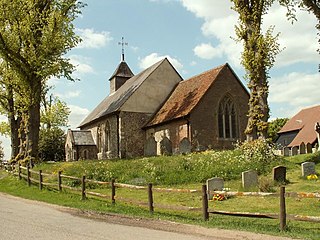
Stocking Pelham is a village and civil parish in the East Hertfordshire district of Hertfordshire, England. It is located on the border with Essex, around 6 miles (10 km) east of Buntingford.The village is one of the three Pelhams, along with the nearby Brent Pelham and Furneux Pelham. Stocking Pelham is home to St. Mary's Church in the Church of England Diocese of St Albans. The aerial view of Stocking Pelham shows that the settlements are sparsely positioned from one another. Close by the village is a major electrical substation of the National Grid.

Clothall is a village and civil parish in the county of Hertfordshire, England, with a population of 358. It is situated 2.25 miles (3.62 km) south-east of Baldock, and is in the district of North Hertfordshire. At the 2011 Census the civil parish had a population of 150. The village contains the Church of St Mary the Virgin, which was built of flint and stone around 1350–70, though parts of the church are older, dating to the 12th century.

Sandon is a village and civil parish in the North Hertfordshire district, in the county of Hertfordshire, England. Sandon is located near the towns of Baldock and Buntingford. The parish also includes the hamlets of Green End and Roe Green, and Blagrove Common, a nature reserve. At the 2011 Census the population of the civil parish was 495.

Chipping is a hamlet in the civil parish of Buckland in the East Hertfordshire district, in the county of Hertfordshire, England. Situated along the A10 road, Chipping was an early, but unsuccessful attempt to create a market town at the crossing of the River Rib by Ermine Street. Situated in a valley, Chipping lies approximately two miles (3.2 km) north of Buntingford and six miles (9.7 km) south of Royston. Chipping is situated half a mile west of the prime meridian. Prior to 1750, Chipping was referred to as New Chipping, today this name is rarely used.
West Mill railway station served the village of Westmill, Hertfordshire, England, from 1863 to 1964 on the Buntingford branch line.
18 'Hertfordshire History: the Westmill Murder' on YouTube.