Widford, Hertfordshire

Last updated

Widford
St John the Baptist Church, Widford, Herts. - geograph.org.uk - 217301.jpg
St John the Baptist Church
Hertfordshire UK location map.svg
Red pog.svg
Widford
Location within Hertfordshire
Population534 (2011) [1]
OS grid reference TL 421 157
Civil parish
  • Widford
District
Shire county
Region
Country England
Sovereign state United Kingdom
Post town WARE
Postcode district SG12
Dialling code 01279
Police Hertfordshire
Fire Hertfordshire
Ambulance East of England
UK Parliament
List of places
UK
England
Hertfordshire
51°49′19″N0°03′36″E / 51.822°N 0.060°E / 51.822; 0.060 Coordinates: 51°49′19″N0°03′36″E / 51.822°N 0.060°E / 51.822; 0.060

Widford is a village and civil parish between Ware and Much Hadham in the East Hertfordshire district of Hertfordshire in England. It covers an area of approximately 1,167 acres [2] and contains 220 houses. [3] The River Ash flows through the north of the parish. Widford had a population of 534 people in the 2011 census. [4]

Contents

History

The name Widford comes from the old English word 'wid' meaning willow tree and the word 'ford' [5]

The Widford commons were extensive and were enclosed under an award of 1856. There was a wood called Lily Wood to the west of the village which was cut down in the late 19th century. [2]

Between 1870 and 1872, John Marius Wilson described Widford as: "a parish, with a village, in Ware district, Herts; near the Buntingford railway, 4 miles E by N of Ware. It has a post-office under Ware, and a r. station." [6]

Demography and employment

Population Graph of Widford between 1801 and 2011. Widford population graph.jpg
Population Graph of Widford between 1801 and 2011.

The population of Widford was first recorded in 1801 at 361. The population peaked in 1841 at 539. [7] In the most recent census in 2011 the population was measured as 534. [4]

Image shows the different occupations people were employed by in 1881 and the numbers of people in each sector. Widford Occupation Structure 1881.jpg
Image shows the different occupations people were employed by in 1881 and the numbers of people in each sector.

The data included in the graph shows that in 1881 there was one sector of employment that was significantly more popular than any others. This sector was the agriculture sector which had a total of 81 people working in. [7]

Buildings and landmarks

Widford School is a combination of a primary school and a pre-School. There are approximately 60 pupils with a capacity for a maximum of 8 children per year group. [3] Widford School has been open since 1875. [8]

The Village Hall, on Bell Lane at the south of the civil parish, provides for local individuals and organisations. It was built in 1910 by George S Pawle. The primary use of the hall at inception was as a drill hall for the Hertfordshire Regiment TA; it was then used by a Regiment from Staffordshire. It was for village activities and events before it was bought in 1956, after volunteers raised money to buy the building and renovate it. These volunteers then cared and maintained the hall. A new kitchen was added in 2009. The hall has two main rooms: a function room and a smaller room. The function room has a removable stage and has capacity for 100 people. The smaller room is more of a committee room with capacity for 30 people. [3] [9]

The Widford pub is The Green Man. A local campaign helped keep the pub open after a possible closure. [3]

There is a disused single-platformed railway station in Widford. The station was used between 1873 and 1963 as part of the Ware to Buntingford Branch Line. Construction of the railway began in 1859, and four years later the line was complete and nearly fourteen miles long. A coal and garden product distribution centre uses the site. The railway line is used by walkers and cyclists. [10]

Widford allotments hold more than 20 plots; these were created in 1978 after the land was purchased by Widford Parish Council. [3]

Church

The parish church is St John the Baptist. [11] The oldest parts of the church date to the early 13th century, with further work in the late 13th and 14th. The church registers, at Hertfordshire County Record Office, date from 1558. The church graveyard was closed for burials in 1903 when a new graveyard on the other side of Ware Road became available. The Church is supported by an independent, non-religious charity called The Friends of Widford Church. The purpose of the charity is to support the parochial church council and to care for the management and maintenance of the church. [12]

Sport and recreation

Playing field

Widford Playing Field includes a children's play area, a football pitch and a cricket strip. The playing field has green areas of planted trees and hedges. The development of the playing field came after Askey's Field was bought in 1979 by volunteers from the Village Hall Community who raised the money for purchase. [3]

Cricket Club

The ground of Ware Cricket Club is one of the few privately owned cricket grounds in the country. [3] The club has two teams that compete in the Saracens Hertfordshire Premier Cricket League. [13]

Notable people

See also

Related Research Articles

Totteridge Human settlement in England

Totteridge is a residential area and former village in the London Borough of Barnet, England. It is a mixture of suburban development and open land situated 8 miles (13 km) north north-west of Charing Cross. It is part of the Whetstone postal district (N20).

Harpenden Town in Hertfordshire, England

Harpenden is a town and civil parish in the City and District of St Albans in the county of Hertfordshire, England. The population of the built-up area was 30,240 in the 2011 census, whilst the population of the civil parish was 29,448. Harpenden is a commuter town, with a direct rail connection through Central London and property prices well over triple the national average.

Much Hadham, formerly known as Great Hadham, is a village and civil parish in the district of East Hertfordshire, Hertfordshire, England. The parish of Much Hadham contains the hamlets of Perry Green and Green Tye, as well as the village of Much Hadham itself and Hadham Cross. It covers 4,490 acres (1,820 ha). The village of Much Hadham is situated midway between Ware and Bishop's Stortford. The population of the parish was recorded as 2,087 in the 2011 census, an increase from 1,994 in 2001.

Buntingford Market town in Hertfordshire, England

Buntingford is a market town and civil parish in the district of East Hertfordshire and county of Hertfordshire in England. It lies next to the River Rib and is located on the historic Roman road, Ermine Street. As a result of its location, it grew mainly as a staging post with many coaching inns and has an 18th-century one-cell prison known as The Cage, by the ford at the end of Church Street. It has a population of 6,844, as of the 2020 UK Census.

Ware, Hertfordshire Town in Hertfordshire, England

Ware is a town in Hertfordshire, England close to the county town of Hertford. It is also a civil parish in East Hertfordshire district.

Eversholt Human settlement in England

Eversholt is a village and civil parish located in Bedfordshire, England. It was mentioned in the Domesday Book and is over 1000 years old. "Eversholt" comes from Anglo-Saxon meaning "wood of the wild boar".

Watton-at-Stone Human settlement in England

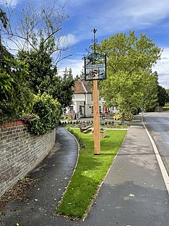
Watton-at-Stone is a village in the English county of Hertfordshire, situated midway between the towns of Stevenage and Hertford in the valley of the River Beane. The 2011 census showed a population of 2,272 living in 946 households. Watton-at-Stone is also a civil parish in East Hertfordshire District Council.

Tewin Village in Hertfordshire, England

Tewin is an English village and civil parish in Hertfordshire, England between the towns of Welwyn Garden City, Stevenage, Welwyn (village) and the county town Hertford, it is within commuting distance of London. Tewin and specifically Tewin Wood is a very affluent residential area and ranked amongst the most expensive streets in the UK with average property prices well in excess of £1-£2 million.

Caddington Human settlement in England

Caddington is a village and civil parish in the Central Bedfordshire district of Bedfordshire, England. It is between the Luton/Dunstable urban area, and Hertfordshire.

Bentley, Suffolk Human settlement in England

Bentley is a village and civil parish in the Babergh district of Suffolk, England, about 6 miles (10 km) southwest of Ipswich. The 2011 Census recorded the parish's population as 776.

Westmill Human settlement in England

Westmill is an English village and civil parish in the East Hertfordshire district of Hertfordshire, with an area of 1036 hectares. A population of 264 was recorded in the 2001 National Census. It lies just to the south of Buntingford, beside the River Rib.

Langley, Essex Human settlement in England

For the historic house in Essex called Langley's, see Great Waltham.

Stanstead St Margarets Human settlement in England

Stanstead St Margarets, often abbreviated to just St Margarets, is a village and civil parish in the district of East Hertfordshire, Hertfordshire, England. It is located halfway between the towns of Hoddesdon and Ware. The village is separated from the village of Stanstead Abbotts by the River Lea, and had a population of 1,318 at the census of 2001, increasing to 1,652 at the 2011 Census.

Hertingfordbury Village in Hertfordshire, England

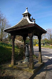
Hertingfordbury is a small village in Hertfordshire, England, close to the county town of Hertford. It was mentioned in the Domesday Book. Hertingfordbury is also the name of a neighbouring civil parish, which does not contain the village, which is actually within the local government area of Hertford Town Council. The population of the civil parish as of the 2011 census was 630.

Widford, Essex Human settlement in England

Widford is an area of Chelmsford and former civil parish, now in the unparished area of Chelmsford, in the Chelmsford district, in the county of Essex, England. It is approximately 1.5 miles (2.4 km) south-south-west of the city's railway station. It encloses a mixed residential, industrial and rural area south of the River Can, east of the River Wid and mostly to the west of the Great Eastern Main Line. In 1931 the parish had a population of 457.

Wareside Civil parish in Hertfordshire, England

Wareside is a small village and civil parish in the East Hertfordshire district, in the county of Hertfordshire, England. The population of the civil parish in the 2011 census was 735. It is approximately 3 miles (5 km) away from the town of Ware and the larger town of Hertford, the county town. Nearby villages include Widford, Hunsdon, Babbs Green and Bakers End. Nearby hamlets include Cold Christmas and Helham Green. The B1004 road linking Ware to Bishop's Stortford goes through the village and the main A10 road can be joined up at Thundridge. Fanhams Hall Road links Wareside back to Ware. Ware railway station on the Hertford East Branch Line is located two and a half miles (4 km) away.

Thundridge Human settlement in England

Thundridge is a village and civil parish in the East Hertfordshire district, in the county of Hertfordshire, England.

Chipping, Hertfordshire Hamlet in East Hertfordshire, England

Chipping is a hamlet in the civil parish of Buckland in the East Hertfordshire district, in the county of Hertfordshire, England. Situated along the A10 road, Chipping was an early, but unsuccessful attempt to create a market town at the crossing of the River Rib by Ermine Street. Situated in a valley, Chipping lies approximately two miles (3.2 km) north of Buntingford and six miles (9.7 km) south of Royston. Chipping is situated half a mile west of the prime meridian. Prior to 1750, Chipping was referred to as New Chipping, today this name is rarely used.

Hadham railway station Disused railway station in Much Hadham, Hertfordshire

Hadham railway station served the village of Much Hadham, Hertfordshire, England, from 1863 to 1965 on the Buntingford branch line.

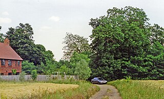
Widford railway station served the village of Widford, Hertfordshire, England, from 1863 to 1964 on the Buntingford branch line.

References

  1. "Civil Parish population 2011". Neighbourhood Statistics. Office for National Statistics. Retrieved 3 November 2016.
  2. 1 2 "British History Online". Parishes: Widford. University of London. Retrieved 17 March 2016.
  3. 1 2 3 4 5 6 7 8 9 "Widford Parish Council". Widford Village. Widford Parish Council. Retrieved 10 March 2016.
  4. 1 2 "Key Figures for 2011 Data: Widford". Neighbourhood Statistics. Office for National Statistics. Retrieved 28 January 2016.
  5. "University of Nottingham". Key to English Place-Names. University of Nottingham. Retrieved 24 April 2016.
  6. Wilson, John Marius (1870–72). Imperial Gazetteer of England and Wales. Edinburgh: A. Fullerton & Co.
  7. 1 2 "Vision of Britain". Widford AP/CP. Retrieved 24 April 2016.
  8. "Widford School". Welcome to Widford School Website!. Retrieved 10 March 2016.
  9. "Widford Parish Council". Widford Village Hall. Widford Parish Council 2011–2015. Retrieved 17 March 2016.
  10. "Disused Stations". Station Name: WIDFORD. Disused Stations. Retrieved 17 March 2016.
  11. "A Church Near You". St John the Baptist, Widford. Archbishops' Council. Retrieved 10 March 2016.
  12. "Hunsdon with Widford and Wareside". The Church of St John the Baptist Widford, Hertfordshire. Retrieved 10 March 2016.
  13. "Saracens Hertfordshire Premier Cricket League". Ware. Saracens Hertfordshire Premier Cricket League. Retrieved 10 March 2016.
  14. "Biographic sketches of memorable Christians of the Past". John Eliot, Missionary To the American Indians. Retrieved 19 March 2016.

Commons-logo.svg Media related to Widford, Hertfordshire at Wikimedia Commons