Related Research Articles

Lorain County is a county located in the northeastern portion of the U.S. state of Ohio. As of the 2020 census, the population was 312,964. Its county seat is Elyria. The county was physically established in 1822, becoming judicially independent in 1824.

Amherst is a city in Lorain County, Ohio, United States. It is located 28 miles (45 km) west of Cleveland. The population was 12,681 at the 2020 census.

Elyria is a city in the Greater Cleveland metropolitan statistical area and the county seat of Lorain County, Ohio, United States, located at the forks of the Black River in Northeast Ohio 23 miles southwest of Cleveland. As of the 2010 census, the city had a population of 54,533. The city is home to Lorain County Community College.

Lorain is a city in Lorain County, Ohio, United States. The municipality is located in northeastern Ohio on Lake Erie, at the mouth of the Black River, about 30 miles west of Cleveland. As of the 2010 census, the city had a population of 64,097, making it Ohio's tenth-largest city, the third-largest in Greater Cleveland, and the largest in Lorain County by population.

North Ridgeville is an affluent city located along the eastern border of Lorain County, Ohio, United States. The city's population was 35,552 in 2020. A west side suburb of Cleveland, North Ridgeville is the fastest-growing city in northern Ohio. It has been ranked the 13th safest city in the United States and the safest in Ohio.

Spencer Township is one of the seventeen townships of Medina County, Ohio, United States. The 2000 census found 2,429 people in the township, 1,682 of whom lived in the unincorporated portions of the township.

Danbury Township is one of the twelve townships of Ottawa County, Ohio, United States. The 2000 census found 4,631 people in the township, 3,869 of whom lived in the unincorporated portions of the township.

Amherst Township is one of the eighteen townships of Lorain County, Ohio, United States. As of the 2010 census, the population was 6,844, down from 7,598 people at the 2000 census. In 2010, 5,728 of the population lived in the unincorporated portions of the township.

Pittsfield Township is one of the eighteen townships of Lorain County, Ohio, United States. As of the 2010 census the population was 1,581.

Maynard is an unincorporated community located in western Colerain Township, Belmont County, Ohio, United States, along Wheeling Creek. It has a post office with the ZIP code 43937. Maynard is part of the Wheeling, WV-OH Metropolitan Statistical Area. The community is near Wheeling Township and its sister community of Blainesville. Maynard is a part of the St. Clairsville-Richland City School District.
Interstate 90 (I-90) runs east–west across the northern tier of the U.S. state of Ohio. Much of it is along the Ohio Turnpike, but sections outside the turnpike pass through Cleveland and northeast into Pennsylvania.
Brentwood Lake is an unincorporated community in far eastern Carlisle Township, Lorain County, Ohio, United States. It lies at the intersection of State Routes 57 and 82 midway between Elyria and Grafton. Located at the center of the planned community was a small lake, compliments of an earthen dam from which a small stream flows to the East Branch Black River that runs just to the west of the community. The earthen dam was dismantled in 2010 for safety reasons and today there is only a small stream without a lake. Mr. Alfred M. Moen, the inventor of the Moen faucet, was a past resident of the lakeside community.
Lorain County Speedway is an auto racing track located in Amherst Township, Lorain County, near South Amherst, Ohio, USA opened in 1949 as a 1/3 mile dirt oval. It was paved between the 1960 and 1961 racing seasons. It is currently a 3/8-mile asphalt oval, with 12 degree banking in both turns, and slight banking on the straightaways.
Ohio's 58th House of Representatives district encompasses all of Huron County, western and southern Lorain County, and eastern Seneca County. Notable cities and villages within the district include Amherst, Attica, Bellevue, Grafton, Greenwich, New London, Norwalk, Vermilion, Wellington, and Willard, among other locations. The 58th District is mainly a rural, agricultural district with the exceptions of Amherst, Norwalk, and Vermilion.
The New Indian Ridge Museum, Historic Shupe Homestead, and Wildlife Preserve is a private museum and nature reserve located on Beaver Creek in Amherst, Ohio, consisting of the Shupe Homestead site. The grounds contain two additional lots of upland and lowland mature wooded forest that contain wetlands, vernal pools, and an area floodplain. The property contains numerous tree and wildflower species, several fern types, buttonbushes, pawpaw trees, native green dragon wildflowers, and about fifty different species of birds.

Beaver Creek is a large creek in Lorain County, Ohio, USA. It flows through the township of Amherst, and through the western end of the corporation-limits of the City of Lorain, and into Lake Erie.
Belden is an unincorporated community in Lorain County, in the U.S. state of Ohio.
Brighton is an unincorporated community in Lorain County, in the U.S. state of Ohio.
Murraysville is an extinct town in Lorain County, in the U.S. state of Ohio. It was located in Carlisle Township.
Barney Creek is a former name for a creek within Amherst Township, Lorain County, Ohio. It is possibly an alternate name for Little Beaver Creek, or perhaps was simply a typographical-error for "Barnes Creek". Modern maps do not have "Little Beaver Creek" labeled separately, but only designate it as being a sub-branch of Beaver Creek.
References
- ↑ U.S. Geological Survey Geographic Names Information System: Whiskyville, Ohio
- ↑ History of Lorain County, Ohio. Williams Brothers. 1879. p. 332.
- ↑ Amherst's Story. Evansville, Indiana: Unigraphic Inc. 1976. pp. 22–23.
- ↑ "Whiskyville · Amherst Township, OH 44001". Whiskyville · Amherst Township, OH 44001. Retrieved 2021-10-04.
Municipalities and communities of Lorain County, Ohio, United States | ||
|---|---|---|
| Cities |  | |
| Villages | ||
| Townships | ||
| CDPs | ||
| Unincorporated communities | ||
| Ghost town | ||
| Footnotes | ‡This populated place also has portions in an adjacent county or counties | |
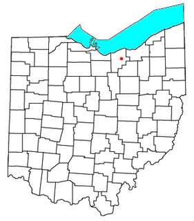
Coordinates: 41°22′00″N82°12′38″W / 41.36667°N 82.21056°W
| | This Lorain County, Ohio state location article is a stub. You can help Wikipedia by expanding it. |