Woodloch, Texas

Last updated

Woodloch, Texas
Woodloch Rd 1.jpg
North Woodloch Street, facing west.
TXMap-doton-Conroe.PNG
Location of Woodloch, Texas
Montgomery County Woodloch.svg
Coordinates: 30°13′5″N95°24′37″W / 30.21806°N 95.41028°W / 30.21806; -95.41028
Country United States
State Texas
County Montgomery
Incorporated1974
Government
[1]
  MayorLaura Kessner
  AldermenJason Restrepo
Matthew Greening
Christopher Waddle
Max Thieme
Empty
Area
[2]
  Total0.08 sq mi (0.22 km2)
  Land0.08 sq mi (0.22 km2)
  Water0.00 sq mi (0.00 km2)
Elevation
108 ft (33 m)
Population
 (2010)
  Total207
  Estimate 
(2019) [3]
208
  Density2,476.19/sq mi (951.70/km2)
Time zone UTC-6 (Central (CST))
  Summer (DST) UTC-5 (CDT)
FIPS code 48-80144 [4]
GNIS feature ID1388602 [5]

Woodloch is a town in Montgomery County, Texas, United States. The population was 207 at the 2010 census. As of October 2022, the mayor is Donald Nichols. [1]

Contents

Geography

Woodloch is located at 30°13′5″N95°24′37″W / 30.21806°N 95.41028°W / 30.21806; -95.41028 (30.217963, –95.410255). [6]

According to the United States Census Bureau, the town has a total area of 0.1 square miles (0.26 km2), all land.

The town consists of three roads: South Woodloch Street, North Woodloch Street, and Needham Road. North and South Woodloch Streets are connected together at the eastern edge of Woodloch. Needham Road, on the western edge, connects the town to State Highway 242.

The west fork of the San Jacinto River flows on the eastern border of the town.

Government

Woodloch is a Type B, General Law municipality, with a mayor and five aldermen. [1]

In the Texas Senate, Woodloch is part of District 4, represented by Republican Brandon Creighton. In the Texas House of Representatives, Woodloch is part of District 15, represented by Republican Mark Keough. [7]

In the United States Senate, Republicans John Cornyn and Ted Cruz represent the entire state of Texas. In the United States House of Representatives, Woodloch is part of District 8, represented by Republican Kevin Brady. [7]

Demographics

Historical population
CensusPop.Note
1980 351
1990 291−17.1%
2000 247−15.1%
2010 207−16.2%
2019 (est.)208 [3] 0.5%
U.S. Decennial Census [8]

As of the 2010 United States Census, [9] there were 207 people, 68 households, and 58 families residing in the town. The racial makeup of the town was 93.7% White, 3.4% Black or African American, 1.9% other races, and 1.0% from two or more races. Hispanic or Latino of any race were 8.7% of the population.

There were 68 households, out of which 25.0% had children under the age of 18 living with them, 85.3% were married couples living together, 10.3% had a female householder with no husband present, and 14.7% were non-families. 13.2% of all households were made up of individuals. The average household size was 3.04 and the average family size was 3.26

In the town, the population was spread out, with 24.2% under the age of 18, 9.7% from 18 to 24, 19.8% from 25 to 44, 29.5% from 45 to 64, and 16.9% who were 65 years of age or older. The median age was 42.3 years. For every 100 females, there were 105.0 males. For every 100 females age 18 and over, there were 101.3 males.

In the 2015 American Community Survey, The median income for a household in the town was $76,875 and the median income for a family was $83,750. Males had median earnings of $36,042 versus $25,417 for females. The per capita income for the town was $38,371. 2.3% of the population and none of its families were below the poverty line.

Education

Woodloch is served by Conroe Independent School District. [10]

Residents of Conroe ISD (and therefore Woodloch) are served by the Lone Star College System (formerly North Harris Montgomery Community College). [11]

Debris and other trash was a common sight in Woodloch in the aftermath of Hurricane Harvey. Woodloch Hurricane Trash.jpg
Debris and other trash was a common sight in Woodloch in the aftermath of Hurricane Harvey.

Hurricane Harvey

In 2017, during Hurricane Harvey, the San Jacinto River overflowed its banks, causing between 3–8 feet of water to flow through every home in Woodloch. The flooding was exacerbated by a record release of 79,000 cubic feet of water per second from Lake Conroe. As a result, the entire city was forced to evacuate. Although an estimated 25 water rescues were performed in Woodloch, no storm-related deaths were reported. [12]

See also

Related Research Articles

<span class="mw-page-title-main">Montgomery County, Texas</span> County in Texas, United States

Montgomery County is a county in the U.S. state of Texas. As of the 2020 U.S. census, the county had a population of 620,443. The county seat is Conroe. The county was created by an act of the Congress of the Republic of Texas on December 14, 1837, and is named for the town of Montgomery. Between 2000 and 2010, its population grew by 55%, the 24th-fastest rate of growth of any county in the United States. Between 2010 and 2020, its population grew by 36%. According to the U.S. Census Bureau, the estimated population is 711,354 as of July 1, 2023.

<span class="mw-page-title-main">San Jacinto County, Texas</span> County in Texas, United States

San Jacinto County is a county in the U.S. state of Texas. As of the 2020 census, its population was 27,402. Its county seat is Coldspring. The county's name comes from the Battle of San Jacinto which secured Texas' independence from Mexico and established a republic in 1836.

<span class="mw-page-title-main">Jacinto City, Texas</span> City in Texas, United States

Jacinto City is a city in Harris County, Texas, United States, east of the intersection of Interstate 10 and the East Loop of Interstate 610. Jacinto City is part of the Houston–Sugar Land–Baytown metropolitan area and is bordered by the cities of Houston and Galena Park. The population was 9,613 at the 2020 census.

<span class="mw-page-title-main">Conroe, Texas</span> City in Texas, United States

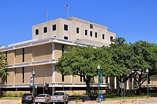
Conroe is a city in and the county seat of Montgomery County, Texas, United States, about 40 miles (64 km) north of Houston. It is a principal city in the Houston–The Woodlands–Sugar Land metropolitan area.

<span class="mw-page-title-main">Cut and Shoot, Texas</span> City in Texas, United States

Cut and Shoot is a city in eastern Montgomery County, Texas, United States, about 6 mi (9.7 km) east of Conroe and 40 mi (64 km) north of Houston. Until 2006, Cut and Shoot was considered and called a town. Then, the town council elected for it to be considered and referred to as a city. The population was 1,087 at the 2020 census.

<span class="mw-page-title-main">Magnolia, Texas</span> City in Texas, United States

Magnolia is a city in southwestern Montgomery County, Texas, United States within the Houston metropolitan area. It is named for the magnolia trees that grow in the area. The population was 2,359 at the 2020 United States Census.

<span class="mw-page-title-main">Montgomery, Texas</span> City in Texas, United States

Montgomery is a city located in Montgomery County, Texas, United States. As of the 2020 census, the city had a total population of 1,948.

<span class="mw-page-title-main">Oak Ridge North, Texas</span> City in Montgomery County, Texas, United States

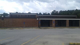
Oak Ridge North is a city in Montgomery County, Texas, United States. It is located along Interstate 45 10 miles (16 km) south of Conroe and 35 miles north of Houston. The population was 3,057 at the 2020 census.

<span class="mw-page-title-main">Panorama Village, Texas</span> City in Texas, United States

Panorama Village is a city in Montgomery County, Texas, United States.

<span class="mw-page-title-main">Patton Village, Texas</span> City in Texas, United States

Patton Village is a city in Montgomery County, Texas, United States. The population was 1,647 at the 2020 census. It is located in Greater Houston.

<span class="mw-page-title-main">Pinehurst, Montgomery County, Texas</span> Census designated place in Texas, United States

Pinehurst is a census-designated place (CDP) in Montgomery County, Texas, United States. The population was 5,195 at the 2020 census.

<span class="mw-page-title-main">Porter Heights, Texas</span> Populated place in Texas, United States

Porter Heights is a census-designated place (CDP) in Montgomery County, Texas, United States. The population was 1,903 at the 2020 census.

<span class="mw-page-title-main">Roman Forest, Texas</span> City in Texas, United States

Roman Forest is a city in Montgomery County, Texas, United States. The population was 1,781 at the 2020 census.

<span class="mw-page-title-main">Shenandoah, Texas</span> City in Montgomery County, Texas, United States

Shenandoah is a city in Montgomery County, Texas, United States. Its population was 3,499 at the 2020 census. It is the hometown of David Vetter, the famous "boy in the plastic bubble". In 1986, the Shenandoah city council renamed Tamina School Road to David Memorial Drive in honor of Vetter.

<span class="mw-page-title-main">Splendora, Texas</span> City in Texas, United States

Splendora is a city in Montgomery County, Texas, United States. The population was 1,683 at the 2020 census. Splendora was named in reference to the "splendor of its floral environment."

<span class="mw-page-title-main">The Woodlands, Texas</span> Census-designated place and special-purpose district in Texas, United States

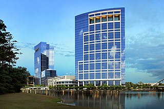
The Woodlands is a special-purpose district and census-designated place (CDP) in the U.S. state of Texas in the Houston–The Woodlands–Sugar Land metropolitan statistical area. The Woodlands is primarily located in Montgomery County, with portions extending into Harris County. The Woodlands is governed by The Woodlands Township, an organization that provides municipal services and is administered by an elected board of directors. As of the 2020 U.S. Census, the township had a population of 114,436 people.

<span class="mw-page-title-main">Willis, Texas</span> City in Texas, United States

Willis is a city in Montgomery County, Texas, United States, located eight miles north of Conroe in north central Montgomery County. The city began to develop in 1870 after what is now the Union Pacific Railroad built track through the area. As a part of the Piney Woods, the Willis economy has historically been driven by lumber, agriculture, and the manufacture of lumber and agriculture equipment. From the late nineteenth to early twentieth century, it produced tobacco as a commodity crop. Competition from Cuba reduced its contribution to the economy.

<span class="mw-page-title-main">Friendswood, Texas</span> City in Texas, United States

Friendswood is a city in the U.S. state of Texas. It is part of the Houston–The Woodlands–Sugar Land metropolitan area. The city lies in Galveston and Harris counties. As of the 2010 census, the population of Friendswood was 35,805.

<span class="mw-page-title-main">Conroe Independent School District</span> School district in Texas

Conroe Independent School District (CISD) is a school district in Montgomery County, Texas. The current superintendent has been Dr. Curtis Null since June of 2018. As of April 2024, Conroe ISD was the 9th largest school district in Texas and 60th largest in the United States.

<span class="mw-page-title-main">Porter, Texas</span> Unincorporated community in Texas, United States

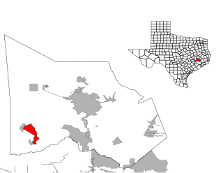
Porter is an unincorporated community in Montgomery County in Southeastern Texas, United States, within the Houston–The Woodlands–Sugar Land metropolitan area. In 2010, its population was estimated at 25,769. Porter is north of the Kingwood area of Houston.

References

  1. 1 2 3 Town of Woodloch Retrieved October 12, 2022.
  2. "2019 U.S. Gazetteer Files". United States Census Bureau. Retrieved August 7, 2020.
  3. 1 2 "Population and Housing Unit Estimates". United States Census Bureau. May 24, 2020. Retrieved May 27, 2020.
  4. "U.S. Census website". United States Census Bureau . Retrieved January 31, 2008.
  5. "US Board on Geographic Names". United States Geological Survey. October 25, 2007. Retrieved January 31, 2008.
  6. "US Gazetteer files: 2010, 2000, and 1990". United States Census Bureau. February 12, 2011. Retrieved April 23, 2011.
  7. 1 2 Who Represents Me: Woodloch. Texas Legislative Council. Accessed on June 21, 2017.
  8. "Census of Population and Housing". Census.gov. Retrieved June 4, 2015.
  9. American Factfinder: Woodloch Town, Texas. 2010 United States Census Bureau. Accessed on June 23, 2017.
  10. Maps and Zones Conroe Independent School District. Accessed on June 23, 2017.
  11. Texas Education Code, Sec. 130.191. LONE STAR COLLEGE SYSTEM DISTRICT SERVICE AREA..
  12. Ellsworth, Meagan. Woodloch homes, water system wrecked by Harvey. The Courier of Montgomery County: September 3, 2017. Accessed November 11, 2017.

Commons-logo.svg Media related to Woodloch, Texas at Wikimedia Commons