
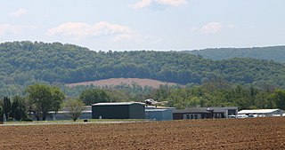
Zelienople is a borough in western Butler County, Pennsylvania, United States, 28 miles (45 km) north of Pittsburgh. The population was 3,812 at the 2010 census. It is part of the Pittsburgh metropolitan area.

Allegheny County Airport is in West Mifflin, Pennsylvania, United States, 7 miles (11 km) southeast of Pittsburgh. It is the fifth-busiest airport in Pennsylvania following Philadelphia, Pittsburgh, Allentown, and Harrisburg. The airport is owned by the Allegheny County Airport Authority and is the primary FAA-designated reliever airport for Pittsburgh International Airport. Allegheny County Airport was dedicated on September 11, 1931.

Mid-Ohio Valley Regional Airport is seven miles northeast of Parkersburg, in Wood County, West Virginia. It is owned by the Wood County Airport Authority and is also known as Wood County Airport or Gill Robb Wilson Field. It serves the Mid-Ohio Valley area which includes the Ohio cities of Marietta and Belpre and the West Virginia cities of Williamstown, Parkersburg and Vienna. It has scheduled passenger service subsidized by the Essential Air Service program.
Venango Regional Airport, also known as Chess Lamberton Field, is a public airport in western Pennsylvania, 2 miles (3 km) southwest of Franklin and about 10 miles (16 km) southwest of Oil City. Both cities are in Venango County, which operates the airport. The airport had limited airline service, which was subsidized by the Essential Air Service program until October 2019.

Williamsport Regional Airport serves Williamsport, Pennsylvania, and the surrounding area with a population of roughly 200,000. The airport processes approximately 40,000 passengers annually and has served north central Pennsylvania since 1929.
DuBois Regional Airport, formerly DuBois–Jefferson County Airport, is in Jefferson County, Pennsylvania, eight miles northwest of DuBois, a city in Clearfield County. The airport is in Washington Township. It is owned and operated by the Clearfield-Jefferson Counties Regional Airport Authority, based at the airport. It has scheduled service on one airline, Southern Airways Express, subsidized by the Essential Air Service program.

Arnold Palmer Regional Airport is in Westmoreland County, Pennsylvania, United States, two miles (3 km) southwest of Latrobe and about 33 miles (53 km) southeast of Pittsburgh. It was formerly Westmoreland County Airport; it was renamed in September 1999 for Arnold Palmer as part of his 70th birthday celebration. Palmer learned to fly at the airport, and the dedication ceremony included Governor Tom Ridge and a flyover of three A-10s of the Pennsylvania Air National Guard.

Greater Pittsburgh is the metropolitan area surrounding the city of Pittsburgh in Western Pennsylvania, United States. The region includes Allegheny County, Pittsburgh's urban core county and economic hub, and seven adjacent Pennsylvania counties: Armstrong, Beaver, Butler, Fayette, Lawrence, Washington, and Westmoreland in Western Pennsylvania, which constitutes the Pittsburgh, PA Metropolitan Statistical Area MSA as defined by the U.S. Census Bureau.

Capital City Airport is a public airport in Fairview Township, York County, Pennsylvania, three miles (5 km) southeast of Harrisburg, the capital of Pennsylvania.

Charlevoix Municipal Airport is a city-owned, public-use airport located one nautical mile (2 km) southwest of the central business district of Charlevoix, a city in Charlevoix County, Michigan, United States. It is mostly used for general aviation, but also offers passenger service to Beaver Island via Island Airways and Fresh Air Aviation.

York Airport (York Aviation) (IATA: THV, ICAO: KTHV, FAA LID: THV) is a privately owned, public use airport that is located seven nautical miles (8 mi, 13 km) southwest of the central business district of York in the Thomasville section of Jackson Township, York County, Pennsylvania, United States.

Washington County Airport is three miles (5 km) southwest of Washington in South Franklin Township, Pennsylvania. It is owned and operated by Washington County and is in the Greater Pittsburgh metropolitan area.

Pennsylvania Route 588 is an east–west state highway in the Western Pennsylvania counties of Beaver and Butler. It travels sixteen miles between PA 51 in Chippewa Township, Beaver County and PA 288 in Zelienople. Other communities through which it passes include the city of Beaver Falls and the borough of Eastvale.

Pennsylvania Route 288 or State Route 288 is an east–west route in western Pennsylvania, United States. The highway is 15.4 miles (24 km) long and runs from PA 18 in Wampum east to the US 19/PA 68 concurrency in Zelienople.

Beaver County Airport or is a county-owned public airport three miles northwest of Beaver Falls, in Beaver County, Pennsylvania.

Murfreesboro Municipal Airport is a city-owned, public-use airport located two nautical miles (3.7 km) north of the central business district of Murfreesboro, a city in Rutherford County, Tennessee, United States. This airport is included in the National Plan of Integrated Airport Systems for 2011–2015, which categorized it as a general aviation airport. Although most U.S. airports use the same three-letter location identifier for the FAA and IATA, this airport is assigned MBT by the FAA, but has no designation from the IATA.
New Castle Municipal Airport is a small municipal airport located in Union Township, Lawrence County, Pennsylvania serving Lawrence County, Pennsylvania, part of the Pittsburgh metropolitan area. Union Township is an outskirt of New Castle, Pennsylvania hence the name. The airport is located four nautical miles northwest of the central business district of New Castle. The airport is a public-owned airport and is controlled by the Lawrence County Airport Authority.
Rogers Executive Airport, also known as Carter Field, is a city-owned public-use airport located two nautical miles (3.7 km) north of the central business district of Rogers, a city in Benton County, Arkansas, United States. This airport is included in the FAA's National Plan of Integrated Airport Systems for 2021–2025, which categorized it as a general aviation facility.
The Greene County Airport is a county-owned, public-use airport in Franklin Township, Greene County, Pennsylvania, United States. It is located two nautical miles (4 km) east of the central business district of Waynesburg, Pennsylvania. This airport was included in the National Plan of Integrated Airport Systems for 2009–2013, which categorized it as a general aviation facility.
Penn Valley Airport is a public airport in Monroe Township, Snyder County, and is a mile north of Selinsgrove, a borough in Snyder County, Pennsylvania. It is owned by the Penn Valley Airport Authority. The National Plan of Integrated Airport Systems for 2011–2015 categorized it as a general aviation facility.


