Kobylniki is a village in the administrative district of Gmina Środa Śląska, within Środa Śląska County, Lower Silesian Voivodeship, in south-western Poland. Prior to 1945 it was in Germany. It lies approximately 11 kilometres (7 mi) north-east of Środa Śląska and 28 km (17 mi) north-west of the regional capital Wrocław.
Kępa-Kolonia is a village in the administrative district of Gmina Borzechów, within Lublin County, Lublin Voivodeship, in eastern Poland.
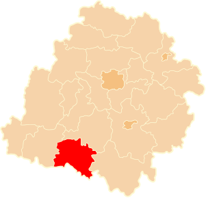
Osieki is a village in the administrative district of Gmina Borzytuchom, within Bytów County, Pomeranian Voivodeship, in northern Poland. It lies approximately 4 kilometres (2 mi) north-east of Borzytuchom, 13 km (8 mi) north-west of Bytów, and 82 km (51 mi) west of the regional capital Gdańsk.
Kolonia Bujnice is a settlement in the administrative district of Gmina Gorzkowice, within Piotrków County, Łódź Voivodeship, in central Poland.
Olewin is a village in the administrative district of Gmina Wieluń, within Wieluń County, Łódź Voivodeship, in central Poland. It lies approximately 5 kilometres (3 mi) east of Wieluń and 84 km (52 mi) south-west of the regional capital Łódź.
Nowe Młyny is a settlement in the administrative district of Gmina Parzęczew, within Zgierz County, Łódź Voivodeship, in central Poland.
Milejów is a village in the administrative district of Gmina Milejów, within Łęczna County, Lublin Voivodeship, in eastern Poland. It lies approximately 9 kilometres (6 mi) south of Łęczna and 25 km (16 mi) east of the regional capital Lublin. The parish church is the Church of Assumption of Blessed Virgin and St Anthony of Padua.
Lipiny is a village in the administrative district of Gmina Chodel, within Opole Lubelskie County, Lublin Voivodeship, in eastern Poland. It lies approximately 4 kilometres (2 mi) north of Chodel, 12 km (7 mi) east of Opole Lubelskie, and 34 km (21 mi) west of the regional capital Lublin.
Słupia is a village in Końskie County, Świętokrzyskie Voivodeship, in south-central Poland. It is the seat of the gmina called Gmina Słupia Konecka. It lies approximately 29 kilometres (18 mi) south-west of Końskie and 37 km (23 mi) north-west of the regional capital Kielce.
Tychów Nowy is a village in the administrative district of Gmina Mirzec, within Starachowice County, Świętokrzyskie Voivodeship, in south-central Poland. It lies approximately 4 kilometres (2 mi) east of Mirzec, 11 km (7 mi) north of Starachowice, and 45 km (28 mi) north-east of the regional capital Kielce.
Wyborów is a village in the administrative district of Gmina Grabów nad Pilicą, within Kozienice County, Masovian Voivodeship, in east-central Poland. It lies approximately 2 kilometres (1 mi) north of Grabów nad Pilicą, 30 km (19 mi) north-west of Kozienice, and 56 km (35 mi) south of Warsaw.
Brzozowo-Maje is a village in the administrative district of Gmina Dzierzgowo, within Mława County, Masovian Voivodeship, in east-central Poland.
Wiktorów is a village in the administrative district of Gmina Radzymin, within Wołomin County, Masovian Voivodeship, in east-central Poland. It lies approximately 4 kilometres (2 mi) east of Radzymin, 8 km (5 mi) north of Wołomin, and 27 km (17 mi) north-east of Warsaw.
Józefów Ochelski is a village in the administrative district of Gmina Pogorzela, within Gostyń County, Greater Poland Voivodeship, in west-central Poland.
Łąkie is a village in the administrative district of Gmina Rakoniewice, within Grodzisk Wielkopolski County, Greater Poland Voivodeship, in west-central Poland. It lies approximately 6 kilometres (4 mi) south-west of Rakoniewice, 18 km (11 mi) south-west of Grodzisk Wielkopolski, and 58 km (36 mi) south-west of the regional capital Poznań.
Kuszyn is a village in the administrative district of Gmina Mycielin, within Kalisz County, Greater Poland Voivodeship, in west-central Poland.
Młynki is a settlement in the administrative district of Gmina Skoki, within Wągrowiec County, Greater Poland Voivodeship, in west-central Poland.
Jaromierz is a village in the administrative district of Gmina Gardeja, within Kwidzyn County, Pomeranian Voivodeship, in northern Poland. It lies approximately 15 kilometres (9 mi) north-east of Gardeja, 17 km (11 mi) south-east of Kwidzyn, and 86 km (53 mi) south-east of the regional capital Gdańsk.
Cyganka is a village in the administrative district of Gmina Nowy Dwór Gdański, within Nowy Dwór Gdański County, Pomeranian Voivodeship, in northern Poland. It lies approximately 2 kilometres (1 mi) north of Nowy Dwór Gdański and 36 km (22 mi) south-east of the regional capital Gdańsk.
Łaszka is a village in the administrative district of Gmina Sztutowo, within Nowy Dwór Gdański County, Pomeranian Voivodeship, in northern Poland. It lies approximately 5 kilometres (3 mi) south-east of Sztutowo, 12 km (7 mi) north-east of Nowy Dwór Gdański, and 40 km (25 mi) east of the regional capital Gdańsk.