Castle Park is a residential area of the town of Caerphilly, south Wales. As the name suggests, it is located near Caerphilly Castle.

The Archdiocese of Warsaw is a Catholic ecclesiastical territory or diocese in Poland encompassing the Polish capital. It was erected on October 16, 1798. It was elevated to an Archdiocese on June 30, 1813.
Koźlice is a village in the administrative district of Gmina Rudna, within Lubin County, Lower Silesian Voivodeship, in south-western Poland. Prior to 1945 it was in Germany.
Kurów is a village in the administrative district of Gmina Wiązów, within Strzelin County, Lower Silesian Voivodeship, in south-western Poland. Prior to 1945 it was in Germany.

Chomiąża is a village in the administrative district of Gmina Malczyce, within Środa Śląska County, Lower Silesian Voivodeship, in south-western Poland. Like most of Silesia, it was first part of Poland, then an independent duchy which was a vassal state of the Kingdom of Bohemia. It became part of the Holy Roman Empire in 1526, then part of Prussia after the Silesian Wars. It remained part of Prussia and later Germany until 1945, when it became part of Poland, which it is still part of today. It was firstr recorded in 1175 as Chomesa, and has since carried the names Chomescha, Kumeise, Kumeyse, Komeise, Cameise, Cames, Camos, Kamos and finally its current name of Chomiaza. It lies approximately 4 kilometres (2 mi) east of Malczyce, 8 kilometres (5 mi) north-west of Środa Śląska, and 37 kilometres (23 mi) west of the regional capital Wrocław.

Mazurowice is a village in the administrative district of Gmina Malczyce, within Środa Śląska County, Lower Silesian Voivodeship, in south-western Poland. Prior to 1945 it was in Germany. It lies approximately 2 kilometres (1 mi) west of Malczyce, 11 km (7 mi) north-west of Środa Śląska, and 42 km (26 mi) west of the regional capital Wrocław.
Dębowiec is a village in the administrative district of Gmina Dąbrowa Chełmińska, within Bydgoszcz County, Kuyavian-Pomeranian Voivodeship, in north-central Poland. It lies approximately 6 kilometres (4 mi) north of Dąbrowa Chełmińska, 24 km (15 mi) north-east of Bydgoszcz, and 31 km (19 mi) north-west of Toruń.
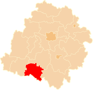
Biskupice is a village in the administrative district of Gmina Iwanowice, within Kraków County, Lesser Poland Voivodeship, in southern Poland.
Zastawie is a village in the administrative district of Gmina Urszulin, within Włodawa County, Lublin Voivodeship, in eastern Poland.
Czarzaste Małe is a village in the administrative district of Gmina Chorzele, within Przasnysz County, Masovian Voivodeship, in east-central Poland.
Janówek Duranowski is a village in the administrative district of Gmina Sochaczew, within Sochaczew County, Masovian Voivodeship, in east-central Poland.
Kościelec is a village in the administrative district of Gmina Mycielin, within Kalisz County, Greater Poland Voivodeship, in west-central Poland. It lies approximately 3 kilometres (2 mi) south of Korzeniew, 20 km (12 mi) north-east of Kalisz, and 104 km (65 mi) south-east of the regional capital Poznań.
Masłowo is a settlement in the administrative district of Gmina Wyrzysk, within Piła County, Greater Poland Voivodeship, in west-central Poland. It lies approximately 7 kilometres (4 mi) north of Wyrzysk, 38 km (24 mi) east of Piła, and 94 km (58 mi) north of the regional capital Poznań.
Koszuty-Huby is a settlement in the administrative district of Gmina Środa Wielkopolska, within Środa Wielkopolska County, Greater Poland Voivodeship, in west-central Poland.
Gapowo is a village in the administrative district of Gmina Stężyca, within Kartuzy County, Pomeranian Voivodeship, in northern Poland. It lies approximately 4 kilometres (2 mi) west of Stężyca, 24 km (15 mi) south-west of Kartuzy, and 51 km (32 mi) west of the regional capital Gdańsk.
Halinowo is a settlement in the administrative district of Gmina Prabuty, within Kwidzyn County, Pomeranian Voivodeship, in northern Poland. It lies approximately 3 kilometres (2 mi) east of Prabuty, 21 km (13 mi) east of Kwidzyn, and 78 km (48 mi) south-east of the regional capital Gdańsk.
Łużki is a settlement in the administrative district of Gmina Kępice, within Słupsk County, Pomeranian Voivodeship, in northern Poland. It lies approximately 3 kilometres (2 mi) south-west of Kępice, 29 km (18 mi) south-west of Słupsk, and 117 km (73 mi) west of the regional capital Gdańsk.
Rakowo Małe is a village in the administrative district of Gmina Biała Piska, within Pisz County, Warmian-Masurian Voivodeship, in northern Poland. It lies approximately 15 kilometres (9 mi) north-east of Biała Piska, 30 km (19 mi) north-east of Pisz, and 113 km (70 mi) east of the regional capital Olsztyn.
Dvory is a village and municipality in Nymburk District in the Central Bohemian Region of the Czech Republic.
Vranishta is a village in Municipality of Struga, Macedonia.