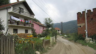
Vásárosnamény is a small town in Szabolcs-Szatmár-Bereg county, in the Northern Great Plain region of eastern Hungary. It also includes Vitka since 1969, and in 1939 Gergelyi and Ugornya formed by uniting Gergelyiugornya.

Stößen is a town in the Burgenlandkreis district, in Saxony-Anhalt, Germany. It is situated southeast of Naumburg. It is part of the Verbandsgemeinde Wethautal.
Zimna Woda is a village in the administrative district of Gmina Lubin, within Lubin County, Lower Silesian Voivodeship, in south-western Poland. Prior to 1945 it was in Germany.

Guzowice is a village in the administrative district of Gmina Cieszków, within Milicz County, Lower Silesian Voivodeship, in south-western Poland. It lies approximately 3 kilometres (2 mi) south-west of Cieszków, 11 kilometres (7 mi) north of Milicz, and 59 kilometres (37 mi) north of the regional capital Wrocław.

Dziewiętlin is a village in the administrative district of Gmina Krośnice, within Milicz County, Lower Silesian Voivodeship, in south-western Poland. Prior to 1945 it was in Germany.
Maly Uzen is a river in Saratov Oblast of Russia and West Kazakhstan Province of Kazakhstan. It is 638 kilometres (396 mi) long, with a drainage basin of 18,250 square kilometres (7,050 sq mi).

Polesie is a village in the administrative district of Gmina Wieruszów, within Wieruszów County, Łódź Voivodeship, in central Poland. It lies approximately 4 kilometres (2 mi) north-east of Wieruszów and 103 km (64 mi) south-west of the regional capital Łódź.

Bedlenko is a village in the administrative district of Gmina Końskie, within Końskie County, Świętokrzyskie Voivodeship, in south-central Poland. It lies approximately 7 kilometres (4 mi) west of Końskie and 41 km (25 mi) north-west of the regional capital Kielce.
Skłody-Stachy is a village in the administrative district of Gmina Zaręby Kościelne, within Ostrów Mazowiecka County, Masovian Voivodeship, in east-central Poland.

Nowe Gralewo is a village in the administrative district of Gmina Raciąż, within Płońsk County, Masovian Voivodeship, in east-central Poland. It lies approximately 8 kilometres (5 mi) south of Raciąż, 21 km (13 mi) north-west of Płońsk, and 82 km (51 mi) north-west of Warsaw.

Stare Gralewo is a village in the administrative district of Gmina Raciąż, within Płońsk County, Masovian Voivodeship, in east-central Poland. It lies approximately 8 kilometres (5 mi) south of Raciąż, 21 km (13 mi) north-west of Płońsk, and 82 km (51 mi) north-west of Warsaw.

Księżpole-Jałmużny is a village in the administrative district of Gmina Mokobody, within Siedlce County, Masovian Voivodeship, in east-central Poland. It lies approximately 21 kilometres (13 mi) north-west of Siedlce and 77 km (48 mi) east of Warsaw.

Hadrianów is a settlement in the administrative district of Gmina Zduny, within Krotoszyn County, Greater Poland Voivodeship, in west-central Poland. It lies approximately 6 kilometres (4 mi) north-west of Zduny, 9 km (6 mi) west of Krotoszyn, and 86 km (53 mi) south of the regional capital Poznań.

Smolniki is a village in the administrative district of Gmina Grabów nad Prosną, within Ostrzeszów County, Greater Poland Voivodeship, in west-central Poland. It lies approximately 3 kilometres (2 mi) south of Grabów nad Prosną, 13 km (8 mi) north-east of Ostrzeszów, and 132 km (82 mi) south-east of the regional capital Poznań.
Łomów is a village in the administrative district of Gmina Zagórów, within Słupca County, Greater Poland Voivodeship, in west-central Poland.

Drzonów is a village in western Poland, in the administrative district of Świdnica, within Zielona Góra County, Lubusz Voivodeship. It lies approximately 8 kilometres (5 mi) north-west of Świdnica and 13 km (8 mi) west of Zielona Góra. The village is home to the Lubusz Military Museum, housing numerous historical tanks, self-propelled anti-tank guns and aeroplanes. Among the historical landmarks of the village are 19th-century church and a palace.

Lo Wu Control Point is a Hong Kong immigration control point in Lo Wu, New Territories. It sits within the Frontier Closed Area that runs along the border with mainland China. Its counterpart across the border is the Luohu Port in Shenzhen, China.

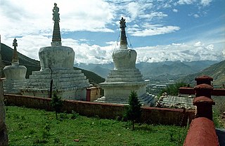
Nyang bran is a suburb district and valley located several kilometres north of the city of Lhasa, Tibet. The valley is noted for its hermitages, belonging to the Sera Monastery, one of the three great historical monasteries of Tibet. Pabonka Hermitage, Drakri Hermitage, Chupzang Nunnery and many others are located in the valley which offers scenic views of Lhasa. Mount Parasol lies on its western side on which the Pabonka Hermitage is located.

Koraćevac is a village in the municipality of Leskovac, Serbia. According to the 2002 census, the village has a population of 192 people.
Wiesa is a district of Kamenz, Saxony. It is located in the southern part of town, south of the town centre, on the Black Elster in the district of Bautzen.


