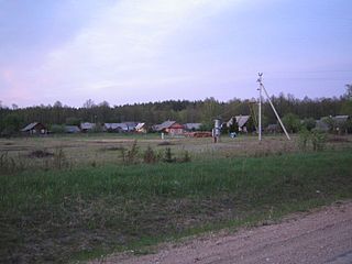
Witków is a village in the administrative district of Gmina Chojnów, within Legnica County, Lower Silesian Voivodeship, in south-western Poland. Prior to 1945 it was in Germany. It lies approximately 7 kilometres (4 mi) north-west of Chojnów, 24 km (15 mi) west of Legnica, and 85 km (53 mi) west of the regional capital Wrocław.

Michałów is a village in the administrative district of Gmina Środa Śląska, within Środa Śląska County, Lower Silesian Voivodeship, in south-western Poland. Prior to 1945 it was in Germany.

Rogoźnica is a village in the administrative district of Gmina Strzegom, within Świdnica County, Lower Silesian Voivodeship, in south-western Poland. Historically, prior to 1945 it was part of Poland, Bohemia, Austria, Prussia and Germany. Rogoźnica lies approximately 7 kilometres (4 mi) north-west of Strzegom, 21 kilometres (13 mi) north-west of Świdnica, and 54 kilometres (34 mi) west of the regional capital Wrocław. The village has a population of 856.
Podborek is the part of Śniadków Górny A village, Gmina Sobienie-Jeziory. From 1975 to 1998 this place was in Siedlce Voivodeship.

Geghadir is a town in the Aragatsotn Province of Armenia.

Tsaghkaber is a town in the Lori Province of Armenia.

Konopnica is a village in Lublin County, Lublin Voivodeship, in eastern Poland. It is the seat of the gmina called Gmina Konopnica. It lies approximately 20 km (12 mi) west of the regional capital Lublin.
Jeżów is a village in the administrative district of Gmina Chodel, within Opole Lubelskie County, Lublin Voivodeship, in eastern Poland.

Studzieniec is a village in the administrative district of Gmina Fałków, within Końskie County, Świętokrzyskie Voivodeship, in south-central Poland. It lies approximately 4 kilometres (2 mi) south of Fałków, 26 km (16 mi) south-west of Końskie, and 45 km (28 mi) north-west of the regional capital Kielce.
Biedrzyce-Koziegłowy is a village in the administrative district of Gmina Sypniewo, within Maków County, Masovian Voivodeship, in east-central Poland.
Wólka Wiśniewska is a village in the administrative district of Gmina Wiśniew, within Siedlce County, Masovian Voivodeship, in east-central Poland.
Drozdów is a village in the administrative district of Gmina Zwoleń, within Zwoleń County, Masovian Voivodeship, in east-central Poland.

Nowa Wieś is a settlement in the administrative district of Gmina Wągrowiec, within Wągrowiec County, Greater Poland Voivodeship, in west-central Poland. It lies approximately 7 kilometres (4 mi) east of Wągrowiec and 50 km (31 mi) north-east of the regional capital Poznań.

Starzyński Dwór is a village in the administrative district of Gmina Puck, within Puck County, Pomeranian Voivodeship, in northern Poland. It lies approximately 10 kilometres (6 mi) north-west of Puck and 49 km (30 mi) north-west of the regional capital Gdańsk.

Goszczyno is a settlement in the administrative district of Gmina Dębnica Kaszubska, within Słupsk County, Pomeranian Voivodeship, in northern Poland. It lies approximately 11 kilometres (7 mi) south-east of Dębnica Kaszubska, 24 km (15 mi) south-east of Słupsk, and 88 km (55 mi) west of the regional capital Gdańsk.

Kašėtos (Marcinkonys) is a village in Varėna district municipality, in Alytus County, in southeastern Lithuania. According to the 2001 census, the village has a population of 24 people.

Velika Sejanica is a village in the municipality of Leskovac, Serbia. According to the 2002 census, the village has a population of 796 people.
Sääsküla is a village in Kose Parish, Harju County in northern Estonia.

Takhemaret is a town and commune in Tiaret Province in north-western Algeria, about 65 km. southwest of the city of Tiaret. The 2008 census population was 34,124 in the commune, with 20,827 in the city.

The Preiļupe is a stream in Latvia (Latgale). It is 19 kilometres (12 mi) long and is a left tributary of the Feimanka River. Its source is Salmejs Lake, from which it flows westward, through the city of Preili, and then into the Feimanka in the area of Škilteri.


