
Nowa Wieś is a village in the administrative district of Gmina Włocławek, within Włocławek County, Kuyavian-Pomeranian Voivodeship, in north-central Poland. It lies approximately 8 kilometres (5 mi) south-west of Włocławek and 56 km (35 mi) south-east of Toruń.
Wójtowskie is a village in the administrative district of Gmina Włocławek, within Włocławek County, Kuyavian-Pomeranian Voivodeship, in north-central Poland. It lies approximately 10 kilometres (6 mi) south-east of Włocławek and 62 km (39 mi) south-east of Toruń.
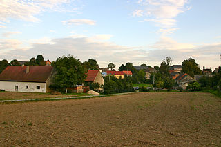
Socha is a village in the administrative district of Gmina Warta, within Sieradz County, Łódź Voivodeship, in central Poland. It lies approximately 6 kilometres (4 mi) north-west of Warta, 20 km (12 mi) north-west of Sieradz, and 61 km (38 mi) west of the regional capital Łódź.
Tomaszów is a village in the administrative district of Gmina Michałów, within Pińczów County, Świętokrzyskie Voivodeship, in south-central Poland. It lies approximately 7 kilometres (4 mi) south-west of Michałów, 14 km (9 mi) south-west of Pińczów, and 50 km (31 mi) south of the regional capital Kielce.
Zadwórze is a village in the administrative district of Gmina Ustrzyki Dolne, within Bieszczady County, Subcarpathian Voivodeship, in south-eastern Poland. It lies approximately 7 kilometres (4 mi) south-east of Ustrzyki Dolne and 87 km (54 mi) south-east of the regional capital Rzeszów.
Podzamcze is a village in the administrative district of Gmina Maciejowice, within Garwolin County, Masovian Voivodeship, in east-central Poland. It lies approximately 4 kilometres (2 mi) north-east of Maciejowice, 23 km (14 mi) south of Garwolin, and 71 km (44 mi) south-east of Warsaw.
Nowa Wieś is a village in the administrative district of Gmina Lipsko, within Lipsko County, Masovian Voivodeship, in east-central Poland.

Osęczyzna is a village in the administrative district of Gmina Dobre, within Mińsk County, Masovian Voivodeship, in east-central Poland. It lies approximately 7 kilometres (4 mi) west of Dobre, 15 km (9 mi) north of Mińsk Mazowiecki, and 42 km (26 mi) east of Warsaw.
Kromnów is a village in the administrative district of Gmina Brochów, within Sochaczew County, Masovian Voivodeship, in east-central Poland. It lies approximately 8 kilometres (5 mi) north-east of Brochów, 18 km (11 mi) north of Sochaczew, and 49 km (30 mi) west of Warsaw.

Çilov is a village on Chilov Island in the municipality of Çilov-Neft Daşları in the Əzizbəyov raion of Baku, Azerbaijan. The village name was changed from Jiloy to Çilov on 5 October 1999.
Żółków is a village in the administrative district of Gmina Żerków, within Jarocin County, Greater Poland Voivodeship, in west-central Poland. It lies approximately 2 kilometres (1 mi) east of Żerków, 13 km (8 mi) north-east of Jarocin, and 60 km (37 mi) south-east of the regional capital Poznań.
Wielatowo is a village in the administrative district of Gmina Złotów, within Złotów County, Greater Poland Voivodeship, in west-central Poland. It lies approximately 3 kilometres (2 mi) north-west of Złotów and 109 km (68 mi) north of the regional capital Poznań.
Czyżowice is a village in the administrative district of Gmina Prudnik, within Prudnik County, Opole Voivodeship, in south-western Poland, close to the Czech border. It lies approximately 5 kilometres (3 mi) north of Prudnik and 42 km (26 mi) south-west of the regional capital Opole.

Kolnowice is a village in the administrative district of Gmina Biała, within Prudnik County, Opole Voivodeship, in south-western Poland. It lies approximately 6 kilometres (4 mi) west of Biała Prudnicka, 9 km (6 mi) north of Prudnik, and 39 km (24 mi) south-west of the regional capital Opole.
Drwęca is a village in the administrative district of Gmina Lidzbark Warmiński, within Lidzbark County, Warmian-Masurian Voivodeship, in northern Poland.
Radysy is a village in the administrative district of Gmina Biała Piska, within Pisz County, Warmian-Masurian Voivodeship, in northern Poland. It lies approximately 4 kilometres (2 mi) south-west of Biała Piska, 16 km (10 mi) east of Pisz, and 104 km (65 mi) east of the regional capital Olsztyn.
Olchowiec is a village in the administrative district of Gmina Drawsko Pomorskie, within Drawsko County, West Pomeranian Voivodeship, in north-western Poland. It lies approximately 7 kilometres (4 mi) north of Drawsko Pomorskie and 83 km (52 mi) east of the regional capital Szczecin.
Mężytki is a settlement in the administrative district of Gmina Stargard, within Stargard County, West Pomeranian Voivodeship, in north-western Poland.

The Nura River is a major watercourse of northeast-central Kazakhstan. It is about 978 kilometres (608 mi) long and drains an area of 58,100 square kilometres (22,400 sq mi).


