Chroberz is a village in Poland with 964 inhabitants (2005). It is situated in Świętokrzyskie Voivodeship, Pińczów County, Gmina Złota. In the years of 1975–1998 Chroberz administratively belonged to Kielce Voivodeship. It lies approximately 7 kilometres (4 mi) north of Złota, 12 km (7 mi) south of Pińczów, and 51 km (32 mi) south of the regional capital Kielce.

Kozubów Landscape Park is a protected area in south-central Poland, covering an area of 66.13 square kilometres (25.53 sq mi).

Młodzawy Duże is a village in the administrative district of Gmina Pińczów, within Pińczów County, Świętokrzyskie Voivodeship, in south-central Poland. It lies approximately 8 kilometres (5 mi) south of Pińczów and 47 km (29 mi) south of the regional capital Kielce.
Młodzawy Małe is a village in the administrative district of Gmina Pińczów, within Pińczów County, Świętokrzyskie Voivodeship, in south-central Poland. It lies approximately 9 kilometres (6 mi) south of Pińczów and 49 km (30 mi) south of the regional capital Kielce.
Mozgawa is a village in the administrative district of Gmina Pińczów, within Pińczów County, Świętokrzyskie Voivodeship, in south-central Poland. It lies approximately 12 kilometres (7 mi) south of Pińczów and 51 km (32 mi) south of the regional capital Kielce.
Umianowice is a village in the administrative district of Gmina Kije, within Pińczów County, Świętokrzyskie Voivodeship, in south-central Poland. It lies approximately 6 kilometres (4 mi) south-west of Kije, 4 km (2 mi) north of Pińczów, and 36 km (22 mi) south of the regional capital Kielce.
Wrocieryż is a village in the administrative district of Gmina Michałów, within Pińczów County, Świętokrzyskie Voivodeship, in south-central Poland. It lies approximately 6 kilometres (4 mi) west of Michałów, 12 km (7 mi) west of Pińczów, and 46 km (29 mi) south of the regional capital Kielce.
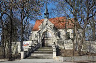
Złota is a village in Pińczów County, Świętokrzyskie Voivodeship, in south-central Poland. It is the seat of the gmina called Gmina Złota. It lies approximately 18 kilometres (11 mi) south of Pińczów and 56 km (35 mi) south of the regional capital Kielce.
Biskupice is a village in the administrative district of Gmina Złota, within Pińczów County, Świętokrzyskie Voivodeship, in south-central Poland. It lies approximately 3 kilometres (2 mi) east of Złota, 19 km (12 mi) south of Pińczów, and 57 km (35 mi) south of the regional capital Kielce.
Kostrzeszyn is a village in the administrative district of Gmina Złota, within Pińczów County, Świętokrzyskie Voivodeship, in south-central Poland. It lies approximately 5 kilometres (3 mi) west of Złota, 19 km (12 mi) south of Pińczów, and 58 km (36 mi) south of the regional capital Kielce.
Miernów is a village in the administrative district of Gmina Złota, within Pińczów County, Świętokrzyskie Voivodeship, in south-central Poland. It lies approximately 5 kilometres (3 mi) south of Złota, 22 km (14 mi) south of Pińczów, and 61 km (38 mi) south of the regional capital Kielce.
Niegosławice is a village in the administrative district of Gmina Złota, within Pińczów County, Świętokrzyskie Voivodeship, in south-central Poland. It lies approximately 2 kilometres (1 mi) north of Złota, 17 km (11 mi) south of Pińczów, and 55 km (34 mi) south of the regional capital Kielce.
Nieprowice is a village in the administrative district of Gmina Złota, within Pińczów County, Świętokrzyskie Voivodeship, in south-central Poland. It lies approximately 3 kilometres (2 mi) north of Złota, 15 km (9 mi) south of Pińczów, and 54 km (34 mi) south of the regional capital Kielce.
Odrzywół is a hamlet in the administrative district of Gmina Złota, within Pińczów County, Świętokrzyskie Voivodeship, in south-central Poland. It lies approximately 5 kilometres (3 mi) west of Złota, 17 km (11 mi) south of Pińczów, and 56 km (35 mi) south of the regional capital Kielce.
Pełczyska is a village in the administrative district of Gmina Złota, within Pińczów County, Świętokrzyskie Voivodeship, in south-central Poland. It lies approximately 3 kilometres (2 mi) south-west of Złota, 20 km (12 mi) south of Pińczów, and 59 km (37 mi) south of the regional capital Kielce.
Probołowice is a village in the administrative district of Gmina Złota, within Pińczów County, Świętokrzyskie Voivodeship, in south-central Poland. It lies approximately 5 kilometres (3 mi) south-west of Złota, 21 km (13 mi) south of Pińczów, and 60 km (37 mi) south of the regional capital Kielce.
Rudawa is a village in the administrative district of Gmina Złota, within Pińczów County, Świętokrzyskie Voivodeship, in south-central Poland. It lies approximately 4 kilometres (2 mi) north-west of Złota, 15 km (9 mi) south of Pińczów, and 54 km (34 mi) south of the regional capital Kielce.
Stawiszyce is a village in the administrative district of Gmina Złota, within Pińczów County, Świętokrzyskie Voivodeship, in south-central Poland. It lies approximately 6 kilometres (4 mi) south of Złota, 23 km (14 mi) south of Pińczów, and 62 km (39 mi) south of the regional capital Kielce.
Wojsławice is a village in the administrative district of Gmina Złota, within Pińczów County, Świętokrzyskie Voivodeship, in south-central Poland. It lies approximately 7 kilometres (4 mi) north-west of Złota, 12 km (7 mi) south of Pińczów, and 51 km (32 mi) south of the regional capital Kielce.
Żurawniki is a village in the administrative district of Gmina Złota, within Pińczów County, Świętokrzyskie Voivodeship, in south-central Poland. It lies approximately 3 kilometres (2 mi) east of Złota, 19 km (12 mi) south of Pińczów, and 56 km (35 mi) south of the regional capital Kielce.


