Bojmie is a village in the administrative district of Gmina Kotuń, within Siedlce County, Masovian Voivodeship, in east-central Poland. It lies approximately 8 kilometres (5 mi) west of Kotuń, 22 km (14 mi) west of Siedlce, and 66 km (41 mi) east of Warsaw.

Broszków is a village in the administrative district of Gmina Kotuń, within Siedlce County, Masovian Voivodeship, in east-central Poland. It lies approximately 4 kilometres (2 mi) north-east of Kotuń, 12 km (7 mi) west of Siedlce, and 77 km (48 mi) east of Warsaw.

Gręzów is a village in the administrative district of Gmina Kotuń, within Siedlce County, Masovian Voivodeship, in east-central Poland. It lies approximately 5 kilometres (3 mi) east of Kotuń, 10 km (6 mi) west of Siedlce, and 78 km (48 mi) east of Warsaw.

Jagodne is a village in the administrative district of Gmina Kotuń, within Siedlce County, Masovian Voivodeship, in east-central Poland. It lies approximately 7 kilometres (4 mi) west of Kotuń, 21 km (13 mi) west of Siedlce, and 68 km (42 mi) east of Warsaw.
Koszewnica is a village in the administrative district of Gmina Kotuń, within Siedlce County, Masovian Voivodeship, in east-central Poland. It lies approximately 7 kilometres (4 mi) west of Kotuń, 20 km (12 mi) west of Siedlce, and 68 km (42 mi) east of Warsaw.
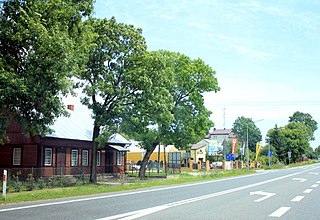
Kotuń is a village in Siedlce County, Masovian Voivodeship, in east-central Poland. It is the seat of the gmina called Gmina Kotuń. It lies approximately 14 kilometres (9 mi) west of Siedlce and 74 km (46 mi) east of Warsaw. The village has a population of 2220.
Łączka is a village in the administrative district of Gmina Kotuń, within Siedlce County, Masovian Voivodeship, in east-central Poland. It lies approximately 9 kilometres (6 mi) west of Kotuń, 23 km (14 mi) west of Siedlce, and 66 km (41 mi) east of Warsaw.
Łęki is a village in the administrative district of Gmina Kotuń, within Siedlce County, Masovian Voivodeship, in east-central Poland. It lies approximately 10 kilometres (6 mi) south-west of Kotuń, 22 km (14 mi) west of Siedlce, and 67 km (42 mi) east of Warsaw.

Mingosy is a village in the administrative district of Gmina Kotuń, within Siedlce County, Masovian Voivodeship, in east-central Poland. It lies approximately 4 kilometres (2 mi) west of Kotuń, 18 km (11 mi) west of Siedlce, and 70 km (43 mi) east of Warsaw.
Niechnabrz is a village in the administrative district of Gmina Kotuń, within Siedlce County, Masovian Voivodeship, in east-central Poland. It lies approximately 5 kilometres (3 mi) west of Kotuń, 19 km (12 mi) west of Siedlce, and 69 km (43 mi) east of Warsaw.
Oleksin is a village in the administrative district of Gmina Kotuń, within Siedlce County, Masovian Voivodeship, in east-central Poland. It lies approximately 9 kilometres (6 mi) west of Kotuń, 23 km (14 mi) west of Siedlce, and 65 km (40 mi) east of Warsaw.
Rososz is a village in the administrative district of Gmina Kotuń, within Siedlce County, Masovian Voivodeship, in east-central Poland. It lies approximately 6 kilometres (4 mi) south-west of Kotuń, 19 km (12 mi) west of Siedlce, and 69 km (43 mi) east of Warsaw.
Ryczyca is a village in the administrative district of Gmina Kotuń, within Siedlce County, Masovian Voivodeship, in east-central Poland. It lies approximately 11 kilometres (7 mi) west of Kotuń, 25 km (16 mi) west of Siedlce, and 63 km (39 mi) east of Warsaw.
Sionna is a village in the administrative district of Gmina Kotuń, within Siedlce County, Masovian Voivodeship, in east-central Poland. It lies approximately 5 kilometres (3 mi) north-west of Kotuń, 18 km (11 mi) west of Siedlce, and 70 km (43 mi) east of Warsaw.
Sosnowe is a village in the administrative district of Gmina Kotuń, within Siedlce County, Masovian Voivodeship, in east-central Poland. It lies approximately 9 kilometres (6 mi) west of Kotuń, 23 km (14 mi) west of Siedlce, and 66 km (41 mi) east of Warsaw.
Trzemuszka is a village in the administrative district of Gmina Kotuń, within Siedlce County, Masovian Voivodeship, in east-central Poland. It lies approximately 5 kilometres (3 mi) south-west of Kotuń, 18 km (11 mi) west of Siedlce, and 70 km (43 mi) east of Warsaw.
Wilczonek is a village in the administrative district of Gmina Kotuń, within Siedlce County, Masovian Voivodeship, in east-central Poland. It lies approximately 4 kilometres (2 mi) west of Kotuń, 18 km (11 mi) west of Siedlce, and 70 km (43 mi) east of Warsaw.
Żeliszew Duży is a village in the administrative district of Gmina Kotuń, within Siedlce County, Masovian Voivodeship, in east-central Poland. It lies approximately 8 kilometres (5 mi) south-west of Kotuń, 20 km (12 mi) west of Siedlce, and 68 km (42 mi) east of Warsaw.

Polaki is a village in the administrative district of Gmina Kotuń, within Siedlce County, Masovian Voivodeship, in east-central Poland. It lies approximately 3 kilometres (2 mi) north of Kotuń, 15 km (9 mi) west of Siedlce, and 73 km (45 mi) east of Warsaw.


