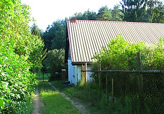
Karaś is a village in the administrative district of Gmina Zbiczno, within Brodnica County, Kuyavian-Pomeranian Voivodeship, in north-central Poland. It lies 3 kilometres (2 mi) north of Zbiczno, 12 km (7 mi) north of Brodnica, and 63 km (39 mi) north-east of Toruń.

Wyszel is a village in the administrative district of Gmina Olszewo-Borki, within Ostrołęka County, Masovian Voivodeship, in east-central Poland. It lies approximately 16 kilometres (10 mi) north-west of Ostrołęka and 107 km (66 mi) north of Warsaw.
Żebry-Chudek is a village in the administrative district of Gmina Olszewo-Borki, within Ostrołęka County, Masovian Voivodeship, in east-central Poland. It lies approximately 9 kilometres (6 mi) west of Ostrołęka and 99 km (62 mi) north of Warsaw.
Budne is a village in the administrative district of Gmina Troszyn, within Ostrołęka County, Masovian Voivodeship, in east-central Poland. It lies approximately 8 kilometres (5 mi) north-east of Troszyn, 17 km (11 mi) east of Ostrołęka, and 111 km (69 mi) north-east of Warsaw.
Choromany is a village in the administrative district of Gmina Troszyn, within Ostrołęka County, Masovian Voivodeship, in east-central Poland. It lies approximately 3 kilometres (2 mi) east of Troszyn, 15 km (9 mi) east of Ostrołęka, and 105 km (65 mi) north-east of Warsaw.
Chrostowo is a village in the administrative district of Gmina Troszyn, within Ostrołęka County, Masovian Voivodeship, in east-central Poland. It lies approximately 4 kilometres (2 mi) south-east of Troszyn, 16 km (10 mi) south-east of Ostrołęka, and 102 km (63 mi) north-east of Warsaw.
Chrzczony is a village in the administrative district of Gmina Troszyn, within Ostrołęka County, Masovian Voivodeship, in east-central Poland. It lies approximately 2 kilometres (1 mi) south-east of Troszyn, 14 km (9 mi) south-east of Ostrołęka, and 103 km (64 mi) north-east of Warsaw.
Dąbek is a village in the administrative district of Gmina Troszyn, within Ostrołęka County, Masovian Voivodeship, in east-central Poland. It lies approximately 3 kilometres (2 mi) east of Troszyn, 15 km (9 mi) east of Ostrołęka, and 105 km (65 mi) north-east of Warsaw.
Dzbenin is a village in the administrative district of Gmina Troszyn, within Ostrołęka County, Masovian Voivodeship, in east-central Poland. It lies approximately 5 kilometres (3 mi) north-east of Troszyn, 14 km (9 mi) east of Ostrołęka, and 109 km (68 mi) north-east of Warsaw.
Grucele is a village in the administrative district of Gmina Troszyn, within Ostrołęka County, Masovian Voivodeship, in east-central Poland. It lies approximately 3 kilometres (2 mi) north-west of Troszyn, 11 km (7 mi) east of Ostrołęka, and 105 km (65 mi) north-east of Warsaw.
Kurpie Dworskie is a village in the administrative district of Gmina Troszyn, within Ostrołęka County, Masovian Voivodeship, in east-central Poland. It lies approximately 3 kilometres (2 mi) north-east of Troszyn, 13 km (8 mi) east of Ostrołęka, and 106 km (66 mi) north-east of Warsaw.
Łątczyn Włościański is a village in the administrative district of Gmina Troszyn, within Ostrołęka County, Masovian Voivodeship, in east-central Poland. It lies approximately 9 kilometres (6 mi) north-east of Troszyn, 17 km (11 mi) east of Ostrołęka, and 112 km (70 mi) north-east of Warsaw.
Mieczki-Poziemaki is a village in the administrative district of Gmina Troszyn, within Ostrołęka County, Masovian Voivodeship, in east-central Poland. It lies approximately 9 kilometres (6 mi) east of Troszyn, 21 km (13 mi) east of Ostrołęka, and 107 km (66 mi) north-east of Warsaw.
Milewo-Łosie is a village in the administrative district of Gmina Troszyn, within Ostrołęka County, Masovian Voivodeship, in east-central Poland. It lies approximately 7 kilometres (4 mi) east of Troszyn, 19 km (12 mi) east of Ostrołęka, and 106 km (66 mi) north-east of Warsaw.
Puchały is a village in the administrative district of Gmina Troszyn, within Ostrołęka County, Masovian Voivodeship, in east-central Poland. It lies approximately 5 kilometres (3 mi) north of Troszyn, 13 km (8 mi) east of Ostrołęka, and 108 km (67 mi) north-east of Warsaw.
Radgoszcz is a village in the administrative district of Gmina Troszyn, within Ostrołęka County, Masovian Voivodeship, in east-central Poland. It lies approximately 12 kilometres (7 mi) east of Troszyn, 23 km (14 mi) east of Ostrołęka, and 112 km (70 mi) north-east of Warsaw.
Trzaski is a village in the administrative district of Gmina Troszyn, within Ostrołęka County, Masovian Voivodeship, in east-central Poland. It lies approximately 9 kilometres (6 mi) north-east of Troszyn, 19 km (12 mi) east of Ostrołęka, and 111 km (69 mi) north-east of Warsaw.
Wysocarz is a village in the administrative district of Gmina Troszyn, within Ostrołęka County, Masovian Voivodeship, in east-central Poland. It lies approximately 5 kilometres (3 mi) south-east of Troszyn, 17 km (11 mi) south-east of Ostrołęka, and 103 km (64 mi) north-east of Warsaw.
Zamość is a village in the administrative district of Gmina Troszyn, within Ostrołęka County, Masovian Voivodeship, in east-central Poland. It lies approximately 4 kilometres (2 mi) west of Troszyn, 9 km (6 mi) south-east of Ostrołęka, and 102 km (63 mi) north-east of Warsaw.
Owsne Ostrowy is a village in the administrative district of Gmina Lipnica, within Bytów County, Pomeranian Voivodeship, in northern Poland. It lies approximately 7 kilometres (4 mi) south of Lipnica, 23 km (14 mi) south of Bytów, and 95 km (59 mi) south-west of the regional capital Gdańsk.


