Related Research Articles

Queens County is located in central New Brunswick, Canada. The county shire town is the village of Gagetown.

Victoria County is located in northwestern New Brunswick, Canada. Farming, especially of potatoes, is the major industry in the county.

York County is located in west-central New Brunswick, Canada. The county contains the provincial capital, Fredericton. Outside the city, farming and forestry are two major industries in the county, which is bisected by the Saint John River. The Southwest Miramichi River flows through the northern section of the county.
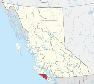
The Alberni–Clayoquot Regional District of British Columbia is located on west central Vancouver Island. Adjacent regional districts it shares borders with are the Strathcona and Comox Valley Regional Districts to the north, and the Nanaimo and Cowichan Valley Regional Districts to the east. The regional district offices are located in Port Alberni.

Cache Creek is a historic transportation junction and incorporated village 354 kilometres (220 mi) northeast of Vancouver in British Columbia, Canada. It is on the Trans-Canada Highway in the province of British Columbia at a junction with Highway 97. The same intersection and the town that grew around it was at the point on the Cariboo Wagon Road where a branch road, and previously only a trail, led east to Savona's Ferry on Kamloops Lake. This community is also the point at which a small stream, once known as Riviere de la Cache, joins the Bonaparte River.
Cameron Bar Indian Reserve No. 13, referred to as Cameron Bar 13 for census purposes, is an Indian reserve in the Fraser Canyon region of the Canadian province of British Columbia. As of 2001, the population was 0. The area of the reserve was .35 square kilometres. It is under the administration of the Lytton First Nation based in nearby Lytton, 15 miles to the south, which is a band government of the Nlaka'pamux people.

Division No. 6 is a census division in Alberta, Canada. It includes the City of Calgary and surrounding areas. The majority of the division consists of Alberta's Calgary Region, while the northern portion of the division is includes central Alberta. The division also forms the southern segment of the Calgary–Edmonton Corridor. Division No. 6 is the largest census division in Alberta according to population and also has the highest population density.

Assiniboia is a town in the Canadian province of Saskatchewan. It is located 110 km (68 mi) south-southwest of Moose Jaw beside Highway 2 and Highway 13.
Birch Hills is a town located in Saskatchewan, Canada. It is located southeast of Prince Albert and the reserve of Muskoday First Nation. Directly to the west is the village of St. Louis, and to the east is Kinistino. It is surrounded by, but not part of, Birch Hills Rural Municipality No. 460.

Elgin is a rural municipality in Quebec, Canada. The population as of the Canada 2016 Census was 394. It is located southwest of Huntingdon and bounded by the Trout and Chateauguay rivers and the Canada–United States border.
Balcarres ; 2006 population 598) is a town located in southern Saskatchewan, Canada along Highway 10 and Highway 22, approximately 85 km northeast of Regina. Highway 619 and Highway 310 are nearby highways to this community.
The Squamish Nation, Sḵwx̱wú7mesh Úxwumixw in Sḵwx̱wú7mesh Sníchim, is an Indian Act government originally imposed on the Squamish (Sḵwx̱wú7mesh) by the Federal Government of Canada in the late 19th century. The Squamish are Indigenous to British Columbia, Canada. Their band government comprises 16 elected councillors, serving four-year terms, with an elected band manager. Their main reserves are near the town of Squamish, British Columbia and around the mouths of the Capilano River, Mosquito Creek, and Seymour River on the north shore of Burrard Inlet in North Vancouver, British Columbia.
The Upper Similkameen Indian Band or Upper Smelqmix, is a First Nations band government in the Canadian province of British Columbia, whose head offices are located in town of Hedley in the Similkameen Country. They are a member of the Okanagan Nation Alliance.
The Ashcroft First Nation is a First Nations government Thompson Canyon area of the Central Interior of the Canadian province of British Columbia. Its Indian Reserves are located near the town of Ashcroft, British Columbia, it is a member of the Nlaka'pamux Nation Tribal Council.
The Lytton First Nation, a First Nations band government, has its headquarters at Lytton in the Fraser Canyon region of the Canadian province of British Columbia. While it is the largest of all Nlaka'pamux bands, unlike all other governments of the Nlaka'pamux (Thompson) people, it is not a member of any of the three Nlaka'pamux tribal councils, which are the Nicola Tribal Association, the Fraser Canyon Indian Administration and the Nlaka'pamux Nation Tribal Council.

The Seton Lake First Nation, a.k.a. the Seton Lake Indian Band, is a First Nations government located in the Central Interior-Fraser Canyon region of the Canadian province of British Columbia. It is a member of the Lillooet Tribal Council, which is the largest grouping of band governments of the St'at'imc people. Other St'at'imc governments include the smaller In-SHUCK-ch Nation on the lower Lillooet River to the southwest, and the independent N'quatqua First Nation at the farther end of Anderson Lake from Seton Portage, which is the location of three of the band's reserve communities.

The Lil'wat First Nation, a.k.a. the Lil'wat Nation or the Mount Currie Indian Band, is a First Nation band government located in the southern Coast Mountains region of the Interior of the Canadian province of British Columbia. It is a member of the Lillooet Tribal Council, which is the largest grouping of band governments of the St'at'imc or Stl'atl'imx people. Other St'at'imc governments include the smaller In-SHUCK-ch Nation on the lower Lillooet River to the southwest, and the independent N'quatqua First Nation at the near end of Anderson Lake from Mount Currie, which is the main reserve of the Lil'wat First Nation, and also one of the largest Indian reserves by population in Canada.
Kinistino is a town in Saskatchewan, Canada. Kinistino is situated in north-central Saskatchewan. It lies on rich agricultural soil in the valley of the Carrot River, which flows a mile east of the town. Kinistino is located 30 km (19 mi) northwest of Melfort on Highway 3 and 65 km (40 mi) southeast of Prince Albert.
The Leqʼ a꞉ mel First Nation, formerly known as Lakahahmen First Nation, is a First Nations band government whose community and offices are located in the area near Deroche, British Columbia in the Fraser Valley region in Canada, about 12 kilometres east of the District of Mission. They are a member government of the Sto:lo Nation Chiefs Council, which is one of two tribal councils of the Sto:lo.

The Buffalo River Dene Nation is a Dene First Nations band government in Saskatchewan, Canada. The band's main community, Dillon, is located on the western shore of Peter Pond Lake at the mouth of the Dillon River, and is accessed by Highway 925 from Highway 155.
References
- ↑ "2021 Community Profiles". 2021 Canadian Census . Statistics Canada. February 4, 2022. Retrieved 2022-04-27.
- ↑ "2006 Community Profiles". 2006 Canadian Census . Statistics Canada. August 20, 2019.
- ↑ "2001 Community Profiles". 2001 Canadian Census . Statistics Canada. July 18, 2021.
Coordinates: 50°44′00″N121°19′00″W / 50.73333°N 121.31667°W
| | This article about a location in the Cariboo Regional District, Canada is a stub. You can help Wikipedia by expanding it. |
| | This article about an Indian reserve in British Columbia is a stub. You can help Wikipedia by expanding it. |