100 Mile House is a district municipality located in the South Cariboo region of central British Columbia, Canada.
South Cariboo Regional Airport or 108 Mile Ranch Airport is a registered aerodrome located 5.3 nautical miles northwest of 108 Mile Ranch, British Columbia, Canada.
Whistler is a resort municipality in Squamish-Lillooet Regional District, British Columbia, Canada. It is located in the southern Pacific Ranges of the Coast Mountains, approximately 125 km (78 mi) north of Vancouver and 36 km (22 mi) south of Pemberton. It has a permanent population of approximately 13,982 (2021), as well as a larger but rotating population of seasonal workers.

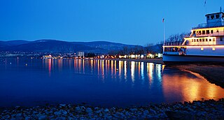
Penticton is a city in the Okanagan Valley of the Southern Interior of British Columbia, Canada, situated between Okanagan and Skaha lakes. In the 2016 Canadian Census, its population was 33,761, while its census agglomeration population was 43,432.
Highway 97 is a major highway in the Canadian province of British Columbia. It is the longest continuously numbered route in the province, running 2,081 km (1,293 mi) and is the only route that runs the entire north–south length of the British Columbia, connecting the Canada–United States border near Osoyoos in the south to the British Columbia–Yukon boundary in the north at Watson Lake, Yukon.

Williams Lake is a city in the Central Interior of British Columbia, in the central part of a region known as the Cariboo. Williams Lake is one of the largest cites, by population of metropolitan area, in the Cariboo after neighbouring Quesnel. The city is famous for the Williams Lake Stampede, which was once the second largest professional rodeo in Canada, after only the Calgary Stampede.

Prince George Airport is an airport that serves Prince George, British Columbia, Canada, and the surrounding area. It is located just within the southern boundary of the city, 2.8 nautical miles southeast, and is run by the Prince George Airport Authority.

Watson Lake Airport is located 5 nautical miles west of Watson Lake, Yukon, Canada, and is operated by the Yukon government. The paved asphalt runway is 5,500 ft (1,676 m) long and is at an elevation of 2,255 ft (687 m).

Northern Rockies Regional Airport is located 3.8 nautical miles east northeast of Fort Nelson, British Columbia, Canada.
Green Lake Aerodrome is located 0.5 nautical miles east of Green Lake east of 70 Mile House in the Cariboo region of British Columbia, Canada. It is a private airport operated by the Flying U Guest Ranch.
Green Lake Water Aerodrome is located on Green Lake east of 70 Mile House in the Cariboo region of British Columbia, Canada. It is a private airport operated by the Flying U Guest Ranch.
North Battleford/Hamlin Airport(TC LID: CJD4) was located 1 nautical mile north-east of Hamlin, Saskatchewan, Canada, in the RM of North Battleford No. 437.

Smithers Airport is 2 nautical miles north of Smithers, British Columbia, Canada.

Northwest Regional Airport Terrace-Kitimat is located 3 nautical miles south of Terrace, British Columbia, Canada. The airport also serves Kitimat, 56 km (35 mi) to the south, and the Nass Valley. It is owned and operated by the Terrace-Kitimat Airport Society.

Williams Lake Airport or Williams Lake Regional Airport is located 4.2 nautical miles northeast of Williams Lake, British Columbia, Canada.

Houston is a forestry, mining and tourism town in the Bulkley Valley of the Northern Interior of British Columbia, Canada. Its population as of 2021 was 3,052, with approximately 2,000 in the surrounding rural area. It is known as the "steelhead capital" and it has the world's largest fly fishing rod. Houston's tourism industry is largely based on ecotourism and Steelhead Park, situated along Highway 16. Houston is named in honour of the pioneer newspaperman John Houston.

Clinton is a village in British Columbia, Canada, located approximately 40 km (25 mi) northwest of Cache Creek and 30 km south of 70 Mile House.
Wilkie is a town in the Canadian province of Saskatchewan, located at Section 5, Township 40, Range 19, west of the 3rd Meridian. The town is at the junctions of Highways 14, 29, and 784.

Del Bonita is a hamlet in southern Alberta, Canada within Cardston County. It is located approximately 49 km (30 mi) south of Magrath at the junction of Highway 62 and Highway 501. Due to its location near the Canada–United States border, it serves as a port of entry into the U.S. state of Montana at the nearby Del Bonita Border Crossing which is located 3 km (1.9 mi) to the south. Del Bonita is a name derived from Spanish meaning "of the pretty".
Lac La Hache is a recreational and retirement community in the Cariboo region of British Columbia, Canada. Located on the shore of Lac La Hache alongside British Columbia Highway 97 near the regional centre of 100 Mile House, the community's origins date to the days of the Cariboo Gold Rush and the Cariboo Wagon Road, for which it provided an important roadhouse. Lac La Hache, or "The Lake of the Axe" as it translates to, was named, during the fur trade era, after the unfortunate incident of a French-Canadian voyageur who lost his axe head while chopping a hole in the ice. It is a town rich in history, as it sits along the Gold Rush Trail.


