Related Research Articles
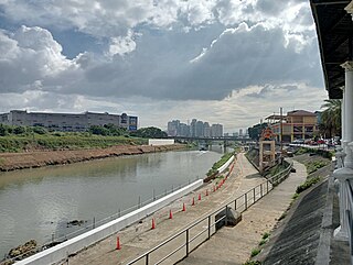
The Marikina River is a waterway in eastern Metro Manila, Philippines. It is the largest tributary of the Pasig River, with headwaters in the Sierra Madre Mountains in what was known as Montalban, presently the municipality of Rodriguez, Rizal.

Typhoon Ketsana, known in the Philippines as Tropical Storm Ondoy, was the second-most devastating tropical cyclone of the 2009 Pacific typhoon season, causing $1.15 billion in damages and 665 fatalities, only behind Morakot earlier in the season, which caused 956 deaths and damages worth $6.2 billion. Ketsana was the sixteenth tropical storm, and the eighth typhoon of the season. It was the most devastating tropical cyclone to hit Manila, surpassing Typhoon Patsy (Yoling) in 1970.
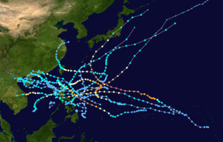
The effects of the 2009 Pacific typhoon season in the Philippines were considered some of the worst in decades. Throughout the year, series of typhoons impacted the country, with the worst damage occurring during September and October from Typhoons Ketsana (Ondoy) and Parma (Pepeng).

Metro Pacific Investments Corporation (MPIC) is a Philippine unit investment holding company of First Pacific Company Limited through Metro Pacific Holdings, Inc. MPIC through its subsidiaries, provides water, sanitation, and sewerage services and also operates in real estate, and infrastructure projects. It also invests in some hospitals in the Philippines.

Riverbanks Center is an integrated development complex for shopping, recreational, business and commercial along Andres Bonifacio Avenue adjacent to Marikina River in Barangka, Marikina, Metro Manila, Philippines. It is home of the Philippine's biggest outdoor amphitheater and outlet center, and the location of once the world's largest pair of shoes.
Widespread flooding occurred in the eastern part of the Philippines since late December 2010. The Visayas and the Bicol and Caraga regions have been particularly affected by abnormally heavy rains. The floods have displaced 452,999 persons in 19 provinces, and has caused the deaths of 25 people. By 12 January, the National Disaster Risk Reduction and Management Council (NDRRMC) pegged those affected at 235,867 families or 1,230,022 people in 1,267 villages in 137 towns and 10 cities in 23 provinces.

Typhoon Haikui was the third tropical cyclone in the span of a week to impact Mainland China during late July and early August 2012. The name Haikui, which replaces Longwang, means sea anemone in Chinese.
The 2012 Luzon southwest monsoon floods, was an eight-day period of torrential rain and thunderstorms in Luzon in the Philippines from August 1 to August 8, 2012. Its effects centered on Metro Manila, the surrounding provinces of the Calabarzon region and the provinces of Central Luzon. Not a typhoon in its own right, the storm was a strong movement of the southwest monsoon caused by the pull of Typhoon Saola (Gener) from August 1–3, strengthened by Typhoon Haikui. It caused typhoon-like damage: the worst caused by rain since September 2009, when Typhoon Ketsana (Ondoy) struck Metro Manila. The heavy rain caused Marikina River to swell, inundating areas also affected by Ketsana, triggering a landslide in the Commonwealth area, and collapsing the northbound Marcos Highway.
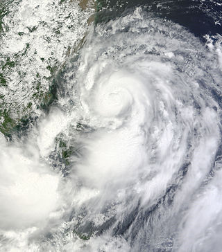
Severe Tropical Storm Trami, known in the Philippines as Severe Tropical Storm Maring, was a tropical cyclone that brought heavy rains to Taiwan and East China during mid-August 2013. Trami also made a fujiwhara interaction with Tropical Depression 13W north of it. The storm also enhanced the southwest monsoon causing more than 20 casualties in the Philippines.
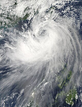
Tropical Storm Fung-wong, known in the Philippines as Tropical Storm Mario, was a relatively weak tropical cyclone which affected the northern Philippines, Taiwan and the Eastern China. The sixteenth named storm of the 2014 typhoon season, Fung-wong caused severe flooding in Luzon, especially Metro Manila.

The effects of the 2013 Pacific typhoon season in the Philippines were considered some of the worst in decades. Throughout the year, a series of typhoons impacted the country, with the worst impacts coming from Typhoon Haiyan, especially in death toll, during November.
The 2017 Visayas and Mindanao floods was an event that caused extreme flooding within parts of the Philippines, caused by several low-pressure systems. In mid-January 2017, several parts of Visayas and Mindanao experienced flooding as a result of a low-pressure area, combined with the tail-end of a cold front.
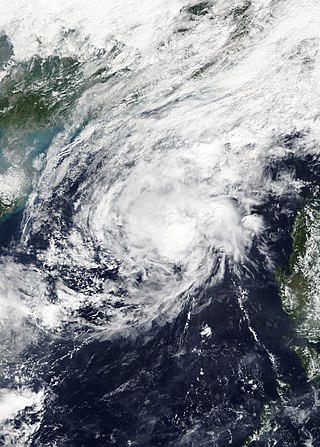
Tropical Storm Haikui, known in the Philippines as Tropical Storm Salome, was a weak tropical cyclone that affected the Philippine archipelagos of Luzon and Visayas. Forming as the twenty-fourth named storm of the 2017 typhoon season, Haikui developed as a tropical depression to the east of Samar on November 9. Traversing some Philippine islands, the system gradually intensified into a named tropical storm by November 10. In that same day, Haikui emerged to the South China Sea. By November 12, the Japan Meteorological History downgraded the storm into a tropical depression. The storm dissipated on November 13, while meteorologists from the USA recorded the storm until November 14.
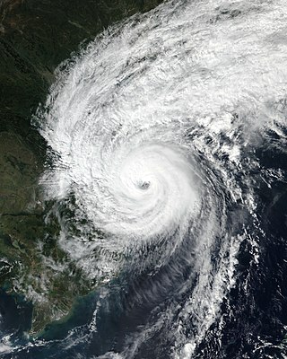
Typhoon Vamco, known in the Philippines as Typhoon Ulysses, was a powerful and very destructive Category 4-equivalent typhoon that struck the Philippines and Vietnam. It also caused the worst flooding in Metro Manila since Typhoon Ketsana in 2009. The twenty-second named storm and tenth typhoon of the 2020 Pacific typhoon season, Vamco originated as a tropical depression northwest of Palau, where it slowly continued its northwest track until it made landfall in Quezon. After entering the South China Sea, Vamco further intensified in the South China Sea until it made its last landfall in Vietnam.

Severe Tropical Storm Maliksi, known in the Philippines as Severe Tropical Storm Domeng, was a tropical cyclone in June 2018 that brought rainfall to the Philippines and Japan. It caused 2 deaths and prompted the PAGASA to declare the beginning of the rainy season in the Philippines. The fifth named storm and 4th tropical cyclone in the Philippine Area of Responsibility (PAR), it was first noted as an area of convection in the South of Palau on May 31.
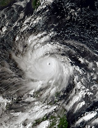
Typhoon Noru, known in the Philippines as Super Typhoon Karding, was an intense and destructive tropical cyclone that affected Vietnam, Thailand, and the Philippines — where it caused widespread agricultural damage. Noru, which means Roe deer in Korean, the sixteenth named storm and eighth typhoon, and third super typhoon of the 2022 Pacific typhoon season, Noru originated from a disturbance over the Philippine Sea, slowly tracking eastward until its development into a tropical depression, where it began to move westward.

Severe Tropical Storm Nalgae, known in the Philippines as Severe Tropical Storm Paeng, was a very large and deadly tropical cyclone that wreaked havoc across the Philippines and later impacted Hong Kong and Macau. Nalgae, meaning wing in Korean, the twenty-second named storm of the 2022 Pacific typhoon season, Nalgae originated from an invest located east of the Philippines on October 26. The disturbance, initially designated as 93W, was eventually upgraded the following day to a tropical depression by the Joint Typhoon Warning Center (JTWC) and re-designated as 26W. The Japan Meteorological Agency (JMA) however, had already considered the disturbance as a tropical depression a day prior to JTWC's; the Philippine Atmospheric, Geophysical and Astronomical Services Administration (PAGASA) also followed the JMA's lead and gave it the name Paeng. That same day, it was upgraded again by the JMA to tropical storm status, thus gaining the name Nalgae.

Typhoon Doksuri, known in the Philippines as Super Typhoon Egay, was a powerful and highly destructive tropical cyclone which became the costliest typhoon to hit China, the costliest tropical cyclone outside of the North Atlantic, and the costliest typhoon on record, breaking the previous record of Typhoon Mireille in 1991. Doksuri was also the strongest typhoon to impact Fujian since Typhoon Meranti in 2016, and the most powerful typhoon to strike the province since records began in 1950. Aside from China, Doksuri also caused extensive damage in the Philippines, Taiwan, and Vietnam, in late July 2023. The name Doksuri means eagle in Korean.
References
- ↑ Mateo, Janvic. "Monsoon swamps Metro Manila; evacuation ordered". The Philippine Star. Retrieved 15 August 2016.
- ↑ De Vera, Ellalyn; Wakefield, Francis; Amio, Armin; Velez, Freddie; Regala, Franco (15 August 2016). "Rains force class suspensions". Manila Bulletin. Retrieved 15 August 2016.
- ↑ "Metro Manila, 8 provinces flooded". motioncars. Philippine Daily Inquirer. 15 August 2016. Retrieved 15 August 2016.
- 1 2 "Thousands flee Philippine floods; 5 killed". The Straits Times. Agence France-Presse, Philippine Daily Inquirer, Asia News Network. 15 August 2016. Retrieved 15 August 2016.
- ↑ "9,152 persons stay in 21 ECs in Marikina". Northbound Philippines News Online. 9,152 persons stay in 21 ECs in Marikina. 14 August 2016. Retrieved 15 August 2016.
- ↑ "Maynilad reduces water production due to monsoon rain". Rappler. 14 August 2016. Retrieved 15 August 2016.