Richmond Valley Council (RVC) is a local government area on the Northern Rivers region of north-eastern New South Wales, Australia. RVC services an area of 3,051 square kilometres (1,178 sq mi) and draws its name from the Richmond River, which flows through most of the council area. The area under management is located adjacent to the Bruxner Highway, Pacific Highway, and the North Coast railway line.

Tweed Shire is a local government area located in the Northern Rivers region of New South Wales, Australia. It is adjacent to the border with Queensland, where that meets the Coral Sea. Administered from the town of Murwillumbah, Tweed Shire covers an area of 1,321 square kilometres (510 sq mi), and has existed as a local government entity since 1947. It was named for the Tweed River.

Conargo Shire was a local government area in the Riverina region in southern New South Wales, Australia.
The Greater Taree City Council (GTCC) was a local government area on the Mid North Coast of New South Wales, Australia, until 12 May 2016 when it was amalgamated to form part of the Mid-Coast Council. It was originally formed in 1981 from the Manning Shire, and the Taree and Wingham Municipal Councils. The council was centred on Taree, located adjacent to the Manning River, the Pacific Highway and the North Coast railway line.

Narromine Shire is a local government area in the Orana region of New South Wales, Australia. The Shire is located adjacent to the Mitchell Highway and the Main Western railway line. It was formed on 1 January 1981 from the amalgamation of the Municipality of Narromine and Timbrebongie Shire resulting from the Local Government Areas Amalgamation Act 1980.

Wakool Shire was a local government area in the Riverina region of New South Wales, Australia. The Shire was located between the Murray River and the Murrumbidgee River and adjacent to the Sturt Highway. Towns in the Shire are Barham, Moulamein, Tooleybuc, Wakool and Koraleigh.

Gloucester Shire was a local government area in the Mid North Coast and Upper Hunter regions of New South Wales, Australia. The Shire was situated adjacent to the Bucketts Way and the North Coast railway line.

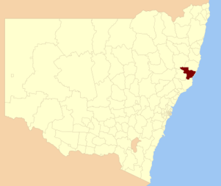
Narrabri Shire is a local government area in the North West Slopes region of New South Wales, Australia. The Shire is located adjacent to the Namoi River and the Newell and Kamilaroi Highways.

The Bombala Shire was a local government area in the Monaro region of south-eastern New South Wales, Australia. The Shire includes the town of Bombala, the villages of Delegate, Cathcart, Bibbenluke and the localities of Ando, Bungarby, Craigie, Mila, Rockton and Creewah. Bombala Shire was formed on 1 October 1977 by the amalgamation of the Municipality of Bombala and Bibbenluke Shire.

Walcha Shire is a local government area located in the New England region of New South Wales, Australia. The Shire is situated adjacent to the junction of the Oxley Highway and Thunderbolts Way and is 20 kilometres (12 mi) east of the Main North railway line passing through Walcha Road. The shire was formed on 1 June 1955 through the amalgamation of Apsley Shire and the Municipality of Walcha.

Glen Innes Severn is a local government area in the New England region of New South Wales, Australia. The council serves an area of 5,487 square kilometres (2,119 sq mi) and is located adjacent to the New England Highway. The council was formed by the amalgamation of Severn Shire and Glen Innes City Council.

Tenterfield Shire is a local government area located in the New England region of New South Wales, Australia. The Shire is situated adjacent to the New England Highway.

Dungog Shire is a local government area in the Hunter region of New South Wales, Australia. The Shire is situated adjacent to the Barrington Tops and consists predominantly of very rugged to hilly country which becomes less rugged from north to south.

Lockhart Shire is a local government area in the Riverina region of New South Wales, Australia. The Shire was created in 1906 and is an agricultural and pastoral area.

Deniliquin Council was a local government area in the Riverina region of south-western New South Wales, Australia. At the date of its abolition, Deniliquin Council was the last rural local government area in New South Wales left consisting only of a rural town.
Barangay elections in the Philippines were held on May 14, 2018. The election elected the Punong Barangay, more commonly known as barangay captains, and members of the Sangguniang Barangay, or barangay council, in 41,948 barangays (villages) throughout the country whose terms start on June 30, 2018. Barangays are the smallest local government unit in the Philippines.

The 2021 United Kingdom local elections were held on Thursday 6 May 2021. More than 145 English local councils, around 5,000 councillor seats, thirteen directly elected mayors in England, and 39 police and crime commissioners in England and Wales were contested. On the same day, the 2021 Hartlepool by-election took place, and there were also elections to the Scottish Parliament, Senedd and London Assembly, the last in conjunction with the London mayoral election.

The 2021 New South Wales local elections were held on 4 December 2021 to elect the councils of 121 of the 128 local government areas (LGAs) in New South Wales. Several councils also held mayoral elections and/or referendums.
The 2016 New South Wales local elections were held on 10 September 2016 to elect the councils of 79 of the 128 local government areas (LGAs) of New South Wales. Several councils also held mayoral elections and/or referendums.
Pristine Waters Council was a short-lived local government area in the Northern Rivers region of New South Wales, Australia.