Related Research Articles

The National Oceanic and Atmospheric Administration is an American scientific and regulatory agency charged with forecasting weather, monitoring oceanic and atmospheric conditions, charting the seas, conducting deep-sea exploration, and managing fishing and protection of marine mammals and endangered species in the US exclusive economic zone. The agency is part of the United States Department of Commerce and is headquartered in Silver Spring, Maryland. NOAA supports the "Dynamic Planet", and "Meteorology" events in Science Olympiad.

A weather balloon, also known as a sounding balloon, is a balloon that carries instruments to the stratosphere to send back information on atmospheric pressure, temperature, humidity and wind speed by means of a small, expendable measuring device called a radiosonde. To obtain wind data, they can be tracked by radar, radio direction finding, or navigation systems. Balloons meant to stay at a constant altitude for long periods of time are known as transosondes. Weather balloons that do not carry an instrument pack are used to determine upper-level winds and the height of cloud layers. For such balloons, a theodolite or total station is used to track the balloon's azimuth and elevation, which are then converted to estimated wind speed and direction and/or cloud height, as applicable.
The National Weather Service (NWS) is an agency of the United States federal government that is tasked with providing weather forecasts, warnings of hazardous weather, and other weather-related products to organizations and the public for the purposes of protection, safety, and general information. It is a part of the National Oceanic and Atmospheric Administration (NOAA) branch of the Department of Commerce, and is headquartered in Silver Spring, Maryland, within the Washington metropolitan area. The agency was known as the United States Weather Bureau from 1891 until it adopted its current name in 1970.

Hurricane hunters, typhoon hunters, or cyclone hunters are aircrews that fly into tropical cyclones to gather weather data. In the United States, the organizations that fly these missions are the United States Air Force Reserve's 53rd Weather Reconnaissance Squadron and the National Oceanic and Atmospheric Administration's Hurricane Hunters. Such missions have also been flown by Navy units and other Air Force and NOAA units. Other organizations also fly these missions, such as Government Flying Service Hong Kong.

The 53rd Weather Reconnaissance Squadron, also known by its nickname, Hurricane Hunters, is a flying unit of the United States Air Force, and "the only Department of Defense organization still flying into tropical storms and hurricanes." Aligned under the 403rd Wing of the Air Force Reserve Command (AFRC) and based at Keesler Air Force Base, Mississippi, with ten aircraft, it flies into tropical cyclones in the Atlantic Ocean, the Caribbean Sea, the Gulf of Mexico and the Central Pacific Ocean for the specific purpose of directly measuring weather data in and around those storms. The 53rd WRS currently operates the Lockheed WC-130J aircraft as its weather data collection platform.

A dropsonde is an expendable weather reconnaissance device created by the National Center for Atmospheric Research (NCAR), designed to be dropped from an aircraft at altitude over water to measure storm conditions as the device falls to the surface. The sonde contains a GPS receiver, along with pressure, temperature, and humidity (PTH) sensors to capture atmospheric profiles and thermodynamic data. It typically relays this data to a computer in the aircraft by radio transmission.

The Weather Prediction Center (WPC), located in College Park, Maryland, is one of nine service centers under the umbrella of the National Centers for Environmental Prediction (NCEP), a part of the National Weather Service (NWS), which in turn is part of the National Oceanic and Atmospheric Administration (NOAA) of the U.S. Government. Until March 5, 2013, the Weather Prediction Center was known as the Hydrometeorological Prediction Center (HPC). The Weather Prediction Center serves as a center for quantitative precipitation forecasting, medium range forecasting, and the interpretation of numerical weather prediction computer models.

Maryland Public Television (MPT) is the PBS member state network for the U.S. state of Maryland. It operates under the auspices of the Maryland Public Broadcasting Commission, an agency of the Maryland state government that holds the licenses for all PBS member stations licensed in the state.
A weather presenter is a person who presents the weather forecast daily on radio, television or internet news broadcasts.

The National Severe Storms Laboratory (NSSL) is a National Oceanic and Atmospheric Administration (NOAA) weather research laboratory under the Office of Oceanic and Atmospheric Research. It is one of seven NOAA Research Laboratories (RLs).
NBC Weather Plus was an American weather-oriented digital multicast television network owned as a joint venture between NBCUniversal and the local affiliates of the NBC television network. The service, which was broadcast in standard definition, was carried on the digital subchannels of many NBC affiliates and on the digital tiers of cable providers.
A Center Weather Service Unit (CWSU) is a National Weather Service (NWS) unit located inside each of the Federal Aviation Administration's 22 Air Route Traffic Control Centers (ARTCC).
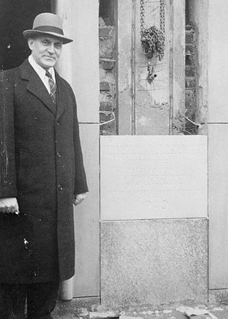
Francis Wilton Reichelderfer, also known as “Reich”, presided over a revolutionary era in the history of the Weather Bureau. He trained as a U.S. Navy pilot and from 1922 -1928, was appointed Chief of Navy Aerology because of his meteorological and aviation experience. In 1931, he was assigned to the Bergen School of Meteorology. From 1938 to 1963, Reich directed the Weather Bureau and brought modern technology to weather forecasting.
The Weather Channel is an American basic cable and satellite television channel owned by Byron Allen's Entertainment Studios that focuses on national and international weather information; although in recent years, the channel has also incorporated entertainment-based programs related to weather on its schedule. This article details the history of the channel, which dates back its founding to around 1980.

The NOAA Hurricane Hunters are a group of aircraft used for hurricane reconnaissance by the United States National Oceanic and Atmospheric Administration (NOAA). They fly through hurricanes to help forecasters and scientists gather operational and research data. The crews also conduct other research projects including ocean wind studies, winter storm research, thunderstorm research, coastal erosion, and air chemistry flights.

National Weather Service Lincoln, Illinois also known as National Weather Service Central Illinois is a weather forecast office responsible for monitoring weather conditions for 35 counties in Central and Southeastern Illinois. The Central Illinois office initially consisted of two forecast offices in Peoria and Springfield until the current location in Lincoln became the sole local forecast office in 1995. Federal meteorology offices and stations in the region date back to the 19th century when the Army Signal Service began taking weather observations using weather equipment at the Springer Building in Springfield. Since that time the presence of the National Weather Service greatly increased with the installation of new weather radars, stations and forecast offices. The current office in Lincoln maintains a WSR-88D (NEXRAD) radar system, and Advanced Weather Interactive Processing System (AWIPS) that greatly improve forecasting in the region. Lincoln is in charge of weather forecasts, warnings and local statements as well as aviation weather.
Weather reconnaissance is the acquisition of weather data used for research and planning. Typically the term reconnaissance refers to observing weather from the air, as opposed to the ground.
National Weather Service Little Rock, Arkansas is a local weather forecast office responsible for monitoring weather conditions for 47 of Arkansas's 75 counties, excluding 7 counties in Northwestern Arkansas, 9 counties in Southwestern and South Central Arkansas, Ashley and Chicot counties in Extreme Southeastern Arkansas, and 14 counties in Eastern Arkansas. Those counties are monitored by the Weather Service offices in Tulsa, Shreveport, Jackson (MS), and Memphis respectively. The current office in North Little Rock maintains a WSR-88D (NEXRAD) radar system and Advanced Weather Interactive Processing System (AWIPS) that greatly improve forecasting in the region. North Little Rock is in charge of weather forecasts, warnings and local statements as well as aviation weather. The name of the Doppler weather radar (WSR-88D) code used by this office is LZK. The National Weather Service at North Little Rock, Arkansas programs 12 NOAA Weather Radio transmitters across Arkansas, with 25 transmitters statewide.
National Weather Service - Shreveport, LA (SHV) is one of 122 weather forecast offices around the United States. It is responsible for issuing public and aviation forecasts and warning for South Central and Southwestern Arkansas, Southeastern Oklahoma, and Eastern and Northeastern Texas Counties, as well as for North Central and Northwestern Louisiana Parishes. It is co-located with a weather radar (KSHV) of the NEXRAD network and an upper air sounding facility. It controls the issuance of weather information and bulletins on a certain number of NOAA Weather Radio.
National Weather Service - Pleasant Hill/Kansas City, Missouri is a Weather Forecast Office (WFO) of the National Weather Service, which is responsible for forecasts and the dissemination of weather warnings and advisories for 37 counties in northern and western Missouri and seven counties in extreme eastern Kansas, including the Kansas City and St. Joseph metropolitan areas. Though, as the Storm Prediction Center (SPC) in Norman, Oklahoma is responsible for issuing severe thunderstorm and tornado watches, the Pleasant Hill/Kansas City WFO only composes outline and status updates for SPC-issued watches affecting any portion of its designated County Warning Area.
References
- ↑ "Archived copy". Archived from the original on 2010-04-14. Retrieved 2010-03-19.
{{cite web}}: CS1 maint: archived copy as title (link)