| A10 road | |
|---|---|
 | |
| Location | |
| Country | Zimbabwe |
| Highway system | |


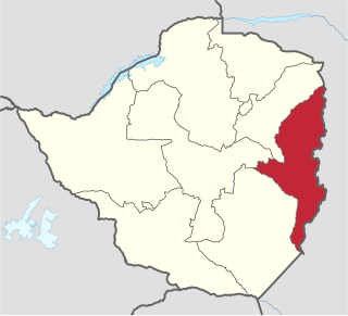
The A10 Highway is a primary road that runs from Ngundu in south Masvingo Province to Tanganda through the Mutare-Masvingo Highway in Manicaland Province. [1] [2]
| A10 road | |
|---|---|
| | |
| Location | |
| Country | Zimbabwe |
| Highway system | |
The A10 Highway is a primary road that runs from Ngundu in south Masvingo Province to Tanganda through the Mutare-Masvingo Highway in Manicaland Province. [1] [2]
The A10 Highway also called the P5 Highway [3] begins at where Cashel/Chimanimani Road turns off from the A9 Highway which runs from Mutare to Masvingo 19°30′22″S32°31′51″E / 19.506157°S 32.530853°E . It ends at Ngundu in Masvingo Province where it makes a T-junction with the A4 Highway running from Harare to Beitbridge. 20°47′41″S30°48′01″E / 20.794714°S 30.800177°E
Locals in Manicaland like to call it Chimanimani Road and after Chimanimani Turn off they call it Tanganda Road and further on they call it Chiredzi Road. Those around Ngundu call it Chiredzi Road and past Chiredzi turn-off they call it Save Road, Tanganda Road and finally Mutare Road.
This article contains a bulleted list or table of intersections which should be presented in a properly formatted junction table.(November 2021) |
(Direction: North to South.)
The A10 Highway turns right to merge with the A16 Highway. 20°05′14″S32°38′49″E / 20.087282°S 32.64701°E
The road is tolled at Toll Plaza number "35" between the 70.5-71.5 km peg, 9 km before Triangle. [5] [6]
Manicaland is a province in eastern Zimbabwe. After Harare Province, it is the country's second-most populous province, with a population of 2.037 million, as of the 2022 census. After Harare and Bulawayo provinces, it is Zimbabwe's third-most densely populated province. Manicaland was one of five original provinces established in Southern Rhodesia in the early colonial period. The province endowed with country's major tourist attractions, the likes of Mutarazi Falls, Nyanga National Park and Zimbabwe's top three highest peaks. The province is divided into ten administrative subdivisions of seven rural districts and three towns/councils, including the provincial capital, Mutare. The name Manicaland is derived from one of the province's largest ethnic groups, the Manyika, who originate from the area north of the Manicaland province and as well as western Mozambique, who speak a distinct language called ChiManyika in Shona.

Masvingo is a province in southeastern Zimbabwe. It has a population of 1.485 million as of the 2012 census, ranking fifth out of Zimbabwe's ten provinces. Established as Victoria Province by the British South Africa Company, it was one of the five original provinces of Southern Rhodesia. In 1982, two years after Zimbabwean independence, it was renamed Masvingo Province. The province is divided into seven districts, including Masvingo District, which contains the provincial capital Masvingo City.

Mutare is the most populous city in the province of Manicaland, and the third most populous city in Zimbabwe, having surpassed Gweru in the 2012 census, with an urban population of 224,802 and approximately 260,567 in the surrounding districts giving the wider metropolitan area a total population of over 500,000 people. Mutare is also the capital of Manicaland province and the largest city in Eastern Zimbabwe.

Chimanimani District is a mountainous district in Manicaland Province of eastern Zimbabwe. The district headquarters is the town of Chimanimani.
Chipinge District is a district in Manicaland Province of Zimbabwe. The administrative headquarters is Chipinge.
The government of Zimbabwe is the main provider of air, rail and road services; historically, there has been little participation of private investors in transport infrastructure.
Buhera District is a district in Manicaland Province, Zimbabwe.
Chisumbanje is an area in the Province of Manicaland, Zimbabwe. It is situated in Chipinge District, one of the seven districts in Manicaland Province. It is located in the Dowoyo communal land on the eastern bank of the Save River, about 95 km (59 mi) south of Birchenough Bridge on the Birchenough Bridge-Chiredzi road.
Ngundu is a village in Chivi District in Masvingo Province in Zimbabwe.
Chipinge is a town in Zimbabwe, located in Chipinge District, in Manicaland Province, in southeastern Zimbabwe, close to the border with Mozambique.

The A4 is a highway, also known as the R1 Highway, which runs between Beitbridge and Harare. From Beitbridge it passes through Rutenga, Ngundu, Masvingo, Mvuma, Chivhu before reaching Harare.
The A6 is a highway in Zimbabwe running from the Beitbridge border with South Africa, through Gwanda, to Bulawayo. It is part of the R9 Route, which links Beitbridge with Victoria Falls.
Nyanyadzi is a village in Chimanimani District of Manicaland Province in Zimbabwe. It is located 96 km south of Mutare on the main Mutare-Birchenough Bridge road, at the confluence of the Nyanyadzi, Odzi, and Save rivers. The region is under irrigation and there are high yields of grain and fruit crops.
The A9 Road is a national highway in Zimbabwe running from Mutare to Mbalabala. The road begins in Mutare and runs south-west through Nyanyadzi, Birchenough Bridge, Masvingo, Mashava, Zvishavane, Filabusi and ends at Mbalabala where it joins the (A6) Bulawayo-Beit Bridge Highway near the 61.5 km peg. It has a total of just less than 513 kilometres (319 mi), which is about a 6 hours 15 minute drive.

Chirundu–Beitbridge Road Corridor is a Trans-African Highway Network Zimbabwean link between South Africa and Zambia. It is part of the North–South Corridor Project and forms the entire Zimbabwean section of the Cape to Cairo Road.

R5 Highway is a 270.8 kilometres (168.3 mi) regional road corridor running from Harare to Mutare. It is also known as the A3 Highway. It is part of the Beira–Lobito Highway.
The R6 Highway is a primary road, a trunk road and regional road corridor link road in Zimbabwe.
R7 Highway is a primary, paved, regional road corridor in central Zimbabwe virtue of linking the regional corridors R1 Highways that runs from Harare to Beitbridge via Masvingo, and R2 Highway that runs from Harare to Plumtree via Bulawayo.
Hot springs are located 80 km south of Mutare in Zimbabwe. It is located near Nyanyadzi and Chiyadzwa diamond fields. The water from the springs is said to have medicinal and healing properties.