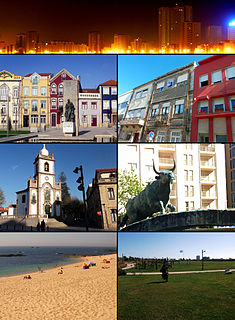
Vila do Conde is a municipality in the Norte Region of Portugal. The population in 2011 was 79,533, in an area of 149.03 km². The urbanized area of Vila do Conde, which includes the parishes of Vila do Conde, Azurara and Árvore, represent 36,137 inhabitants. Vila do Conde is interlinked to the north with Póvoa de Varzim, forming a single urban agglomeration. The town is on the Portuguese Way of the Camino de Santiago.

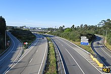
Póvoa de Varzim' is served by a transportation network that employs maritime, aerial and terrestrial travel. The terrestrial access infrastructure is composed of national motorways (freeways), the national roads system, and light rail metro. These infrastructures and the airport, bus terminal, marina and harbour are daily used by commuters.

Póvoa de Varzim, with an area of 82.06 square kilometres, lies between the Cávado and Ave Rivers, or, from a wider perspective, halfway between the Minho and Douro Rivers on the northern coast of Portugal. Although in administrative reforms of 1936, the city was integrated in Douro Litoral, the case for such an administrative integration is arguable, because Póvoa de Varzim is found in a transition region. It has characteristic Minho traditions, historical and demographic bounds with several towns and villages in the region, religiously it is part of Braga archdiocese, and due to that it is perhaps preferable to recognize Póvoa as part of the old region, favouring more Entre-Douro-e-Minho, given its central geographic position in this region.
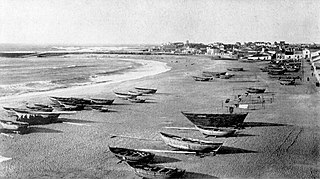
Póvoa de Varzim is a former Portuguese civil parish, located in the city of Póvoa de Varzim. It is the core of the city of Póvoa de Varzim and until the new city limits established in 1995 it was the single parish that made up the city. In the census of 2011, it had a population of 28,420 inhabitants and a total area of 5.25 km². A 2012 law merged the parish with neighbouring Argivai and Beiriz, becoming the southern parish of the city of Póvoa de Varzim, known as União das Freguesias da Póvoa de Varzim, Beiriz e Argivai.
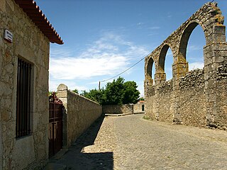
Argivai is an urban area in Póvoa de Varzim, Portugal. It is an ancient ecclesiastical parish and former civil parish located in the city of Póvoa de Varzim. In the census of 2001, it had a population of 2,187 inhabitants and a total area of 2.32 km². A 2012 law merged the parish with neighbouring Póvoa de Varzim (parish) and Beiriz, becoming the southern parish of the city of Póvoa de Varzim, with a population of 34,266 inhabitants and a total area of 11.88 km².

Beiriz is a suburban area in Póvoa de Varzim, Portugal. It is an ancient ecclesiastical parish and former civil parish. In the census of 2001, it had a population of 3,229 inhabitants and a total area of 4.31 km². A 2012 law merged the parish with neighbouring Póvoa de Varzim (parish) and Argivai, becoming the southern parish of the city of Póvoa de Varzim, known as União das Freguesias da Póvoa de Varzim, Beiriz e Argivai.

Bairro Sul, literally the South Neighborhood, also known as Lapa, is the fishery district of the city of Póvoa de Varzim in Portugal. It is one of the six traditional neighborhoods of Póvoa de Varzim and one of the eleven parts in which the city is subdivided. The quarter is situated south of Póvoa de Varzim City Center. It has green and white as neighborhood colors and Lancha Poveira as symbol, also the icon of the city.
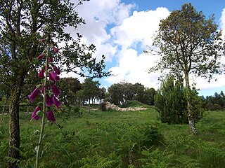
Cividade Hill or Cividade de Terroso Hill with an elevation of 153 metres (502 ft) is one of the two hills next to the city of Póvoa de Varzim in Portugal.
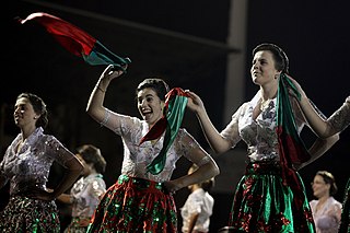
The urban area of Póvoa de Varzim in northern Portugal is divided into eleven districts, each with distinctive zones (zonas), which are significant areas of the city and have population and topological differences. The vernacular terminology and 19th century subdivisions for the town is Bairro.

The Castelo da Póvoa, also Fortress of Póvoa de Varzim, officially Fortaleza da Nossa Senhora da Conceição or Nossa Senhora da Conceição Fortress, is a Portuguese fortress in Póvoa de Varzim rebuilt during the reigns of Peter II and John V to defend the town from privateers, in the site of an earlier fort known as "Forte de Torrão". It is considered a listed property of Public Interest in Portugal.

Matriz Church of Póvoa de Varzim, also Nossa Senhora da Conceição Parish Church is the Mother Roman Catholic church in Póvoa de Varzim, Portugal. The temple is located in Praça Velha square, in Bairro da Matriz quarter. The church is dedicated to the Our Lady of the Immaculate Conception, Nossa Senhora da Conceição in Portuguese, the main patron saint of Póvoa de Varzim.
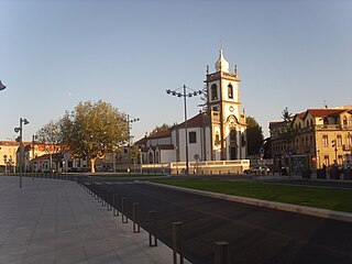
Largo das Dores or Dores Square is a square in Póvoa de Varzim city center in Portugal. Part of the earliest old town of Póvoa de Varzim, this area is listed by City Hall as heritage site. With about 11.000 square meters, its most noticeable features are its two churches, located in the sites of ancient chapels, one of which was the main church of the city.

The history of Póvoa de Varzim, Portugal, and its development as a maritime trade and fishing hub, have been greatly influenced by its location at the entrance to one of Portugal's best natural ports.
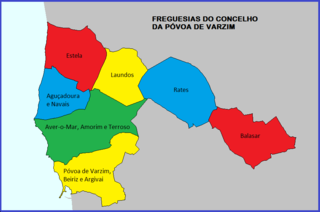
Póvoa de Varzim is divided into seven civil parishes, most of which were created as civil entities in the 19th century and some were merged in the 21st century, but are directly derived from ecclesiastical parishes existing since the Early Middle Ages. These parishes are grouped into three areas recognized by the Municipal masterplan: urban (city), suburban and rural.
Anjo Festival or Ivy Festival is an Easter Monday festival held in coastal Northern Portugal. Originating in Póvoa de Varzim, it is currently observed in several towns, especially Vila do Conde and Esposende.
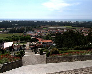
Around the city of Póvoa de Varzim in Portugal there is a large number of dependent settlements or hamlets dispersed in the civil parishes. These parishes have dispersed settlement, with small clusters that are called Lugares or Localidades (localities) in Portugal, these hamlets are also known as villages (aldeias) and most of the municipal territory and beyond is actually continuous, in urban terms, with the city in the highways that link it to neighbouring cities such as Barcelos, Famalicão or Esposende, the same occurs to the South, and several of these hamlets are suburbs with a number of separate farmsteads scattered throughout the area.
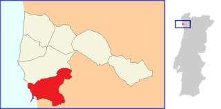
União das Freguesias da Póvoa de Varzim, Beiriz e Argivai is a major part of the Portuguese city of Póvoa de Varzim and the city's south side region. It is one of the seven civil parishes of Póvoa de Varzim. It is, by far, the most populated with 34,266 inhabitants, more than half of the total population in the municipality. The administrative parish evolved from the amalgamation of the former parishes Póvoa de Varzim, Beiriz and Argivai. The population in 2011 was 34,266, in an area of 12.60 km².
