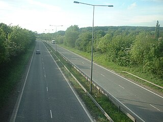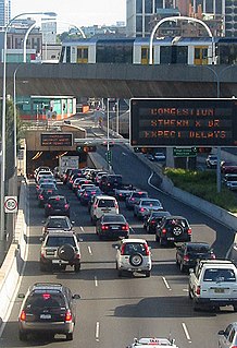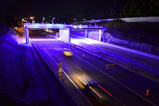
Controlled-access highways in Poland are part of the national roads network and they are divided into motorways and expressways. Both types of highways feature grade-separated interchanges with all other roads, emergency lanes, feeder lanes, wildlife protection measures and dedicated roadside rest areas. Motorways differ from expressways in their technical parameters, like designated speed, permitted road curvature, lane widths or minimal distances between interchanges. Moreover, expressways might have single carriageway sections in case of low traffic densities.

A dual carriageway or divided highway is a class of highway with carriageways for traffic travelling in opposite directions separated by a central reservation. Roads with two or more carriageways which are designed to higher standards with controlled access are generally classed as motorways, freeways, etc., rather than dual carriageways.

The N3 is a national route in South Africa that connects Johannesburg and Durban, respectively South Africa's largest and third-largest cities. Johannesburg is the financial and commercial heartland of South Africa, while Durban is South Africa's key port and one of the busiest ports in the Southern Hemisphere and is also a holiday destination. Durban is the port through which Johannesburg imports and exports most of its goods. As a result, the N3 is a very busy highway and has a high volume of traffic.

A limited-access road, known by various terms worldwide, including limited-access highway, dual-carriageway, expressway, and partial controlled access highway, is a highway or arterial road for high-speed traffic which has many or most characteristics of a controlled-access highway, including limited or no access to adjacent property, some degree of separation of opposing traffic flow, use of grade separated interchanges to some extent, prohibition of some modes of transport such as bicycles or horses, and very few or no intersecting cross-streets or level crossings. The degree of isolation from local traffic allowed varies between countries and regions. The precise definition of these terms varies by jurisdiction.

The N17 road is a national primary road in Ireland, and is part of the Atlantic Corridor route. It begins in County Galway and ends in County Sligo. On 27 September 2017 the southern, Tuam–Galway, section was upgraded to motorway status and designated M17.

A controlled-access highway is a type of highway that has been designed for high-speed vehicular traffic, with all traffic flow—ingress and egress—regulated. Common English terms are freeway, motorway and expressway. Other similar terms include throughway and parkway. Some of these may be limited-access highways, although this term can also refer to a class of highway with somewhat less isolation from other traffic.

The Eastern Distributor is a 4.7-kilometre-long (2.9 mi) motorway in Sydney, New South Wales, Australia. Part of the M1, the motorway links the Sydney central business district with Sydney Airport. The centre-piece is a 1.7 km (1.1 mi) tunnel running from Woolloomooloo to Surry Hills. Built as a build-own-operate-transfer project, it is 75.1% owned by Transurban.

2+1 road is a specific category of three-lane road, consisting of two lanes in one direction and one lane in the other, alternating every few kilometres, and usually separated with a steel cable barrier. The second lane allows faster-moving traffic to overtake slower vehicles at regular intervals. Traditional roads of at least 10 metres (33 ft) width can be converted to 2+1 roads and reach near-motorway safety levels at a much lower cost than an actual conversion to motorway or dual carriageway.

State Highway 1 is the longest and most significant road in the New Zealand road network, running the length of both main islands. It appears on road maps as SH 1 and on road signs as a white number 1 on a red shield, but it has the official designations SH 1N in the North Island, SH 1S in the South Island.

The Hills Motorway is a tollway in north-western Sydney, Australia, owned by toll road operator Transurban. It forms majority of Sydney's M2 route and part of the 110 km Sydney Orbital Network, with Lane Cove Tunnel constituting the rest of the M2 route. The M2 is also part of the National Highway west of Pennant Hills Road. It was known as the North West Transport Link during planning in the early 1990s.

The M4 Motorway is a 50.2-kilometre-long (31.2 mi) dual carriageway partially tolled motorway in Sydney, New South Wales, Australia that is designated as the M4 route. The M4 designation is part of the wider A4 and M4 route designation, the M4 runs parallel/below ground to the Great Western Highway and Parramatta Road (A44).

The M5 Motorway is a 29-kilometre-long (18 mi) motorway located in Sydney, New South Wales, Australia that is designated with the M5 route and forms part of the Sydney Orbital Network. The M5 route number comprises two connected parts, separately owned and operated:

Brisa – Auto-estradas de Portugal, S.A. is a Portugal-based international transportation company. The group's largest business area is highway management, in which it is the largest concessionaire in its home country. Founded in 1972 by Jorge de Brito, Brisa also has operations in countries including the United States and the Netherlands. Since 2000 Brisa's largest shareholder has been the investment company Grupo José de Mello, which owns over 30% of its stock through subsidiaries. The Spanish infrastructure company Abertis holds around 15% of the firm. The company is listed on the Lisbon Stock Exchange and is a constituent of the benchmark PSI-20 and Euronext 100 indices.

The A7 motorway is a 42.4-kilometre-long (26.3 mi) motorway in Croatia. It connects the nation's largest port in Rijeka, to the Croatian motorway network, as well as to the Rupa and Pasjak border crossings to Slovenia. The motorway forms part of a longitudinal transportation corridor in Croatia, and it is a part of European route E61 Villach–Ljubljana–Trieste–Rijeka. The A7 motorway route south of Orehovica interchange, where it also intersects Pan-European corridor Vb, is a part of European route E65.

The A9 motorway is a north–south motorway in Croatia, with a length of 78.3 kilometres. Beginning in Pula, the largest city on the Istrian peninsula, it runs north to the Croatian motorway and expressway network at the Kanfanar interchange. Here it meets the A8 motorway, forming the Istrian Y road system. The A9 continues north from here to the Kaštel and Plovanija border crossings into Slovenia. The motorway represents a significant north–south transportation corridor in Croatia and is a part of the European route E751. The motorway's national significance is reflected in the positive economic impact on the cities and towns it connects, as well as its importance to tourism in Croatia. Importance of the motorway for tourism is particularly high during summer tourist seasons, when traffic volume increases by more than 80%.

Roads in Portugal are defined by the Plano Rodoviário Nacional, which describes the existing and planned network of Portuguese roads. The present plan in force is the 2000 National Road Plan (PRN 2000), approved in 1998. It replaced PRN 1985, which itself had replaced PRN 1945.

The M6 motorway is a motorway in Ireland, which runs from Dublin to Galway. The M6 extends from its junction with the M4 at Kinnegad all the way west to the outskirts of Galway City, but the Athlone bypass and the approach to Galway city - while of dual carriageway standard - have not been designated motorway and are still signed as N6. The motorway was officially completed and opened to traffic on 18 December 2009, and was the first city-to-city direct major inter-urban route to be completed in Ireland. The M6 and M4, which form the Galway-Dublin route, consist of a grade-separated 2+2 dual carriageway road with a top speed limit of 120 km/h. At approximately 144 km (90 mi), the M6 is the third longest motorway in the state and will be 159 km.
This article describes the highway systems available in selected countries.


