Svalbard, previously known as Spitsbergen or Spitzbergen, is a Norwegian archipelago in the Arctic Ocean. North of mainland Europe, it lies about midway between the northern coast of Norway and the North Pole. The islands of the group range from 74° to 81° north latitude, and from 10° to 35° east longitude. The largest island is Spitsbergen, followed in size by Nordaustlandet and Edgeøya. The largest settlement is Longyearbyen on the west coast of Spitsbergen.

Norway is a country located in Northern Europe in the northern and western parts of the Scandinavian Peninsula. The majority of the country borders water, including the Skagerrak inlet to the south, the North Sea to the southwest, the North Atlantic Ocean to the west, and the Barents Sea to the north. It has a land border with Sweden to the east and a shorter border with Finland and an even shorter border with Russia to the northeast.

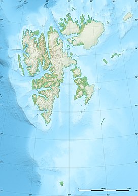
Spitsbergen is the largest and the only permanently populated island of the Svalbard archipelago in northern Norway.

Bear Island is the southernmost island of the Norwegian Svalbard archipelago. The island is located at the limits of the Norwegian and Barents Seas, approximately halfway between Spitsbergen and the North Cape. Bear Island was discovered by Dutch explorers Willem Barentsz and Jacob van Heemskerck on 10 June 1596. It was named after a polar bear that was seen swimming nearby. The island was considered terra nullius until the Spitsbergen Treaty of 1920 placed it under Norwegian sovereignty.

Longyearbyen is the world's northernmost settlement with a population greater than 1,000 and the largest inhabited area of Svalbard, Norway. It stretches along the foot of the left bank of the Longyear Valley and on the shore of Adventfjorden, the short estuary leading into Isfjorden on the west coast of Spitsbergen, the island's broadest inlet. As of 2002 Longyearbyen Community Council became an official Norwegian municipality. It is the seat of the Governor of Svalbard. The town's mayor is Arild Olsen.
The extreme points of Norway include the coordinates that are farther north, south, east or west than any other location in Norway; and the highest and the lowest altitudes in the country. The northernmost point is Rossøya on Svalbard, the southernmost is Pysen in Mandal, the easternmost is Kræmerpynten on Svalbard, and the westernmost is Hoybergodden on Jan Mayen. The highest peak is Galdhøpiggen, standing at 2,469 m (8,100 ft) above mean sea level, while the lowest elevation is sea level at the coast.

The Svalbard Treaty recognises the sovereignty of Norway over the Arctic archipelago of Svalbard, at the time called Spitsbergen. The exercise of sovereignty is, however, subject to certain stipulations, and not all Norwegian law applies. The treaty regulates the demilitarisation of the archipelago. The signatories were given equal rights to engage in commercial activities on the islands. As of 2023, Norway and Russia make use of this right.

Barentsøya, anglicized as Barents Island, is an island in the Svalbard archipelago of Norway, lying between Edgeøya and Spitsbergen. Barents Island has no permanent human inhabitants. Named for the Dutch explorer Willem Barents, it is a part of Søraust-Svalbard Nature Reserve.

The Svalbard Global Seed Vault is a secure backup facility for the world's crop diversity on the Norwegian island of Spitsbergen in the remote Arctic Svalbard archipelago. The Seed Vault provides long-term storage of duplicates of seeds conserved in genebanks around the world. This provides security of the world's food supply against the loss of seeds in genebanks due to mismanagement, accident, equipment failures, funding cuts, war, sabotage, disease and natural disasters. The Seed Vault is managed under terms spelled out in a tripartite agreement among the Norwegian government, the Crop Trust, and the Nordic Genetic Resource Center (NordGen).

Vnukovo Airlines Flight 2801 was an international charter flight from Vnukovo International Airport in Moscow, Russia, to Svalbard Airport on Spitsbergen, in the Norwegian archipelago of Svalbard. On 29 August 1996 at 10:22:23 CEST, a Tupolev Tu-154M operating this flight crashed into the ground in Operafjellet during the final approach to Svalbard Airport. All 141 people aboard the plane were killed, making it the deadliest aviation accident in Norway. The accident was the result of a series of small navigational errors causing the aircraft to be 3.7 kilometres from the approach centerline at the time of impact.

Svalbard Airport is the main airport serving Svalbard in Norway. It is 5 km (3.1 mi) northwest of Longyearbyen on the west coast, and is the northernmost airport in the world with scheduled public flights. The first airport near Longyearbyen was constructed during World War II. In 1959, it was first used for occasional flights, but could only be used a few months a year. Construction of the new airport at Hotellneset started in 1973, and the airport was opened on 2 September 1975. It is owned and operated by state-owned Avinor.

Kongsøya is an island in Svalbard, Norway. It is the largest of the islands in King Charles Land. Its area is 191 square kilometres (74 sq mi). The other main island in the chain is Svenskøya.

Svalbard, Norway, is a vast, very sparsely inhabited Arctic archipelago. With fewer than 3,000 inhabitants in three main communities, plus some smaller meteorological and scientific outposts, there are no communities connected by road. Off-road motorized transport is prohibited on bare ground, but snowmobiles are used extensively during winter, both for commercial and recreational activities. Transport from Longyearbyen to Barentsburg and Pyramiden is possible by snowmobile at winter, or by ship all year round. Road systems exist within the communities of Longyearbyen, Barentsburg, Ny-Ålesund and the now-closed Sveagruva. All settlements have ports and Longyearbyen has a bus system.
Novelists, screenwriters and filmmakers have set their works in Svalbard, an archipelago in the Arctic, the northernmost part of Norway yet closer to Greenland. Such works often make use of its Arctic climate, polar bears, isolation and the natural beauty of its dominant glaciers, mountains and fjords.

Oscar II Land is the land area between Isfjorden and Kongsfjorden on Spitsbergen, Svalbard. The 30 km (19 mi) long glacier Sveabreen divides Oscar II Land from James I Land.
Haakon VII Land is a land area at the northwestern part of Spitsbergen, Svalbard, between Woodfjorden and Kongsfjorden.
Nathorst Land is the land area between Van Keulenfjorden and Van Mijenfjorden on Spitsbergen, Svalbard.
Aagaardtoppen is a mountain in Nordenskiöld Land at Spitsbergen, Svalbard. It reaches a height of 731 m.a.s.l. and is part of the mountain ridge of Linnéfjella. The mountain is named after Norwegian businessperson Andreas Zacharias Aagaard.

Hayesbreen is a glacier in Sabine Land at Spitsbergen, Svalbard. It is named after American politician and Arctic explorer Isaac Israel Hayes. The glacier has a length of about eighteen kilometers, and debouches into the bay of Mohnbukta. Surrounding mountains are Aagaardfjellet to the north, Jebensfjellet to the south, and Panofskyfjellet where Hayesbreen joins the glacier of Königsbergbreen.

The wildlife of Norway includes the diverse flora and fauna of Norway. The habitats include high mountains, tundras, rivers, lakes, wetlands, sea coast and some lower cultivated land in the south. Mainland Norway has a long coastline, protected by skerries and much dissected by fjords, and the mostly-icebound archipelago of Svalbard lies further north. The flora is very varied and a large range of mammals, birds, fish and invertebrate species live here, as well as a few species of reptiles and amphibians.