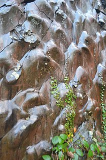
The Old Red Sandstone is an assemblage of rocks in the North Atlantic region largely of Devonian age. It extends in the east across Great Britain, Ireland and Norway, and in the west along the northeastern seaboard of North America. It also extends northwards into Greenland and Svalbard. These areas were a part of the ancient continent of Euramerica/Laurussia. In Britain it is a lithostratigraphic unit to which stratigraphers accord supergroup status and which is of considerable importance to early paleontology. For convenience the short version of the term, ORS is often used in literature on the subject. The term was coined to distinguish the sequence from the younger New Red Sandstone which also occurs widely throughout Britain.

The geology of Wales is complex and varied; its study has been of considerable historical significance in the development of geology as a science. All geological periods from the Cryogenian to the Jurassic are represented at outcrop, whilst younger sedimentary rocks occur beneath the seas immediately off the Welsh coast. The effects of two mountain-building episodes have left their mark in the faulting and folding of much of the Palaeozoic rock sequence. Superficial deposits and landforms created during the present Quaternary period by water and ice are also plentiful and contribute to a remarkably diverse landscape of mountains, hills and coastal plains.
The geology of Monmouthshire in southeast Wales largely consists of a thick series of sedimentary rocks of different types originating in the Silurian, Devonian, Carboniferous, Triassic and Jurassic periods.
The Claerwen Group is a Silurian lithostratigraphic group in mid Wales. The name is derived from Claerwen in Powys where the strata are exposed. The Group comprises the Rhayader Mudstones Formation and the underlying Derwenlas Formation which outcrop across the region. The rocks of the Rhayader Mudstone Formation have variously been known as the Rhayader Pale Shales, Rhayader Pale Shales Formation and Cwmsymlog Formation.
The Cwmystwyth Grits Group is a Silurian lithostratigraphic group in mid Wales. The name is derived from the village of Cwmystwyth near Devil's Bridge in Ceredigion. The Group comprises the Blaen Myherin Mudstones Formation, the Glanyrafon Formation, the Caerau Mudstones Formation, the Rhuddnant Grits Formation and the Pysgotwr Grits Formation.

The Solva Group is a Cambrian lithostratigraphic group in west Wales. The name is derived from Solva on the west coast of Pembrokeshire where the strata are well exposed in coastal cliffs. This rock succession was formerly known as the Solva Series and ascribed to the British regional stratigraphic unit ‘’St David’s Epoch’’, though these terms are now obsolete.
The Caerfai Group is a Cambrian lithostratigraphic group in west Wales. The name is derived from Caerfai Bay on the north coast of St Brides Bay on the Pembrokeshire coast where the strata are well exposed in coastal cliffs. This rock succession has previously been known variously as the Caerfai Series, Caerfai Formation and Caerfai Beds and largely ascribed to the British regional stratigraphic unit Comley Epoch, though these terms are now obsolete.

The Menevian Group is a Cambrian lithostratigraphic group in west Wales. The name is derived from Menevia, the Roman name for the St Davids area north of St Brides Bay on Pembrokeshire’s west coast where the strata are well exposed in coastal cliffs. This rock succession has previously been known variously as the Menevian Series and Menevian Beds and largely ascribed to the British regional stratigraphic unit St David’s Epoch, though these terms are now obsolete.

The Exmoor Group is a late Devonian to early Carboniferous lithostratigraphic group in southwest England whose outcrop extends from Croyde in north Devon east across Exmoor to Minehead in west Somerset. The group comprises the following formations the:
The Riccarton Group is a Silurian lithostratigraphic group in southern Scotland and northern England. The name is derived from Riccarton in the Edinburgh area. The rocks of the Riccarton Group have also previously been known as the Riccarton Formation and the Riccarton and Raeberry Castle Beds. The Group comprises around 500m thickness of greywackes, mudstones and siltstones which are faulted and folded.
The Gala Group is a Silurian lithostratigraphic group in the Southern Uplands of Scotland and northernmost England. The name is derived from Gala Water, a tributary of the River Tweed. The rocks of the Gala Group have also previously been known as the Queensberry Grits and the Strangford Group. Graded beds variously of wackestone, siltstone and mudstone are interpreted as turbidites and have been matched with the Central Belt turbidites which are seen in the Ards Peninsula in Northern Ireland. The strata are generally near-vertical and are bounded to the north by the Orlock Bridge Fault and to the south by the Laurieston Fault. Graptolites are found in a few beds.
The geology of the Isle of Man consists primarily of a thick pile of sedimentary rocks dating from the Ordovician period, together with smaller areas of later sedimentary and extrusive igneous strata. The older strata was folded and faulted during the Caledonian and Acadian orogenies The bedrock is overlain by a range of glacial and post-glacial deposits. Igneous intrusions in the form of dykes and plutons are common, some associated with mineralisation which spawned a minor metal mining industry.
The Kendal Group is a Silurian lithostratigraphic group in the southern Lake District and the Howgill Fells of northern England. The name is derived from the town of Kendal in Cumbria. The Group is included within the Windermere Supergroup. The group comprises couplets of siltstone and mudstone along with some turbiditic sandstones and which may exceed a thickness of 4200m. Its lower unit is the Bannisdale Formation above which is the Kirkby Moor Formation. Some of the rocks of the latter were earlier included in the Underbarrow and Scout Hill Flag formations.

The Coniston Group is a Silurian lithostratigraphic group in the southern Lake District and north-west Pennines of northern England. The name is derived from the small town of Coniston in Cumbria. The rocks of the Group have also previously been referred to as the Coniston Grits or Coniston Grits Formation and Coniston Subgroup. The group comprises sandstones and siltstones and some laminated hemipelagites which achieve a thickness of between 1400 and 1900m. Overlain by the Bannisdale Formation of the Kendal Group and underlain by the Wray Castle Formation of the Tranearth Group, it is divided into several formations. These are, in ascending order : Wray Castle, Gawthwaite, Latrigg, Poolscar, Moorhow and Yewbank.
The Stockdale Group is a Silurian lithostratigraphic group in the southern Lake District and Howgill Fells of the Pennines of northern England. The name is derived from the locality of Stockdale near the top of Longsleddale in Cumbria. It is included within the Windermere Supergroup. The rocks of the Group have also previously been referred to as the Stockdale Shales or Stockdale Subgroup. The group comprises limestones and oolites and some sandstones and shales which reach a maximum thickness of 120m in the area. It is divided into a lower Skelgill Formation which is overlain by an upper Browgill Formation.
The Dalby Group is a Silurian lithostratigraphic group on the west coast of the Isle of Man in the Irish Sea. The name is derived from the village of Dalby near the west coast of the island. Together with those of the adjoining Manx Group, the rocks of the Group have also previously been referred to as the Manx Slates or Manx Slate Series. The group comprises wacke sandstones with siltstones and mudstones which reach a thickness of about 1200m in the west of the island. It contains only the single Niarbyl Formation which is exposed along the coast between Niarbyl Point and the town of Peel to the north.
This article describes the geology of the Brecon Beacons National Park in mid/south Wales. The area gained national park status in 1957 with the designated area of 1,344 km2 (519 sq mi) including mountain massifs to both the east and west of the Brecon Beacons proper. The geology of the national park consists of a thick succession of sedimentary rocks laid down from the late Ordovician through the Silurian and Devonian to the late Carboniferous period. The rock sequence most closely associated with the park is the Old Red Sandstone from which most of its mountains are formed. The older parts of the succession, in the northwest, were folded and faulted during the Caledonian orogeny. Further faulting and folding, particularly in the south of the park is associated with the Variscan orogeny.

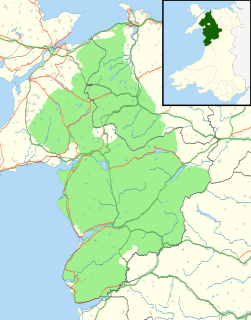
The geology of Snowdonia National Park in North Wales is dominated by sedimentary and volcanic rocks from the Cambrian and Ordovician periods with intrusions of Ordovician and Silurian age. There are Silurian and Cenozoic sedimentary rocks on the park's margins. The succession was intensely faulted and folded during the Caledonian Orogeny. The region was uplifted as the North Atlantic Ocean opened during the Cenozoic. The current mountainous landscape arises from repeated glaciations during the Quaternary period.
The bedrock geology of Ceredigion in west Wales consists wholly of a considerable thickness of Ordovician and Silurian age sedimentary rocks of marine origin. Unconsolidated deposits of Quaternary age include a widespread cover of glacial till, valley floor alluvium and scattered peat deposits in both upland and lowland settings.
The geology of Pembrokeshire in Wales inevitably includes the geology of the Pembrokeshire Coast National Park which extends around the larger part of the county’s coastline and where the majority of rock outcrops are to be seen. Pembrokeshire’s bedrock geology is largely formed from a sequence of sedimentary and igneous rocks originating during the late Precambrian and the Palaeozoic era, namely the Ediacaran, Cambrian, Ordovician, Silurian, Devonian and Carboniferous periods, i.e. between 635 and 299 Ma. The older rocks in the north of the county display patterns of faulting and folding associated with the Caledonian Orogeny. On the other hand, the late Palaeozoic rocks to the south owe their fold patterns and deformation to the later Variscan Orogeny.


