Related Research Articles

Oxfordshire is a ceremonial county in South East England. The county is bordered by Northamptonshire and Warwickshire to the north, Buckinghamshire to the east, Berkshire to the south, and Wiltshire and Gloucestershire to the west. The city of Oxford is the largest settlement and county town.

Kensington is an area of London in the Royal Borough of Kensington and Chelsea, around 2.9 miles (4.6 km) west of Central London.
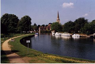
Abingdon-on-Thames, commonly known as Abingdon, is a historic market town and civil parish on the River Thames in the Vale of the White Horse district of Oxfordshire, England. The historic county town of Berkshire, the area was occupied from the early to middle Iron Age and the remains of a late Iron Age and Roman defensive enclosure lies below the town centre. Abingdon Abbey was founded around 676, giving its name to the emerging town. In the 13th and 14th centuries, Abingdon was an agricultural centre with an extensive trade in wool, alongside weaving and the manufacture of clothing. Charters for the holding of markets and fairs were granted by various monarchs, from Edward I to George II.

Covent Garden is a district in London, on the eastern fringes of the West End, between St Martin's Lane and Drury Lane. It is associated with the former fruit-and-vegetable market in the central square, now a popular shopping and tourist site, and with the Royal Opera House, itself known as "Covent Garden". The district is divided by the main thoroughfare of Long Acre, north of which is given over to independent shops centred on Neal's Yard and Seven Dials, while the south contains the central square with its street performers and most of the historical buildings, theatres and entertainment facilities, including the London Transport Museum and the Theatre Royal, Drury Lane.

Hoddesdon is a town in the Borough of Broxbourne, Hertfordshire, lying entirely within the London Metropolitan Area and Greater London Urban Area. The area is on the River Lea and the Lee Navigation along with the New River.

Shifnal is a market town and civil parish in Shropshire, England, about 4 miles (6 km) east of Telford, 17 miles (27 km) east of Shrewsbury and 13 miles (20 km) west-northwest of Wolverhampton. It is near the M54 motorway and A5 road aka Watling Street. At the 2001 census, it had a population of 6,391, increasing to 6,776 at the 2011 census.

Pub names are used to identify and differentiate traditional drinking establishments. Many pubs are centuries old, and were named at a time when most of their customers were illiterate, but could recognise pub signs. The use of signage was not confined to drinking establishments. British pubs may be named after and depict anything from everyday objects, to sovereigns, aristocrats and landowners. Other names come from historic events, livery companies, occupations, sports, and craftsmen's guilds. One of the most common pub names is the Red Lion. This list contains both modern and historical examples.

The Crown and Treaty is a pub on Oxford Road in Uxbridge, London, England, where Charles I and his Parliamentary opponents during the English Civil War held negotiations between 30 January and 22 February 1645. It is a Grade II* listed building, dating from 1576.

The King's Arms is one of the main student pubs in Oxford, England. It claims to be the oldest pub in Oxford.

Queen Street is a pedestrianised shopping street in central Oxford, England. It is one-way for buses and taxis, two-way for cyclists outside main shopping hours, and forbidden for cars. It runs west from the centre of Oxford at Carfax. Here it adjoins Cornmarket Street to the north, the High Street continuing east, and St Aldate's to the south.

Abingdon Road is the main arterial road to the south of the city of Oxford, England. The road passes through the suburbs of Grandpont and New Hinksey. It is named after the town of Abingdon to the south.

Market Street is a street in central Oxford, England, running east to west.
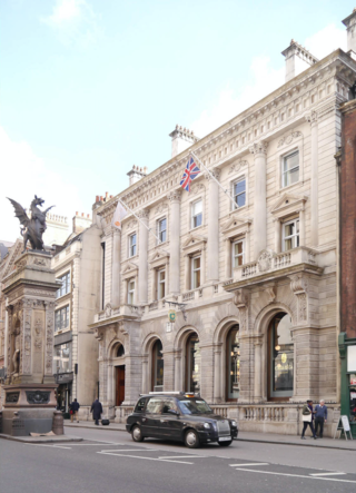
Child & Co. is a historic private bank in the United Kingdom, later integrated into the NatWest Group. The bank operated from its long-standing premises at 1 Fleet Street, on the western edge of the City of London, near the Temple Bar Memorial and opposite the Royal Courts of Justice.

The Victoria Arms is a pub on the eastern bank of the River Cherwell at the end of Mill Lane close to Old Marston, northeast of Oxford, England.
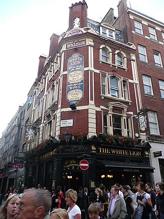
The White Lion is a pub in Covent Garden, London, on the corner of James Street and Floral Street.

Lower Belgrave Street is a street in London's Belgravia district.

The Swan with Two Necks was a coaching inn in the City of London that, until the arrival of the railways, was one of the principal departure points for travel to the north of England from London. Its site was given over in the early 1860s to a goods and parcels depot for a firm of railway agents and carriers.

The Bull and Mouth Inn was a coaching inn in the City of London that dated from before the Great Fire of London in 1666. It was located between Bull and Mouth Street in the north and Angel Street in the south. It was once an important arrival and departure point for coaches from all over Britain, but particularly for the north of England and Scotland. It became the Queen's Hotel in 1830 but was demolished in 1887 or 1888 when new post office buildings were built in St Martin's Le Grand.

Chiswick High Road is the principal shopping and dining street of Chiswick, a district in the west of London. It was part of the main Roman road running west out of London, and remained the main road until the 1950s when the A4 was built across Chiswick. By the 19th century the road through the village of Turnham Green had grand houses beside it. The road developed into a shopping centre when Chiswick became built up with new streets and housing to the north of Old Chiswick, late in the 19th century. There are several listed buildings including public houses, churches, and a former power station, built to supply electricity to the tram network.
References
- 1 2 "Market Street (off east side of Cornmarket)". Oxford History. UK. Retrieved 31 July 2022.
- ↑ Honey, Derek S. (1998). An Encyclopaedia of Oxford Pubs, Inns and Taverns. The Oakwood Press. ISBN 978-0853615354.
- 1 2 Hibbert, Christopher, ed. (1988). "Abingdon Arms". The Encyclopaedia of Oxford . Macmillan. p. 1. ISBN 0-333-39917-X.
- ↑ "Pub etiquette manual found – The proprietor of the Abingdon Arms pub in Market Street, Oxford, clearly enjoyed a joke with his customers". Oxford Mail . 13 August 2007. Retrieved 23 August 2022.
- ↑ "Oxford inns and hotels in 1846". Oxford History. UK. Retrieved 31 July 2022.
- ↑ "Oxford Trustee Savings Bank records". Archives Hub . Jisc . Retrieved 31 July 2022.
51°45′11″N1°15′25″W / 51.75311°N 1.25704°W
| | This article about an Oxfordshire building or structure is a stub. You can help Wikipedia by expanding it. |