
The English River is a river in Kenora District and Thunder Bay District in Northwestern Ontario, Canada. It flows through Lac Seul to join the Winnipeg River at Tetu Lake as a right tributary. The river is in the Hudson Bay drainage basin, is 615 kilometres (382 mi) long and has a drainage basin of 52,300 square kilometres (20,200 sq mi). Although there are several hydroelectric plants on this river, the English River upstream of Minnitaki Lake is notable as one of the few large river systems in northwestern Ontario with a natural flow and without any upstream source of pollution. It is the fourth longest river entirely in Ontario.
Robinson is a railway point and unincorporated place just west of an arm of Marchington Lake on the Sturgeon River in Unorganized Kenora District in northwestern Ontario, Canada.
The Marchington River is a river in the Hudson Bay drainage basin located in Kenora and Thunder Bay Districts in northwestern Ontario, Canada. It travels 78 kilometres (48 mi) from its head at Kashaweogama Lake in Thunder Bay District through a series of lakes to Marchington Lake, where it meets the Sturgeon River and North River. It then continues 30 kilometres (19 mi) over the small McDougall Falls and through Botsford Lake before emptying into the English River at Abram Lake near Sioux Lookout.
Marchington Lake is a lake in the Hudson Bay drainage basin located near Sioux Lookout in the Kenora District of northwestern Ontario, Canada.
Lake St. Joseph is a large lake in Kenora District and Thunder Bay District in Northwestern Ontario, Canada. It is in the James Bay drainage basin and is the source of the Albany River. The east end of the lake can be reached using Ontario Highway 599 from the town of Ignace, 260 kilometres (160 mi) to the south on Ontario Highway 17. The nearest town is Pickle Lake, 30 kilometres (19 mi) north along Highway 599.
Departure Lake is a dispersed rural community and unincorporated place in geographic Haggart Township, Cochrane District in Northeastern Ontario, Canada. It is located on Ontario Highway 11 between the communities of Strickland to the west and Smooth Rock Falls to the east.
Ena Lake is the name of a lake and an adjacent unincorporated area and railway point in Unorganized Kenora District in northwestern Ontario, Canada, about 23 kilometres (14 mi) north of the city of Kenora. Formerly a stop on the Canadian National Railway, it is now a small cottage community of approximately 50 seasonal residents and 11 year round residents.
Black Lake is a lake in the Hudson Bay drainage basin in the Unorganized Part of Kenora District in Northwestern Ontario, Canada. It is about 2 kilometres (1.2 mi) long and 0.6 kilometres (0.4 mi) wide and lies at an elevation of 372 metres (1,220 ft), 13 kilometres (8.1 mi) northeast of Superior Junction and Highway 642, 4 kilometres (2 mi) southwest of McDougall Mills and 1.3 kilometres (0.8 mi) south of Rosnel. The primary outflow is an unnamed creek north to Botsford Lake on the Marchington River, which flows via the English River, the Winnipeg River and the Nelson River to Hudson Bay. The CN transcontinental rail line crosses the creek between Black Lake and Botsford Lake.
Drive Lake is a lake in the Nelson River drainage basin in the Unorganized Part of Kenora District in northwestern Ontario, Canada. It is about 1,250 metres (4,101 ft) long and 490 metres (1,608 ft) wide, lies at an elevation of 394 metres (1,293 ft), and is 1 kilometre (0.6 mi) north of Highway 516. Drive Lake is the source of Drive Creek; the creek leaves the lake at its eastern tip and flows into the Marchington River.
Botsford Lake is a lake in the Hudson Bay drainage basin in Kenora District in northwestern Ontario, Canada. It is about 15 kilometres (9 mi) long and 2.2 kilometres (1.4 mi) wide, is at an elevation of 357 metres (1,171 ft), and lies between the settlements of Superior Junction and McDougall Mills; Rosnel is on the south shore of the lake. The CN transcontinental rail line travels the along the entire south shore. Highway 642 runs west of the lake, and Highway 516 runs approximately parallel to the north shore of the lake at a distance of about 6 kilometres (4 mi).
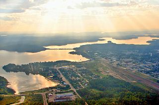
Pelican Lake is a lake in the Hudson Bay drainage basin in the town of Sioux Lookout and in Unorganized Kenora District in Kenora District, northwestern Ontario, Canada. It is about 8.5 kilometres (5.3 mi) long and 6.3 kilometres (3.9 mi) wide and lies at an elevation of 356 metres (1,168 ft). The town centre of Sioux Lookout is on the east shore of the lake, the railway point Pelican on the southwest, and the Canadian National Railway transcontinental main line crosses the lake and runs along the west shore.
Ghost River is an unincorporated place on the south side of Marchington Lake on the Marchington River in Unorganized Kenora District in northwestern Ontario, Canada.
Rosnel is a railway point and unincorporated place on the south side of Botsford Lake on the Marchington River in Unorganized Kenora District in northwestern Ontario, Canada.
North River may refer to one of five rivers in Ontario, Canada:
McDougall Mills is an unincorporated place on the Marchington River between Botsford Lake and the McDougall Falls downstream and Marchington Lake upstream in Unorganized Kenora District in northwestern Ontario, Canada.
Superior Junction is a community in the town of Sioux Lookout, Kenora District in northwestern Ontario, Canada. It is on the Marchington River downstream of Botsford Lake and upstream of the river's mouth at Abram Lake on the English River.

The Groundhog River is a river in Cochrane District and Sudbury District in Northeastern Ontario, Canada. The river is in the James Bay drainage basin and is a left tributary of the Mattagami River.
Lake of Bays is a lake in Kenora District in Northwestern Ontario, Canada in the Hudson Bay drainage basin. The primary inflows are the Bays River at the southeast, and the Lake of Bays River at the northeast; the primary outflow is the Lake of Bays River at the north, which flows via the Sturgeon River, Marchington River, English River, Winnipeg River, and Nelson River to Hudson Bay.
The Lake of Bays River is a river in Kenora District in Northwestern Ontario, Canada. It is in the Hudson Bay drainage basin and is a left tributary of the Sturgeon River.

