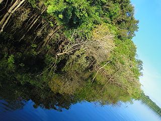
Apuí is a municipality located in the Brazilian state of Amazonas. Its population was 22,359 (2020) and its area is 54,240 km2.

Borba is a municipality in the state of Amazonas in northern Brazil.

Novo Aripuanã is a municipality located in the Brazilian state of Amazonas.

The Abacaxis River is a river in the Amazonas state in north-western Brazil. It is located east of the Madeira River and these two are connected via the Paraná Urariá.

The Arauá River is a river of Amazonas state in north-western Brazil. It is a tributary of the Aripuanã River.

Camaiú River is a tributary of the Sucunduri River in the Amazonas state in north-western Brazil.

Jatuarana River is a river of Amazonas state in north-western Brazil, a tributary of the Manicoré River.

Manicoré River is a river of Amazonas state in north-western Brazil. It is a tributary of the Madeira River and merges into this river about 3 km (1.9 mi) upstream from the town of Manicoré.

Sucunduri River is a river of Amazonas state in north-western Brazil, one of the main headwaters of the Canumã River.

Nascentes do Lago Jari National Park is a national park in the state of Amazonas, Brazil. It protects an area of Amazon rainforest in the BR-319 highway area of influence.

Mapinguari National Park is a national park in the states of Rondônia and Amazonas, Brazil. It covers a large area of Amazon rainforest. The boundaries have been adjusted several times.

The Campos Amazônicos National Park is a National park in the states of Rondônia, Amazonas and Mato Grosso, Brazil.

Acari National Park is a national park in the state of Amazonas, Brazil.

The Campos de Manicoré Environmental Protection Area is an environmental protection area (APA) in the state of Amazonas, Brazil.

The Manicoré Biological Reserve is a biological reserve in the state of Amazonas, Brazil. It fully protects an intact area of the Amazon rainforest that is rich in biodiversity, and serves as part of a shield against the advance of the arc of deforestation.

The Manicorezinho River is a river of Amazonas state in north-western Brazil, a tributary of the Manicoré River.

The Aripuanã National Forest is a national forest in the state of Amazonas, Brazil. It supports sustainable forestry, and also protects the environment, supports scientific research and protects the sustainable lifestyle of the traditional inhabitants of the forest.

The Juma Sustainable Development Reserve (Portuguese: Reserva de Desenvolvimento Sustentável Juma is a sustainable development reserve in the state of Amazonas, Brazil. It supports sustainable extraction of the forest resources by the traditional population. It is the first in Brazil to be funded by a REDD Project.

The Mariepauá River is a tributary of the Madeira River in the state of Amazonas, Brazil.

Urupadi National Forest is a national forest (Brazil) in the state of Amazonas, Brazil.


