
Dharmapuri is a city in the north western part of Tamil Nadu, India. It serves as the administrative headquarters of Dharmapuri district which is the first district created in Tamil Nadu after the independence of India by splitting it from then Salem district on 2 October 1965. The city is located 50 km from Krishnagiri, 69 km from Salem, 60 km from Tirupattur, 90 km from Hosur, 117 km from Thiruvannamalai, 126 km from Bangalore and Erode, 181 km from Tiruppur, 200 km from Coimbatore and Tiruchirappalli, 300 km from Madurai and the state capital Chennai. It is located between latitudes N 11 47’ and 12 33’ and longitudes E 77 02’ and 78 40’. It is one of the major leading cultivators and producers of mangoes in the state along with Krishnagiri, and is often referred as Mango Capital of India.

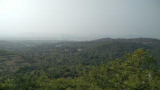
The Javadhu Hills are an extension of the Eastern Ghats spread across parts of Vellore, Tirupattur and Tiruvannamalai districts in the northern part of the state of Tamil Nadu in south-eastern India. The hills separate Vellore, Tirupattur and Tiruvannamalai districts: Tirupattur district, with its towns of Tirupattur, Vaniyambadi and Ambur, lie on the north-western side; Vellore district with the city of Vellore and Amirthi forest are located on the North-eastern side. and Tiruvannamalai district with the towns of Chengam and Polur are located on the south-eastern side.

Vellore district is one of the 38 districts in the Tamil Nadu state of India. It is one of the eleven districts that form the north region of Tamil Nadu. Vellore city is the headquarters of this district. As of 2011, the district had a population of 1,614,242 with a sex ratio of 1,007 females for every 1,000 males. In 2017 Vellore district ranked eleventh in list of districts in Tamil Nadu by Human Development Index.

Krishnagiri district is one of the 38 districts of the state of Tamil Nadu, in India. This district is carved out from Dharmapuri District by 2004. The municipal town of Krishnagiri is the district headquarters. In Tamil Nadu, e-Governance was first introduced at Krishnagiri district under the National e-Governance Project (NEGP) in revenue and social welfare departments on a pilot basis. The district is one of the largest producers of mangoes in India. As of 2011, the district had a population of 1,879,809 with a sex-ratio of 958 females for every 1,000 males. Hosur is the most populous city in the district.
Jolarpettai is a railway town in Tirupattur district, Tamil Nadu, India. It is a commuter rail hub in Southern Railway, which is one of the largest Railway Junction in Tamil nadu. It is 7 km from district headquarter Tirupattur and 18 km from Vaniyambadi.
Natrampalli is a selection grade panchayat town and Taluk in Tirupattur district in the Indian state of Tamil Nadu. The Natrampalli block is a revenue block in the Tirupattur district of Tamil Nadu, India.

Tirupattur (194) is a state assembly constituency in Sivaganga district in Tamil Nadu. It is one of the 234 State Legislative Assembly Constituencies in Tamil Nadu, in India. Elections and winners in the constituency are listed below. Elections were not held in year 1957 and 1962. Most successful party: DMK.

Tirupattur is a state assembly constituency in Tirupattur district in Tamil Nadu, India. Its State Assembly Constituency number is 50. It is one of the 234 State Legislative Assembly Constituencies in Tamil Nadu, in India. Most successful party: DMK.
Tirupathur taluk is a taluk in Tirupathur district of the Indian state of Tamil Nadu. The headquarters of the taluk is the town of Tirupathur. It is known as the "Sandalwood Town" due to the abundant availability of sandalwood trees in the surrounding hills. On 15 August 2019, Chief Minister of Tamil Nadu, Edapaadi K. Palanisami announced Tirupathur district, as a new district of Tamil Nadu.

Tiruvannamalai district is the second largest district in Tamil Nadu by area after Dindigul District and one of the 38 districts in the state of Tamil Nadu, in South India. It was formed in the year 1989 through the bifurcation of North Arcot into the Tiruvannamalai Sambuvarayar and Vellore Ambedkar districts. The city of Tiruvannamalai is the district headquarters.

K. C. Veeramani is the former Member of the Legislative Assembly from Jolarpet assembly constituency in Tirupattur district, Tamil Nadu. He was elected as a representative of the All India Anna Dravida Munnetra Kazhagam party in 2011 and again in the elections of 2016.

Jolarpet is a state assembly constituency in Tamil Nadu, India, formed after constituency delimitations in 2007. Its State Assembly Constituency number is 49. It comprises portions of Natrampalli taluk, Vaniyambadi and Tirupattur taluks and is a part of the Tiruvannamalai parliamentary constituency for national elections. It is one of the 234 State Legislative Assembly Constituencies in Tamil Nadu in India.
The Kandili is a revenue block in the Tirupattur district of Tamil Nadu, India. It has a total of 39 panchayat villages.
Thiruppattur (Tirupattur) is a small village in Manachanallur Taluka, Tiruchirappalli district, Tamil Nadu, India. It is 33 km by road north of the city of Tiruchirappalli on the NH-45, the Chennai - Tiruchi highway. It is 18.5 km by road north of the village of Samayapuram, and 15 km by road southwest of Padalur (East).
Tiruppattur Junction railway station is an NSG–5 category Indian railway station in the Salem railway division of the Southern Railway zone. It is a railway station serving the town of Tiruppattur in Tamil Nadu, India.
The Pambar River is a tributary of the Thenpennai River in the Krishnagiri and Tirupattur districts of the Indian state of Tamil Nadu.
Tirupattur district, or Tirupathur district, is one of the 38 districts in the southern Indian state of Tamil Nadu. The district was formed in 2019 by the division of Vellore district into three smaller districts. Its creation alongside Ranipet district was announced on 15 August 2019, and it was officially declared on 28 November 2019. The town of Tirupattur serves as the district headquarters.

Tirupathur or Tirupattur is the headquarters of Tirupathur district in the state of Tamil Nadu in India and is one of the oldest inhabited places in the state, with a history of over 1,600 years. The town is known for an abundance of sandalwood in the surrounding hills. It is located about 89 km (55 mi) from Vellore, 85 km (53 mi) from Hosur, 60 km (37 mi) from Dharmapuri, 50 km (31 mi) from Krishnagiri, 50 km (31 mi) from Thiruvannamalai, 279 km (173 mi) from coimbatore, 210 km (130 mi) from Chennai, and 125 km (78 mi) from Bangalore.
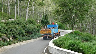
Tamil Nadu State Highway 60 (SH-60) connects Hogenakkal with Tirupattur.

