Related Research Articles
Verden is a Kreis (district) in the centre of Lower Saxony, Germany. Adjoining it are the districts of Osterholz, Rotenburg, Heidekreis, Nienburg, and Diepholz, as well as the city of Bremen.

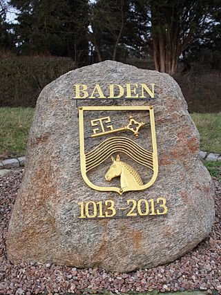
Baden is a human settlement near Bremen, in Lower Saxony, Germany. It is known to Africanists and Phoneticians as the place where Diedrich Hermann Westermann was born and died. It is a borough of the town of Achim in Verden district.

Bremen-Verden, formally the Duchies of Bremen and Verden, were two territories and immediate fiefs of the Holy Roman Empire, which emerged and gained imperial immediacy in 1180. By their original constitution they were prince-bishoprics of the Archdiocese of Bremen and Bishopric of Verden.

Bouches-du-Weser was a department of the First French Empire in present-day Germany.

Land Wursten is a former Samtgemeinde in the district of Cuxhaven, in Lower Saxony, Germany. It was situated approximately 20 km (12 mi) southwest of Cuxhaven, and 15 km (9.3 mi) north of Bremerhaven. Its seat was in the village Dorum. It was disbanded in January 2015, when its member municipalities merged into the new municipality Wurster Nordseeküste.

Achim, commonly Achim bei Bremen, is a municipality and the largest town in the district of Verden, in Lower Saxony, Germany. It is situated on the right bank of the Weser, approx. 17 km northwest of Verden, and 16 km southeast of Bremen.

Bremen, officially the City Municipality of Bremen, is the capital of the German state of the Free Hanseatic City of Bremen, a two-city-state consisting of the cities of Bremen and Bremerhaven. With about 570,000 inhabitants, the Hanseatic city is the 11th largest city of Germany and the second largest city in Northern Germany after Hamburg.

Midlum is a village and a former municipality in the district of Cuxhaven, in Lower Saxony, Germany. Since 1 January 2015 it is part of the municipality Wurster Nordseeküste.
The Stade Region emerged in 1823 by an administrative reorganisation of the dominions of the Kingdom of Hanover, a sovereign state, whose then territory is almost completely part of today's German federal state of Lower Saxony. Until 1837 the Kingdom of Hanover was ruled in personal union by the Kings of the United Kingdom of Great Britain and Ireland.
The Stade Geest is a natural region of low, sandy heath (geest) in the North German Plain.
The Linteln Geest, shown on some maps as the Verden Heath, is a geest region in the north German state of Lower Saxony and belongs administratively to the borough of Kirchlinteln.

The region between the Elbe and Weser rivers forms the Elbe–Weser triangle, also rendered Elbe-Weser Triangle, in northern Germany. It is also colloquially referred to as the Nasses Dreieck or "wet triangle".

The Wümme Depression is a bog, geest and forest landscape within the Elbe–Weser triangle in the German state of Lower Saxony. It belongs mainly to the district of Rotenburg and is part of the Stade Geest. To the south it borders on the Achim-Verden Geest. It has no sharply defined boundary with the Lüneburg Heath; as a result many places are seen as belonging to both regions. Typical of the gently undulating terrain are the many small rivers, streams and lakes. These include the rivers Wümme, Wieste, Fintau, Rodau, Wiedau and Vissel, as well as the twin lakes known in German as the Bullenseen. In this ancient landscape Low German is commonly spoken.

The Middle Weser Valley is part of the Weser Depression around the River Weser on the North German Plain, extending from the gap of Porta Westfalica to the town of Hoya. It is not a true valley, because it is only bordered by low hills at two points. It lies in the German federal states of Lower Saxony and North Rhine-Westphalia.

The Weser Depression or Weser Lowlands is the region north of Porta Westfalica in Germany, where the River Weser no longer flows through a valley, but a broad plain consisting of meadows and river terraces.
The Middle Weser Region includes, in its fullest sense, the land along the Middle Weser between Minden and Bremen. It lies within the federal states of North Rhine-Westphalia, Lower Saxony and Bremen. However, the term is often used just to refer to the Lower Saxon part, because of the different political development of the three states and the cooperative associations formed in Lower Saxony some years ago. The Lower Saxon part of the Middle Weser Region forms the geographical heart of this state. In the centre of the Middle Weser Region are the towns of Minden, Nienburg/Weser and Verden (Aller). In the extreme north, the city of Bremen, which is not part of Lower Saxony, has a very important influence on that area of Lower Saxony surrounding it.

The Wunstorf–Bremen railway line is one of the most important lines in the German state of Lower Saxony. It connects the port city of Bremen via Verden an der Aller and Nienburg to Wunstorf, where it connects with the line to Hanover. The 122.3-kilometre-long (76.0 mi), twin-track main line is continuously electrified. The maximum speed is 160 kilometres per hour (99 mph), the maximum axle load is 22.5 tonnes (50,000 lb) and the line is rated as class D4 in the German system of track classification. It was opened on in 1847.
The Zeven Geest, which is part of the Stade Geest, is an area of sandy terrain in the northeast of the German state of Lower Saxony. It is named after the town of Zeven.
The Wesermünde Geest is the collective name for several geest ridges in the west of Cuxhaven district and Bremen's North Borough in northern Germany. The ridges are separated from one another by wetlands. These terminal moraines were formed during the Saale glaciation, are up to between 10 and 70 m above sea level (NN), and are covered by scattered woods and farmland. The wetland areas, between 0 and 5 m above sea level, are predominantly used for grazing.

Uesen is a village in and a district of Achim, a town located in Lower Saxony (Germany). It is part of the district of Verden and the river Weser is very close. Uesen is situated between the eastern part of Baden and the western city of Achim.