Achttienhoven | |
|---|---|
Hamlet | |
 | |
 Achttienhoven Location in the Netherlands  Achttienhoven Achttienhoven (Netherlands) | |
| Coordinates: 52°8′54″N5°8′20″E / 52.14833°N 5.13889°E | |
| Country | Netherlands |
| Province | Utrecht |
| Municipality | De Bilt |
| Time zone | UTC+1 (CET) |
| • Summer (DST) | UTC+2 (CEST) |
| Postal code | 3615 [1] |
| Dialing code | 0346 [1] |
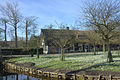
Achttienhoven is a former hamlet in the municipality of De Bilt, in the Netherlands. It is now considered to be part of the village of Westbroek.
Achttienhoven used to be a heerlijkheid (manor), until it became part of Westbroek in 1812. From 1818 to 1954, Achttienhoven was a separate municipality again. It then merged with Westbroek, which in its turn was annexed by Maartensdijk in 1957. [2]
According to the 19th-century historian A.J. van der Aa, [3] the village used to be called "Everckesdorp".
It was first mentioned between 1280 and 1287 as achtienhoeven, and means eighteen parcels of land. [4] Achttienhoven is not a statistical entity, [5] and the postal authorities have placed it under Westbroek. [1] It has place name signs. In 1840, it was home to 236 people. Nowadays, it consists of about 120 houses. [6]