The Auckland Islands are an archipelago of New Zealand, lying 465 km (289 mi) south of the South Island. The main Auckland Island, occupying 460 km2 (180 sq mi), is surrounded by smaller Adams Island, Enderby Island, Disappointment Island, Ewing Island, Rose Island, Dundas Island, and Green Island, with a combined area of 570 km2 (220 sq mi). The islands have no permanent human inhabitants.

Ōtaki is a town in the Kāpiti Coast District of the North Island of New Zealand, situated half way between the capital city Wellington, 70 km (43 mi) to the southwest, and Palmerston North, 70 km (43 mi) to the northeast.

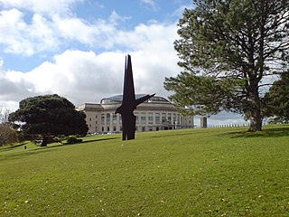
The Auckland Domain, also known as Pukekawa / Auckland Domain, is a large park in Auckland, New Zealand. Consisting of 75 hectares of land, Auckland Domain is the oldest park in the city. Located in the central suburb of Grafton, the parkland is the remains of the explosion crater and most of the surrounding tuff ring of the Pukekawa volcano.

The New Zealand outlying islands are nine offshore island groups that are part of New Zealand, with all but Solander Islands lying beyond the 12nm limit of the mainland's territorial waters. Although considered integral parts of New Zealand, seven of the nine island groups are not part of any administrative region or district, but are instead each designated as an Area Outside Territorial Authority. The two exceptions are the Chatham Islands, which are covered by their own special territorial authority, and the Solander Islands, which are part of the Southland Region and Southland District.

The Waiariki River is a river of the Northland Region of New Zealand's North Island. It forms at the confluence of the Waikiore and Pukekaikiore Streams and is in the catchment of the Wairua River, which it reaches by the Waiotu River, approximately halfway between Whangārei and Kawakawa.

Cape Rodney-Okakari Point Marine Reserve is a 5.5 km2 (2.1 sq mi) protected area in the North Island of New Zealand. All fishing, and the removal or disturbing of marine life or materials, is forbidden within the reserve.

Motumānawa / Pollen Island is an island in the Waitematā Harbour, very near the northern end of Rosebank Peninsula, in Auckland, New Zealand. It is one of two islands surrounded by the Motu Manawa Marine Reserve, the other being Traherne Island. The 500 hectares (1.9 sq mi) marine reserve was established in 1995. The official name of the island was changed from Pollen Island and gazetted as Motumānawa / Pollen Island on 12 November 2015.
The Awaroa River is a short river in the Waikato District of New Zealand's North Island. It flows east from its source in the dunes near Karioitahi Beach and Lake Puketi, then south from Waiuku joining with the Aka Aka Stream before reaching the Waikato River in its tidal reaches close to Motutieke Island.

Waiteti was a passing loop on the North Island Main Trunk railway (NIMT) in New Zealand, built in 1939 to relieve congestion along a single track block, where the line rises steeply from Te Kuiti on a 1 in 70 gradient for 7 mi (11 km), including curves of 8 ch (160 m) to 20 ch (400 m) radius. It was 470.07 km (292.09 mi) from Wellington. From its opening it was under central control from Te Kuiti signalbox. The loop could hold 100 4-wheeled wagons.

The Stephens Island / Takapourewa lighthouse is one of New Zealand most powerful lights with a range of 18 nautical miles. Perched 183 metres (600 ft) up, on top of Stephens Island, it guards Cook Strait and Tasman Bay / Te Tai-o-Aorere, at the top of the South Island / Te Wai Pounamu.The light flashes white once every six seconds from a white cast iron tower.

Motuaiko Island is the only island within Lake Taupō on the North Island of New Zealand. It sits near the town of Motutere. The name "Motutaiko" is from the Māori language, with "motu" meaning island, and "taiko" being a name for the black petrel.
Bay of Many Coves, or Miritū Bay, is a bay in Queen Charlotte Sound, New Zealand, east of Ruakākā Bay and Blackwood Bay. It is one of the larger bays of the inner sound, located north of the Tory Channel it is vulnerable to southerly winds.

A sanctuary area is a type of New Zealand protected area. They exist to preserve populations of important forest types, like the remnants of kauri forests in Northland.
Ōnahau Bay is a large bay in Queen Charlotte Sound, New Zealand, just north-east of Grove Arm and meeting it at Houhou Point.
Ruakākā Bay is a bay in Queen Charlotte Sound, New Zealand, sitting between Blackwood Bay and Bay of Many Coves / Miritū Bay.
Endeavour Inlet is a large inlet of Queen Charlotte Sound, part of New Zealand's Marlborough Sounds. It lies north-east of Bay of Many Coves / Miritū Bay and south-west of Resolution Bay. The inlet is home to a number of retreats, including Furneaux Lodge and Punga Cove.
Alert Stack is an outlying island of New Zealand. It is a part of the Snares Islands, lying southwest of North East Island. There is an estimated five pairs of nesting Antarctic tern as of 2018.
Archway Island is an island in the Auckland Region of New Zealand. It lies to the south west of Kawau Island.


